

Wandelkaart 1502 Appalachian Trail - Deel 2 - NatGeo
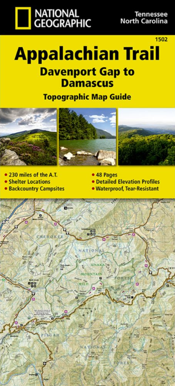
Davenport Gap to Damascus

Korte omschrijving
Wandelkaarten North Carolina, USA en Tennessee, USA van National Geographic. Ideaal voor tochten in Verenigde Staten van Amerika (USA).
Wandelkaart 1502 > Appalachian Trail deel 4 > Davenport Gap-Damascus (9781597756396) Nat Geo Productomschrijving: Deze trail is een wonderbaarlijke route die van Main tot in Atlanta loopt, e...

Specificaties
- Uitgever: National Geographic
- ISBN-13: 9781597756396
- HOOFDCATEGORIEËN: Wandelkaart
- Auteur: National Geographic
- Regio: North Carolina, USA, Tennessee, USA
- Land: Verenigde Staten van Amerika (USA)
- Lange afstand wandelroutes: Appalachian Trail (3500 km)
- TOPO's & Stafkaarten: Topografisch wandelen
- Schaal: 1:63360
- Taal: Engels
- Iconische Wandelroutes: Appalachian Trail, USA
Volledige omschrijving
Wandelkaart 1502 > Appalachian Trail deel 4 > Davenport Gap-Damascus (9781597756396) Nat Geo
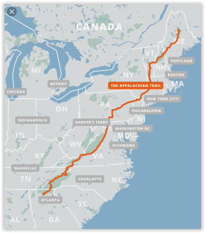
Productomschrijving: Deze trail is een wonderbaarlijke route die van Main tot in Atlanta loopt, en ettelijke duizenden Km lang is. De route loopt door de mooiste delen van Oost USA, meerbepaald Virginia e.d. De route wordt jaarlijke door duizenden liefhebbers afgelopen, maar aangezien de route dusdanige lengte heeft, is de route nooit overbevolkt. The Appalachian trail is wereld bekend en elke ervaren wandelaar moet deze route hebben afgelegd. De route is verdeeld in 13 topografisch wandelkaarten hieronder bij gerelateerde art. allemaal onder alkaar opgesomd, buiten deze kaart. Indien u alle 13 kaarten wenst, kunnen wij u 15% korting geven op de volledige bundel van 13 kaarten die de volledige route omschrijft.
Engelse omschrijving van de uitgever: The Davenport Gap to Damascus Topographic Map Guide makes a perfect traveling companion when traversing the northeastern Tennessee and western North Carolina section of the Appalachian Trail (A.T.). The A.T. in northeastern Tennessee and western North Carolina mostly follows a high, crooked ridgeline across the Southern Appalachians, an area that is known for both its natural beauty and rich history. This mountainous section of trail, which is mostly contained within the Cherokee and Pisgah National Forests, travels across the uplands of the Tennessee Valley, through the scenic Roan Highlands, and along the high ridge that separates Tennessee and North Carolina, deep in the heart of the Appalachian Mountain Range.
Each A.T. Topographic Map Guide includes detailed topographic maps at a detail of 1 inch = 1 mile. Each page is centered on the A.T. and overlaps with the adjacent pages so there is little chance of getting lost. Along the bottom of each page is a trail profile that shows the distance between shelters, camping areas, and trail access points. The map and trail profile provide a step by step visual guide to hiking the trail, mile by rugged mile. The Topographic Map Guide is built for all levels of hiking enthusiasts, from the day tripper to the multi month 'thru-hiker'. The front pages of the printed Topographic Map Guide include resupply information, town inset maps, camping options, and much more.
Every Topographic Map Guide is printed on "Backcountry Tough" waterproof, tear-resistant paper. A full UTM grid is printed on the map to aid with GPS navigation.
Other features found on this map include: Abingdon Gap Shelter, Bald Mountain Shelter, Big Bald, Cherokee National Forest, Cherry Gap Shelter, Clyde Smith Shelter, Cosby Knob Shelter, Curley Maple Gap Shelter, Damascus, Davenport Gap Shelter, Deer Park Mountain Shelter, Double Springs Shelter, Erwin, Flint Mountain Shelter, Groundhog Creek Shelter, Hogback Ridge Shelter, Hot Springs, Iron Mountain Shelter, Jerry Cabin Shelter, Laurel Fork Gorge, Laurel Fork Shelter, Little Laurel Shelter, Max Patch Mountain, Moreland Gap Shelter, Mountaineer Shelter, No Business Knob Shelter, Overmountain Shelter, Pisgah National Forest, Roan High Knob Shelter, Roaring Fork Shelter, Saunders Shelter, Spring Mountain Shelter, Stan Murray Shelter, Vandeventer Shelter, Walnut Mountain Shelter, Watauga Lake Shelter.
Locatie op kaart
Gekoppelde artikelen
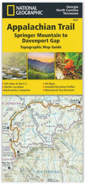
Wandelkaart 1501 Appalachian Trail - Deel 1 - Natgeo • 9781597756389
standaard versieTOPO Wandelkaart 1501 - Springer Mt to Davenport Gap - Natgeo Productomschrijving: Deel 1 - 3500 km wonderbaarlijke route van Main tot in Atlan. Deze kaart omvat het eerste deel van 13 van Springer mountain tot aan Davenport Gap. Omvat de regio's Georgia, North Carolina & Tennessee. Engelse omschrijving: The Springer Mountain to Davenport Gap Topographic Map Guide makes a perfect trav…

Wandelkaart 1503 Appalachian Trail - Deel 3 - Natgeo • 9781597756402
standaard versieWandelkaart 1503 > Appalachian Trail deel 3 > Damascus-Bailey Gap (9781597756402) Nat Geo Productomschrijving: Deze trail is een wonderbaarlijke route die van Main tot in Atlanta loopt, en ettelijke duizenden Km lang is. De route loopt door de mooiste delen van Oost USA, meerbepaald Virginia e.d. De route wordt jaarlijke door duizenden liefhebbers afgelopen, maar aangezien de route dusdani…

Wandelkaart 1504 Appalachian Trail - Deel 4 - Natgeo • 9781597756419
standaard versieWandelkaart 1504 - Appalachian Trail deel 4 - Bailey Gap > Calf Mt (9781597756419) Nat. Geo Productomschrijving: Deze trail is een wonderbaarlijke route die van Main tot in Atlanta loopt, en ettelijke duizenden Km lang is. De route loopt door de mooiste delen van Oost USA, meerbepaald Virginia e.d. De route wordt jaarlijke door duizenden liefhebbers afgelopen, maar aangezien de route dusda…

Wandelkaart 1505 Appalachian Trail - Deel 5 - Natgeo • 9781597756426
standaard versieWandelkaart 1505 > Appalachian Trail deel 5 - Calf Mt > Raven Rock (9781597756426) Nat. Geo Productomschrijving: Deze trail is een wonderbaarlijke route die van Main tot in Atlanta loopt, en ettelijke duizenden Km lang is. De route loopt door de mooiste delen van Oost USA, meerbepaald Virginia e.d. De route wordt jaarlijke door duizenden liefhebbers afgelopen, maar aangezien de route dusda…

Wandelkaart 1507 Appalachian Trail - Deel 7 - Natgeo • 9781597756440
standaard versieWandelkaart 1507 - Appalachian Trail - Deel 7 - Natgeo Productomschrijving: Deel 7 - 3500 km wonderbaarlijke route van Main tot in Atlan. Een uitmuntende langeafstands wandelroutes van zuid to noord door de Amerikaanse countryside. Engelse omschrijving: The Swatara Gap to Delaware Water Gap Topographic Map Guide makes a perfect traveling companion when traversing the northeastern Penns…

Wandelkaart 1508 Appalachian Trail - Deel 8 - Natgeo • 9781597756457
standaard versieWandelkaart 1508 > Appalachian Trail deel 5 >Delaware WG to Schaghticoke Mt (9781597756457) Nat Geo Productomschrijving: Deze trail is een wonderbaarlijke route die van Main tot in Atlanta loopt, en ettelijke duizenden Km lang is. De route loopt door de mooiste delen van Oost USA, meerbepaald Virginia e.d. De route wordt jaarlijke door duizenden liefhebbers afgelopen, maar aangezien de rou…

Wandelkaart 1509 Appalachian Trail - Deel 9 - Natgeo • 9781597756464
standaard versieWandelkaart 1509 - Appalachian Trail - Deel 9 - Natgeo Productomschrijving: Deel 9 van een epische wandeltocht van Zuid naar Noord op het Noord-Ameriakaanse continent. Dit deel omvat Schaghticoke Mountain to East Mountain. Het iets meer plattelands gedeelte van de 3500 km lange levensverhaal om U tegen te zeggen. Engelse omschrijving: The Schaghticoke Mountain to East Mountain Topograp…

Wandelkaart 1510 Appalachian Trail - Deel 10 - Natgeo • 9781597756471
standaard versieWandelkaart 1510 > Appalachian Trail deel 10 > East Mountain > Hanover (9781597756471) Nat Geo Productomschrijving: Deze trail is een wonderbaarlijke route die van Main tot in Atlanta loopt, en ettelijke duizenden Km lang is. De route loopt door de mooiste delen van Oost USA, meerbepaald Virginia e.d. De route wordt jaarlijke door duizenden liefhebbers afgelopen, maar aangezien de route du…

Wandelkaart 1511 Appalachian Trail - Deel 11 - Natgeo • 9781597756488
standaard versieWandelkaart 1511 > Appalachian Trail – Hanover to Mount Carlo (9781597756488) Nat Geo Productomschrijving: Deze trail is een wonderbaarlijke route die van Main tot in Atlanta loopt, en ettelijke duizenden Km lang is. De route loopt door de mooiste delen van Oost USA, meerbepaald Virginia e.d. De route wordt jaarlijke door duizenden liefhebbers afgelopen, maar aangezien de route dusdanige l…
Wandelkaart 1509 Appalachian Trail - Deel 9 - Natgeo • 9781597756464
standaard versieWandelkaart 1509 - Appalachian Trail - Deel 9 - Natgeo Productomschrijving: Deel 9 van een epische wandeltocht van Zuid naar Noord op het Noord-Ameriakaanse continent. Dit deel omvat Schaghticoke Mountain to East Mountain. Het iets meer plattelands gedeelte van de 3500 km lange levensverhaal om U tegen te zeggen. Engelse omschrijving: The Schaghticoke Mountain to East Mountain Topograp…

Wandelkaart 1512 Appalachian Trail - Deel 12 - Natgeo • 9781597756495
standaard versieWandelkaart 1512 > Appalachian Trail deel 12 > Mt Carlo-Pleasant Pond (9781597756495) Nat Geo Productomschrijving: Deze trail is een wonderbaarlijke route die van Main tot in Atlanta loopt, en ettelijke duizenden Km lang is. De route loopt door de mooiste delen van Oost USA, meerbepaald Virginia e.d. De route wordt jaarlijke door duizenden liefhebbers afgelopen, maar aangezien de route dus…

Wandelkaart 1513 Appalachian Trail - Deel 13 - Natgeo • 9781597756501
standaard versieWandelkaart 1513 > Appalachian Trail deel 9 > Pleasant Pond > Katahdin (9781597756501) Nat Geo Productomschrijving: Deze trail is een wonderbaarlijke route die van Main tot in Atlanta loopt, en ettelijke duizenden Km lang is. De route loopt door de mooiste delen van Oost USA, meerbepaald Virginia e.d. De route wordt jaarlijke door duizenden liefhebbers afgelopen, maar aangezien de route du…
Artikelen uit dezelfde regio
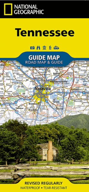
Landkaart Wegenkaart Tennessee State guide map - Nat Geo • 9781566957274
Wegenkaart Tennessee State guide map - Nat Geo Productomschrijving: National Geographic's Tennessee Guide Map is the ultimate ultimate travel companion to "The Volunteer State," combining a comprehensive road map with an expertly research travel guide. The road network contains designations for free access and toll highways; U.S., state and country routes; paved and unpaved roads; and scen…

Reisgids Great Smokey Mountains - Lonely Planet • 9781838697921
The Great Smokey Mountains - Lonely Planet. Productomschrijving: Ga terug naar de natuur tussen in mist gehulde bergtoppen, glinsterende watervallen en weelderige bossen in de grote Amerikaanse wildernis. Lonely Planet brengt je naar het hart van Great Smoky Mountains National Park, met geweldige reiservaringen en het beste planningsadvies. Lonely Planet's Great Smoky Mountains Nationa…

Reisgids Georgia & the Carolinas - Lonely planet • 9781837584321
Georgia & the Carolinas - Lonely planet Productomscrijving: Breathtaking natural beauty, deeply hospitable people, quaint rural backwaters and cosmopolitan capitals make the South Caucasus region a thrilling, offbeat discovery. Lonely Planet will get you to the heart of Georgia & tge Carolinas with amazing travel experiences and the best planning advice. Lonely Planet Georgia, is your …

Wandelkaart 784 Fontana and Hiwassee Lakes - Nat Geo • 9781566953337
Fontana lake and Hiwassee Lake - Nat Geo Productomschrijving: Genesteld tussen de Cherokee en Chattahoochee National Forests, ligt Nantahala National Forest met zijn overvloed aan recreatieve mogelijkheden. National Geographic's Trails Illustrated kaart van Fontana en Hiwassee Lakes levert ongeëvenaarde details en waardevolle informatie om u te helpen bij uw verkenning van dit bos. Deskun…

Wandelgids Florida & the South National Parks - Lonely Planet • 9781838696092
Florida & the South National Parks - Lonely Planet Productomschrijving: Lonely Planet's Florida and the South's National Parks is uw paspoort voor het meest relevante, up-to-date advies over wat je moet zien en overslaan. Kampeer in Congaree, peddel door de Everglades en beklim de Great Smoky Mountains, allemaal met je vertrouwde reisgenoot. Duik in het hart van Florida en de nationale par…