

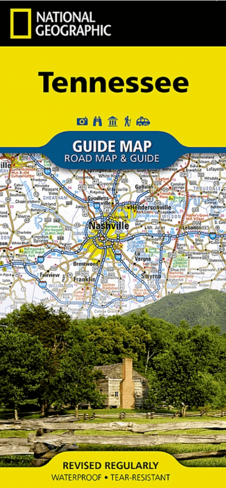
Landkaart Wegenkaart Tennessee State guide map - Nat Geo
Knoxville- Chattanooga- Nashville- Memphis....

Korte omschrijving
Wegenkaart Tennessee State guide map - Nat Geo Productomschrijving: National Geographic's Tennessee Guide Map is the ultimate ultimate travel companion to "The Volunteer State," combining a ...

Specificaties
- Uitgever: National Geographic
- ISBN-13: 9781566957274
- HOOFDCATEGORIEËN: Wegenkaart - Landkaart
- Activiteiten: Street/Road maps & city plans
- Auteur: National Geographic
- Regio: Tennessee, USA
- Land: Verenigde Staten van Amerika (USA)
- TOPO's & Stafkaarten: Topografisch wandelen
- Schaal: 1:1140000
- Taal: Engels
- Reeks/Serie: Nat Geo, State Guide Maps
Volledige omschrijving
Wegenkaart Tennessee State guide map - Nat Geo
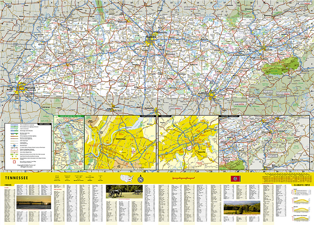
Productomschrijving: National Geographic's Tennessee Guide Map is the ultimate ultimate travel companion to "The Volunteer State," combining a comprehensive road map with an expertly research travel guide. The road network contains designations for free access and toll highways; U.S., state and country routes; paved and unpaved roads; and scenic byways. Mileage markers are shown on major highways and scenic routes have pinpointed wayside stops. An index of cities, towns and counties along with a chart of driving distances will aid in your finding your destination and planning your route.
Found on the map are hundreds of points of interest, such as national and state parks, national forests, campgrounds, visitor centers, airports, hospitals, ski areas and much more. City inset maps provide extra detail of Knoxville, Chattanooga, Nashville, Memphis as well as the Land Between the Lakes Recreation Area. Great Smoky Mountains National Park and Natchez Trace Parkway scenic drive are given special coverage including both maps and descriptions. A calendar of events, chart of services at national parks and an overview of points of interest are all provided along with relevant contact information.
Every State Guide Map is printed on durable synthetic paper, making them waterproof, tear-resistant and tough — capable of withstanding the rigors of any kind of travel.
Artikelen uit dezelfde regio
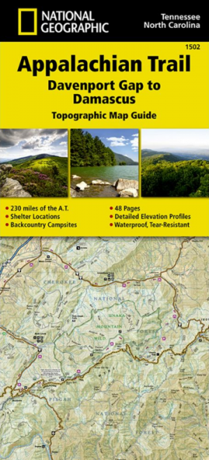
Wandelkaart 1502 Appalachian Trail - Deel 2 - NatGeo • 9781597756396
Wandelkaart 1502 > Appalachian Trail deel 4 > Davenport Gap-Damascus (9781597756396) Nat Geo Productomschrijving: Deze trail is een wonderbaarlijke route die van Main tot in Atlanta loopt, en ettelijke duizenden Km lang is. De route loopt door de mooiste delen van Oost USA, meerbepaald Virginia e.d. De route wordt jaarlijke door duizenden liefhebbers afgelopen, maar aangezien de route dusd…

Landkaart Wegenkaart Planning map Great Smoky Mountains NP • 9781788685955
Planning map Great Smoky Mountains NP - Lonely Planet Productomschrijving: Durable and waterproof, with a handy slipcase and an easy-fold format, Lonely Planet’s Great Smoky Mountains National Park Planning Map helps you get around with ease. Get more from your map and your trip with images and information about top attractions, itinerary suggestions, a transport guide, planning informatio…

Reisgids Great Smokey Mountains - Lonely Planet • 9781838697921
The Great Smokey Mountains - Lonely Planet. Productomschrijving: Ga terug naar de natuur tussen in mist gehulde bergtoppen, glinsterende watervallen en weelderige bossen in de grote Amerikaanse wildernis. Lonely Planet brengt je naar het hart van Great Smoky Mountains National Park, met geweldige reiservaringen en het beste planningsadvies. Lonely Planet's Great Smoky Mountains Nationa…

Wandelkaart 229 Great Smoky Mountains NP- Tennessee - Nat Geo • 9781566953016
TOPO Wandelkaart 229 - Great Smoky Mountains NP- Nat Geo Productomschrijving: Great Smoky Mountains National Park is een nationaal park in de Amerikaanse staten North Carolina en Tennessee, dat een groot deel van de Great Smoky Mountains beschermt. Met bijna 9,5 miljoen bezoekers in 2010 is dit het best bezochte park van het land. Het gebied is in 1934 ingericht als nationaal park en staat…
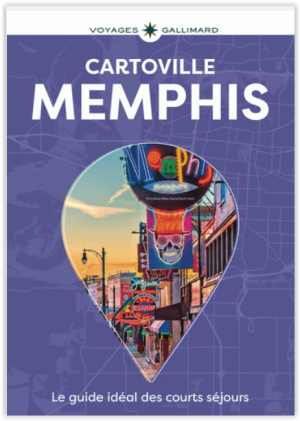
Reisgids Memphis Tennesee USA Cartoville - Gallimard • 9782742467549
Reisgids Memphis - Gallimard Productomschrijving: Beale Street et ses clubs, mythiques Graceland, Sun Studio et Stax Museum, galeries de Cooper-Young, National Civil Rights Museum, diners et restaurants de soul food, brasseries et scènes live, balade à vélo vers le Shelby Farms Park, échappée sur le Mississippi: suivez le guide ! • Les incontournables, et aussi tous les musées, monume…