

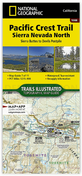
Wandelkaart 1008 Pacific Crest Trail - Nat Geo
Sierra Nevada North California
Korte omschrijving
Wandelkaarten Californië, USA van National Geographic. Ideaal voor tochten in Verenigde Staten van Amerika (USA).
Wandelkaart Pacific Crest Trail - Nat Geo Productomschrijving: De Pacific Crest Trail, die in de topografische kaartengids voor de Sierra Nevada North staat aangegeven, loopt door subalpiene...

Specificaties
- Uitgever: National Geographic
- ISBN-13: 9781566957908
- HOOFDCATEGORIEËN: Wandelkaart
- Activiteiten: Wandelen, Hiking & Trekking
- Auteur: National Geographic
- Regio: Californië, USA
- Land: Verenigde Staten van Amerika (USA)
- Lange afstand wandelroutes: Pacific Crest Trail (4264 km)
- TOPO's & Stafkaarten: Topografisch wandelen
- Schaal: 1:75000
- Taal: Engels
Volledige omschrijving
Wandelkaart Pacific Crest Trail - Nat Geo
Productomschrijving: De Pacific Crest Trail, die in de topografische kaartengids voor de Sierra Nevada North staat aangegeven, loopt door subalpiene bossen en vulkanische rotsformaties en blijft dicht bij de Sierra Crest. De John Muir Trail loopt 160 mijl samen met de PCT en splitst zich in het westen van de PCT bij Tuolumne Meadows in Yosemite National Park. Het wandelseizoen in de Sierra loopt meestal van half juni tot september. Zware sneeuwval kan echter al in oktober beginnen en tot begin juli aanhouden. Hoogtepunten van dit deel zijn Yosemite National Park, Devils Postpile National Monument, en Ansel Adams, Carson-Iceberg, Emigrant, Mokelumne, Hoover, Granite Chief, en Desolation wildernis gebieden.
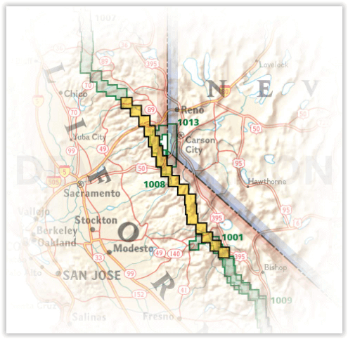
De PCT strekt zich uit over 4264 km vanaf de Canadese grens, door Washington, Oregon en Californië tot het zuidelijke eindpunt aan de Mexicaanse grens. De beroemde trail doorkruist enkele van de meest wilde en schilderachtige landschappen van het westen van de VS, waaronder 6 nationale parken, 25 nationale bossen, 48 wildernis gebieden, de vulkanische Cascade Range van de Pacific Northwest, de met sneeuw bedekte Sierra Nevada, en de Mojave en Sonoran woestijnen.
Engelse omschrijving: The Pacific Crest Trail (PCT) mapped in the Sierra Nevada North Topographic Map Guide travels through subalpine forests and volcanic rock formations, staying close to the Sierra Crest. The John Muir Trail coincides with the PCT for 160 miles, splitting west from the PCT at Tuolumne Meadows in Yosemite National Park. The high Sierra hiking season typically lasts from mid-June through September. However, heavy snow can begin as early as October and linger until early July. Highlights of this section include Yosemite National Park, Devils Postpile National Monument, and Ansel Adams, Carson-Iceberg, Emigrant, Mokelumne, Hoover, Granite Chief, and Desolation wilderness areas.
The PCT spans 2,650 miles from the Canadian border, through Washington, Oregon, and California to the southern terminus at the Mexican border. The famous trail crosses some of the most wild and scenic landscapes of the western U.S., including six national parks, 25 national forests, 48 wilderness areas, the volcanic Cascade Range of the Pacific Northwest, the snowcapped Sierra Nevada, and the Mojave and Sonoran deserts.
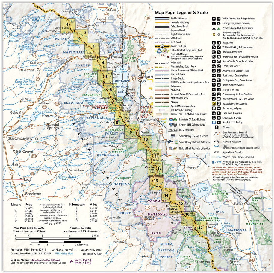
Each PCT Topographic Map Guide includes detailed topographic maps at a scale of almost 1 inch = 1 mile. Each page is centered on the PCT and overlaps with the adjacent pages so there is little chance of getting lost. Along the bottom of each page is a trail profile that shows the distance between camping areas, trailheads, and other points of interest. The map and trail profile provide a step by step visual guide to hiking the trail, mile by rugged mile. The Topographic Map Guide is built for all levels of hiking enthusiasts, from the day tripper to the multi month 'thru-hiker'. The front pages of the printed Topographic Map Guide include resupply locations, health and safety information, and much more.
More convenient and easier to use than folded maps, but just as compact and lightweight, National Geographic’s Topographic Map Guide booklets are printed on "Backcountry Tough" waterproof, tear-resistant paper with stainless steel staples. A full UTM grid is printed on the map to aid with GPS navigation.
Artikelen uit dezelfde regio

Reisgids Experience California - Lonely Planet • 9781838697440
Lonely Planet Experience California Productomschrijving: Inside Lonely Planet's Experience California: Unique experiences to string together an unforgettable trip Inspiring full-color travel photography and maps throughout Highlights and trip builders to help tailor a trip to your personal needs and interests Fresh perspectives to surprise you with things you hadn't thought…
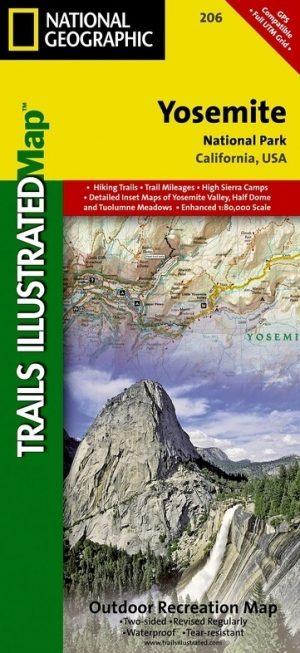
Wandelkaart 206 Yosemite NP - California - Nat Geo • 9781566952996
TOPO Wandelkaart 206 - Yosemite NP- California - Nat geo Productomschrijving: Yosemite National Park, wat een parel van schoonheid en tegelijk wereld bekend, is een nationaal park in het oosten van de Amerikaanse staat Californië. Hij ligt op de westelijke flanken van de centrale Sierra Nevada, in het oosten van Tuolumne, Mariposa en Madera County. Engelse omschrijving: Explore the maj…

Reisgids The Rough Guide to California - Rough Guides • 9781839058592
The Rough Guide to California - Rough Guides Productomschrijving: De volledig bijgewerkte The Rough Guide to California is de definitieve gids voor de meest bezochte staat in de VS. Ontdek de hoogtepunten van Californië met prachtige fotografie, gemakkelijk te gebruiken kaarten en meer lijsten en informatie dan ooit tevoren. De Rough Guide to California bevat leuke en avontuurlijke reisrou…

Reisgids L'essentiel de Californie - Lonely Planet • 9782816171204
L'essentiel de Californie du Lonely Planet Description de produits: Le guide Lonely Planet qui va à l'essentiel, pour découvrir le meilleur de la Californie. Un guide tout en couleurs, illustré par des centaines de photos. Sonoma Valley, la Pacific Coast Highway, Yosemite, les parcs à thème, San Francisco, Lake Tahoe, Death Valley… tous les incontournables de la région réunis dans ce volum…

Wandelkaart 812 Los Padres Nat. Forest East - Natgeo • 9781566955805
TOPO Wandelkaart 812 - Los Padres Nat. Forest East - Natgeo Productomschrijving: Los Padres National Forest is een bosgebied in Amerika, meerbepaald in oost- en centraal California. Het bos is uitermate gekend voor mountainbikers en hikers. Engelse omschrijving: One of the most diverse National Forests in the United States, Los Padres National Forest provides recreation opportunities f…