

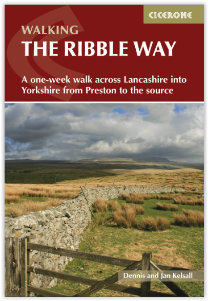
Wandelgids The Ribble way - Cicerone
A Northern England trail
Korte omschrijving
Wandelgidsen Lanacshire, England van CICERONE Press. Ideaal voor tochten in England.
Wandelgids The Ribble way - Cicerone Productomschrijving: Deze gids beschrijft de Ribble Way, een route van 116 km die de Ribble vallei volgt, van de monding van de rivier bij Preston tot de...

Specificaties
- Uitgever: CICERONE Press
- ISBN-13: 9781786310910
- HOOFDCATEGORIEËN: Wandelgids
- Activiteiten: Wandelen, Hiking & Trekking
- Auteur: Dennis Kelsall, Jan Kelsall
- Regio: Lanacshire, England
- Land: England
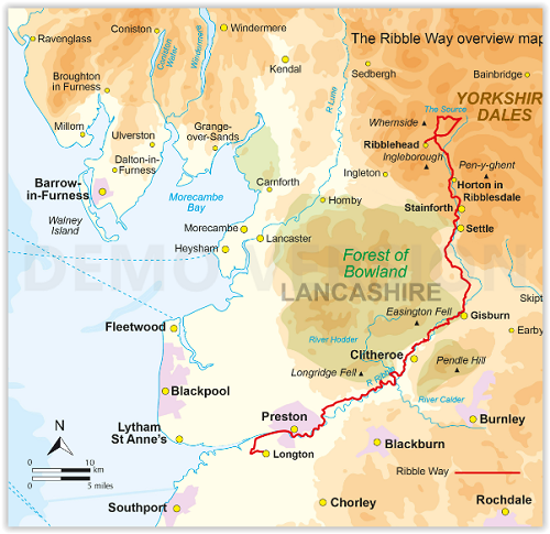
- Nationale parken: Yorkshire Dales NP, England
- AONB - Area of Outstanding Beauty/National Landscape: Forest of Bowland AONB
- Editie: 2
- Taal: Engels
Volledige omschrijving
Wandelgids The Ribble way - Cicerone
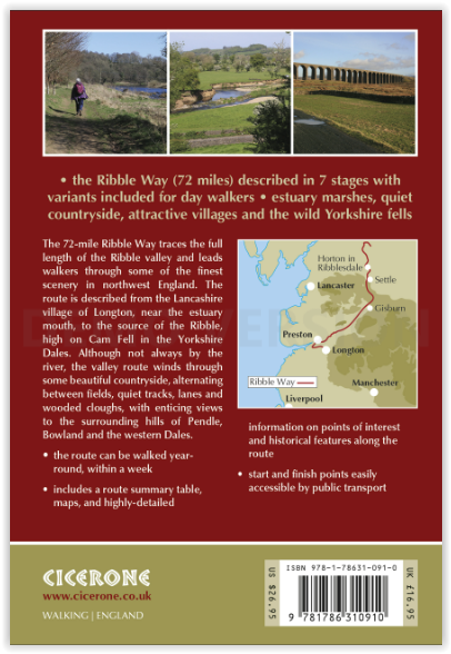
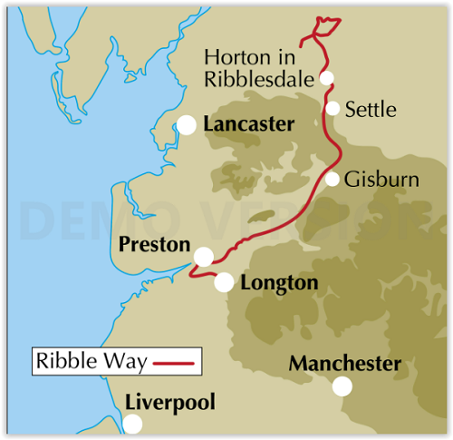
Productomschrijving: Deze gids beschrijft de Ribble Way, een route van 116 km die de Ribble vallei volgt, van de monding van de rivier bij Preston tot de bron van de rivier bij Cam Fell in de Yorkshire Dales. Het boek bevat een volledige routebeschrijving opgedeeld in 7 overzichtelijke etappes, met suggesties voor dagwandelaars.
Engelse omschrijving: This guidebook describes the Ribble Way, a 71 mile route following the Ribble valley, from the estuary mouth near Preston to the river's source on Cam Fell in the Yorkshire Dales. The book contains a full route description split into 7 convenient stages, with suggestions for day walkers.
Seasons:
Suitable all year, though winter weather may make the upper sections more challenging.
Centres:
Preston, Clitheroe, Gisburn, Sette, Stainforth, Horton in Ribblesdale.
Difficulty:
Ideal for those new to long-distance walking. Gentle terrain, more remote in its upper sections.
Must See:
Views of Whernside, Pen-y-ghent and Ingleborough; landscape of the Dales; Ribblehead viaduct; industrial heritage.
Locatie op kaart
Artikelen uit dezelfde regio

Wandelgids 015 Pathfinder guides Yorkshire Dales NP - OS • 9780319090404
Wandelgids Yorkshire Dales NP - OS Productomschrijving: Pathfinder Yorkshire Dales covering parts of the National Park, Ribblesdale and Swaledale. This selection offers interest, regional variety and balance of routes in the Yorkshire Dales providing the best walks in the area. From an easy stroll through Ingleton Waterfalls to the much more challenging walks in Gunnerside, this volume co…

Wandelkaart 102 Preston & Blackpool- Lancashire - OSI • 9780319262009
Wandelkaart Preston & Blackpool- Lancashire - OSI Productbeschrijving: OS Landranger kaart 102 bestrijkt het gebied rond Preston & Blackpool. De bruisende badplaats & Blackpool's eigenzinnige vibes heeft zijn sporen nagelaten, sindsdien komen de toeristen als sinds vele jaren. Attracties zoals het pleasure beach, Blackpool Tower en de wereld beroemde illuminations onderscheiden Blackpool v…

Wandelgids - Silverdale & Arnside AONB - Cicerone • 9781852846282
Wandelgids - Silverdale & Arnside AONB - Cicerone Omvat: Leighton Moss, Dallam Park, Arnside Knott, Hutton Roof en Morecambe Bay Productomschrijving: Deze handige gids van 21 makkelijke dagwandelingen is gegarandeerd om u te helpen bij het verkennen van fantastische landschappen in de vorm van ruige kustpaden en betoverende bosroutes. Er zijn routes van verschillende terreinen door Le…

Wandelkaart OL41 - Forest of Bowland & Ribblesdale - OSI • 9780319469590
Wandelkaart Forest of Bowland & Ribblesdale - North Yorkshire Omvat ook: Pendle Hill, Clitheroe & Settle Productbeschrijving: Kaart nummer OL41 in de OS Explorer kaarten reeks omvat de Forest of Bowland en Yorkshire Dales National Park in de buurt van Clitheroe. Hoogtepunten van het gebied zijn onder andere: Ribble way & Wyre way, Lune Valley walkway en Pendle way, samen met de steden …

Wandelkaart 286 Blackpool & Preston- Lancashire - OSI • 9780319471586
Wandelkaart Blackpool & Preston - Lancashire England Omvat ook: Lytham St Anne’s & Leylan Productomschrijving: Van Blackpool en Preston langs de kust naar het binnenland van Preston en Leyland. Deze OS Explorer kaart 286 toont de zuidkant van de kust van Lancashire, vanaf Freckleton, tot het westelijke deel van de Ribble way. Het gebied is grotendeels vlak, waardoor dit een geweldige l…