

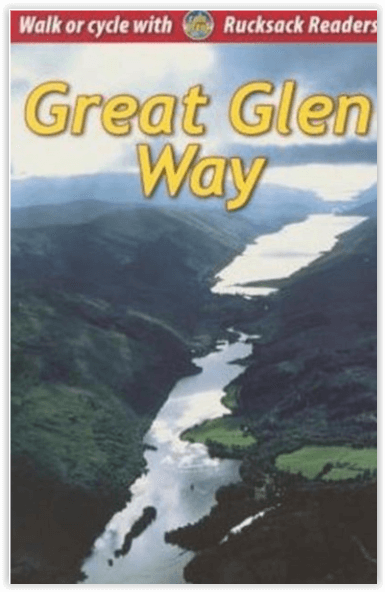
Wandelgids The Great Glen Way 124 km - Rucksach Readers
Tussen Fort William en Inverness - 124 Kkm
Korte omschrijving
Wandelgidsen Highlands, Schotland van RUCKSACK READERS. Ideaal voor tochten in Schotland.
Wandelgids The Great Glen Way - Rucksach Readers Productomschrijving: De Great Glen Way is een van de Great Trails van Schotland en biedt een geweldige ervaring voor zowel wandelaars als fie...

Specificaties
- Uitgever: RUCKSACK READERS
- ISBN-13: 9781913817206
- HOOFDCATEGORIEËN: Wandelgids
- Activiteiten: Wandelen, Hiking & Trekking
- Auteur: Jacquetta Megarry, Sandra Bardwell
- Regio: Highlands, Schotland
- Land: Schotland
- Lange afstand wandelroutes: The Great Glen Way (124 km)
- Schaal: 1:38000
- Editie: 7
- Taal: Engels
- Iconische Wandelroutes: The Graet Glenn Way, Irerland
- Scotlands Great Trails: Great Glen Way
Volledige omschrijving
Wandelgids The Great Glen Way - Rucksach Readers
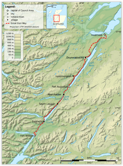
Productomschrijving: De Great Glen Way is een van de Great Trails van Schotland en biedt een geweldige ervaring voor zowel wandelaars als fietsers. De route loopt over een afstand van 77 mijl (124 km) langs de Great Glen van Schotland tussen Fort William en Inverness. De route volgt het schilderachtige Caledonisch Kanaal en loopt langs vier van de mooiste lochs van de Highlands - waaronder Loch Ness, beroemd om zijn monsterlegende en om Urquhart Castle. De route is uitgebreid met verschillende High Route-opties, waarvan de meest recente de Abriachan High Route uit 2024 is, die wandelaars naar een nieuw hoogtepunt brengt op 434 m.
Engelse omschrijving: The Great Glen Way is one of Scotland’s Great Trails and offers a superb experience for both walkers and cyclists. The Way runs for 77 miles (124 km) along Scotland’s Great Glen between Fort William and Inverness. It follows the scenic Caledonian Canal and runs beside four of the Highlands’ loveliest lochs – including Loch Ness, famous for its monster legend and for Urquhart Castle. The route has been enhanced with several High Route options, most recently the 2024 Abriachan High Route taking walkers to a new high point at 434 m/1425 ft.
This edition was revised in late April 2024 and covers several important route updates for 2024-25: the Invergarry link route is mandatory until Loch Oichside reopens in 2025, the Fort Augustus to Invermoriston High Route is closed until summer 2024 and the approach to Inverness has changed around Craig Dunain. See Route updates below for more detail. The book is in our slim pocket-friendly format, with perfect binding (glued and sewn) and still on rainproof paper.
This guidebook contains all you need to plan and enjoy the Great Glen Way – on foot or on a bike:
• detailed mapping on 13 pages at 1:38,000
• hill and mountain side-trips including Ben Nevis
• background on canal heritage, clan history and wildlife
• detailed description for each section walked from Fort William to Inverness
• summaries showing distance, terrain, food/drink stops and altitude profile
• planning information for walkers and cyclists
• town plans of Fort William and Inverness
• in full colour, with 100+ photos, many of them new
• rucksack-friendly and on rainproof paper.
Locatie op kaart
Artikelen uit dezelfde regio
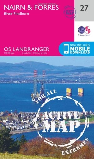
Wandelkaart 27 Nairn & Forres- Highland's Schotland - OSI • 9780319473504
Wandelkaart Nairn & Forres - Highland's Schotland Productbeschrijving: OS Landranger kaart 27 toont Moray Firth, net ten oosten van Inverness. De kust stad van Nairn is een populaire vakantiebestemming, of neem de Moray Coastal Trail langs Forres aan Findhorn. De OS Landranger kaarten reeks heeft betrekking op Groot-Brittannië met 204 gedetailleerde kaarten, perfect voor dagtochten en kort…

Wandelkaart 407 Isle of Skye & Dunvegan- Highland's - OSI • 9780319246429
Wandelkaart Isle of Skye & Dunvegan - Highland's Schotland Omvat ook: Waternish & Macleod’s Tables. Productbeschrijving: Kaart nummer 407 in de OS Explorer kaarten reeks is de perfecte kaart om te gebruiken bij het verkennen van "The Isle of Skye", Dunvegan, Waternish en de Macleod's tables. Het gebied is rijk aan geschiedenis en de perfecte plek om te genieten van kust wandelingen. Ho…

Wandelkaart 451 Thurso & John o'Groats Schotland - OSI • 9780319473030
Wandelkaart Thurso & John o'Groats - Highland's Schotland Omvat ook: Dunnet Head. Productbeschrijving: OS Explorer kaart 451 toont het uiterste noord-oosten van Schotland. John o'Groats is technisch gezien niet het meest noordelijke dorp, maar dat heeft het niet tegen gehouden om een belangrijke toeristische attractie te worden. Thurso is een gemoedelijk dorp en een uitstekende uitvals…
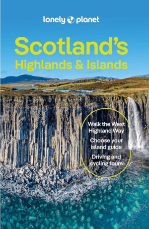
Reisgids Scotland's Highlands & Islands - Lonely Planet • 9781837583607
Reisgids Scotland's Highlands & Islands - Lonely Planet Productomschrijving: The hills and glens and wild coastline of Scotland’s Highlands and islands offer the ultimate escape – one of the last corners of Europe where you can discover genuine solitude. Lonely Planet will get you to the heart of Scotland’s Highlands & Islands, with amazing travel experiences and the best planning advice: …

Wandelgids Great Glen Way - Rucksack Readers • 9781898481874
Wandelgids - Great Glen Way - Rucksack Readers Productomschirjving: De Great Glen Way loopt 124 km lang langs de Great Glen van Schotland tussen Fort William en Inverness. Het volgt het historische Caledonische kanaal en loopt langs vier van de mooiste meren van de Hooglanden, waaronder Loch Ness, beroemd om zijn monsterlegende en om Urquhart Castle. SecLons van de High Route bieden een pr…