

Wandelgids Reivers Way through historic Northumberland- Cicerone
De Reivers Way van Corbridge naar Alnmouth in Northumberland


Korte omschrijving
Wandelgidsen North & North East England en Northhumberland, North England van CICERONE Press. Ideaal voor tochten in England.
Wandelgids- Reivers Way through historic Northumberland- Cicerone Productomschrijving: Een handige zakformaat handleiding voor iedereen die van plan is om de Reivers Way af te lopen. Volg in...

Specificaties
- Uitgever: CICERONE Press
- ISBN-13: 9781852844981
- HOOFDCATEGORIEËN: Wandelgids
- Activiteiten: Wandelen, Hiking & Trekking
- Auteur: Paddy Dylan
- Regio: North & North East England, Northhumberland, North England
- Land: England
- Lange afstand wandelroutes: Reivers Way (193 km)
- Editie: 1
- Taal: Engels
- De Nationale Parken: Northumberland National Park, England
- De Engelse Graafschappen: Northumberland
Volledige omschrijving
Wandelgids- Reivers Way through historic Northumberland- Cicerone
Productomschrijving: Een handige zakformaat handleiding voor iedereen die van plan is om de Reivers Way af te lopen. Volg in de voetstappen van de border reivers op deze 150 mijl lange route, die loopt van Corbridge naar Alnmouth. De reivers route dwaalt door wilde en schilderachtige delen van Northumberland, en kan worden gewandeld in 9 dagen. Het boek bevat ook varianten en alternatieve routes. Wandelen in de voetstappen van de beruchte border reivers en ontdek hoe zij eeuwen van conflicten en oorlog overleefden.
Product description: A guidebook to walking the Reivers Way. Follow in the footsteps of the border reivers on this 240km (150 mile) route running from Corbridge to Alnmouth. The reivers route wanders through wild and scenic parts of Northumberland, and can be walked in 9 days. The book also includes variants and alternative routes.
Seasons:
Spring can be the most attractive time; in summer accommodation needs to be booked ahead but ferries will be running to the Farne Islands; weather is less reliable in the autumn; in winter some accommodation providers will be closed and walking may be harder (in deep snow or after prolonged rain).
Centres:
Newcastle-upon-Tyne, Corbridge, Rothbury, Bamburgh, Alnwick, Alnmouth.
Difficulty:
The Reivers Way is straightforward but sometimes the walk is remote and not specifically waymarked so navigation skills are required; terrain is varied; the route is described in 9 day stages but experienced long-distance walkers could tackle it in a week.
Must See:
North Pennines Area of Outstanding Natural Beauty; Hadrian’s Wall; Northumberland National Park; Cheviot Hills; Northumberland Heritage Coast; Farne Islands; dramatic castles and wild, empty landscapes.

Locatie op kaart
Artikelen uit dezelfde regio
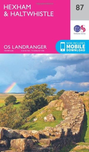
Wandelkaart 87 Hexham & Haltwhistle- England - OSI • 9780319474105
Wandelkaart Hexham & Haltwhistle - England Productbeschrijving: OS Landranger kaart 87 van Hexham & Zeist omvat ook Langley, Allenheads, Ramshaw, Stocksfield, Haydon Bridge, Hallington, Wark, deel van Hadrianus Wall pad, deel van de Pennine Way en deel van Northumberland National Park. De OS Landranger kaarten reeks heeft betrekking op Groot-Brittannië met 204 gedetailleerde kaarten, perfe…
Landkaart Wegenkaart Engeland Noord & Midlands - Reise Know-How • 9783831774364
Wegenkaart Engeland Noord & Midlands - Reise Know-How Productomschrijving: De Reise Know-How wegenkaart van Engeland Noord & Midlands is een betrouwbare, gedetailleerde en duurzame landkaart voor wie Engeland Noord & Midlands zelfstandig wil verkennen. Deze hoogwaardige reiskaart is ideaal voor gebruik tijdens een rondreis met de auto, camper, motor of fiets en biedt alle informatie die j…
Wandelkaart 80 Cheviot Hills & Kielder Water - England - OSI • 9780319474037
Wandelkaart Cheviot Hills & Kielder Water - Northumberland Productbeschrijving: Omgeven door de prachtige Northumberland National Park en Cheviot Hills, maakt de Walliser Way voor een prachtige wandel tocht door het platteland niet ver van de Schotse grens. De OS Landranger kaarten reeks heeft betrekking op Groot-Brittannië met 204 gedetailleerde kaarten, perfect voor dagtochten en korte p…
Wandelgids Teesdale Way - Cicerone • 9781852844615
Wandelgids - Teesdale Way - Cicerone Productomschrijving: Deze handige gids is ideaal voor degenen die van plan zijn om de 135 km lange Teesdale Way te doorlopen. De route wordt beschreven in acht stappen en heeft betrekking op de gehele 100 mijl van Dufton naar Teesmouth. Elke fase biedt gematigde dagwandelingen en gemakkelijk 2 weken. Het omvat ook routebeschrijvingen voor een selectie …
Wandelkaart 87 Hexham & Haltwhistle- England - OSI • 9780319261859
Wandelkaart Hexham & Haltwhistle - England Productbeschrijving: OS Landranger kaart 87 van Hexham & Zeist omvat ook Langley, Allenheads, Ramshaw, Stocksfield, Haydon Bridge, Hallington, Wark, deel van Hadrian's wall pad, deel van de Pennine Way en deel van Northumberland National Park. De OS Landranger kaarten reeks heeft betrekking op Groot-Brittannië met 204 gedetailleerde kaarten, p…