

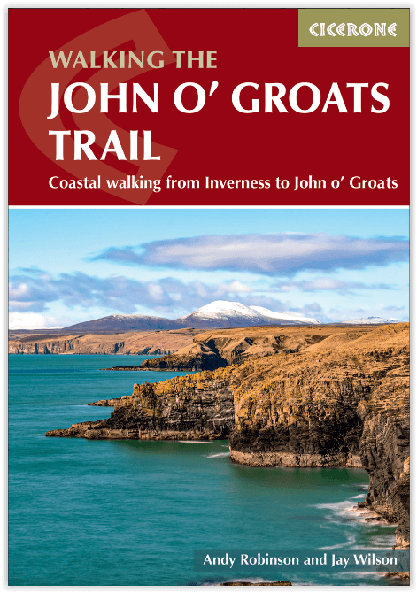
Wandelgids John o' Groats Trail - Cicerone
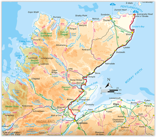
Inverness to John O' Groats - 235 km
Korte omschrijving
Wandelgidsen Northern Highland's, Schotland van CICERONE Press. Ideaal voor tochten in United Kingdom, Great Britain en Schotland.
John o' Groats Trail - Cicerone Press Productomschrijving: Gids voor de John O' Groats Trail, een 235 km langeafstandswandeling van Inverness naar John O' Groats in het uiterste noorden van ...

Specificaties
- Uitgever: CICERONE Press
- ISBN-13: 9781786310576
- HOOFDCATEGORIEËN: Wandelgids
- Activiteiten: Wandelen, Hiking & Trekking
- Auteur: Andy Robinson, Jay Wilson
- Regio: Northern Highland's, Schotland
- Land: Schotland, United Kingdom, Great Britain
- Lange afstand wandelroutes: John o'Groats Trail (232 km)
- Editie: 1
- Taal: Engels
Volledige omschrijving
John o' Groats Trail - Cicerone Press
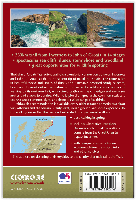
Productomschrijving: Gids voor de John O' Groats Trail, een 235 km langeafstandswandeling van Inverness naar John O' Groats in het uiterste noorden van Schotland. Het pad biedt een prachtig kustlandschap en fantastische wandelingen op de klippen, terwijl aantrekkelijke steden en dorpen accommodatie bieden. De tocht kan in ongeveer veertien dagen worden voltooid.
Engelse omschrijving: Guidebook to the John O' Groats Trail, a 235 km long-distance walk from Inverness to John O' Groats in the far north of Scotland. The trail boasts stunning coastal scenery and fantastic cliff-top walking, while attractive towns and villages offer accommodation. It can be completed in around a fortnight.
Seasons:
Spring is the best time for this walk, with a lot of daylight. There is more undergrowth in the summer, and more visitors means accommodation may be harder to find.
Centres:
Inverness, Tain, Dornoch, Brora, Helmsdale, Wick, John o' Groats
Difficulty:
The northern half of the Trail is challenging, mainly following rough clifftops, often close to the edge and across rough ground. There are also fences to cross. The southern half is relatively straightforward, but overall this route is not recommended for less experienced walkers.
Must See:
Some of the most spectacular sea-cliff scenery in Britain, with many sea stacks, sea arches and caves; ruined medieval castles perched on the cliff edges; vast empty beaches and sand-dune systems; seals, ospreys, eider ducks and large numbers of other seabirds; varied woodland.
Artikelen uit dezelfde regio
Wandelkaart Cape Wrath Trail North - Schotland - Harvey maps • 9781851375332
Wandelkaart Cape Wrath Trail North - Schotland - Harvey maps Omvat: Cape Wrath - Durness Schotland - Trail North Productomschrijving: De Cape Wrath Trail is een uitdagende route van Fort William naar Cape Wrath. Hij is ongeveer 200 mijl lang en stroomt door enkele van de wildste en meest spectaculairste landschappen van Schotland. Deze kaart heeft betrekking op het noordelijke deel va…
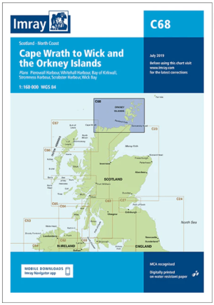
Passage kaart C068 Cape Wrath tot Wick en de Orkney-eilanden • 9781846239298
PassagekaartCape Wrath tot Wick en de Orkney-eilanden - Imray (F&B) Productomschrijving: De noordkust van Schotland van Cape Wrath tot Wick, inclusief de Pentland Firth en de Orkney-eilanden. Grotere schaalplannen van Pierowall, Kirkwall, Whitehall Harbour, Wick Bay, Stromness en Scrabster. Op schaal 1: 160.000 De Imray Charts C-serie bestrijken vaargebieden in Noordwest-Europa, en…
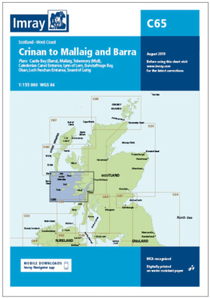
Passage kaart C065 Crinan naar Mallaig en Barra - Imray (F&B) • 9781846238413
Passagekaart Crinan naar Mallaig en Barra - Imray (F&B) Productomschrijving: De westkust van Schotland van Crinan naar Mallaig en verder naar Barra in de Buiten-Hebriden. Rasterlijnen van één minuut. Grotere schaalplannen van de Sound of Luing, Lynne of Thorne, Tobermory, Castlebay, de ingang van het Caledonisch kanaal en Oban. Op schaal 1: 155.000 De Imray Charts C-serie bestrijken …
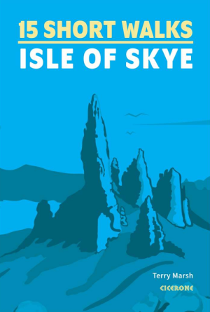
Wandelgids 15 Short Walks on the Isle of Skye - Cicerone Press • 9781786312334
15 Short Walks on the Isle of Skye - Cicerone Productomschrijving: Would you like to explore the best of the Isle of Skye? This guidebook covers 15 of the best short walks in the area (all under three hours), including the Old Man of Storr, the Quiraing pinnacles, Rubha Hunish and the Fairy Pools. Why choose this guidebook? - Easy to moderate walks suitable for almost everyone -…
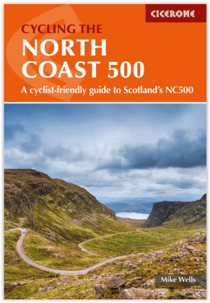
Fietsgids Cycling The North Coast 500 - Cicerone • 9781786312198
Cycling The North Coast 500 - Cicerone Productomschrijving: Het verre noorden van Schotland, biedt met deze nieuwe fietsgids een wervelende route rond het schiereiland van om en bij de 850 km fietsplezier, of 528 miles. De route brengt u langs Wester Ross, Sutherland, Caithness, Easter Ross & the Black Isle. Engelse omschrijving: This guidebook describes a 528-mile cycling route …