

Wandelgids Great Walks on the England Coast Path - Cicerone
30 classic walks on the 4500 km long National Trail


Korte omschrijving
Wandelgidsen South West England, North & North East England, North West England en South East England van CICERONE Press. Ideaal voor tochten in England.
Great Walks on the England Coast Path - Cicerone Engelse omschrijving: At around 4500 km (2800 miles), the England Coast Path is the longest coastal trail in the world. This inspirational la...

Specificaties
- Uitgever: CICERONE Press
- ISBN-13: 9781852849894
- HOOFDCATEGORIEËN: Wandelgids
- Activiteiten: Wandelen, Hiking & Trekking
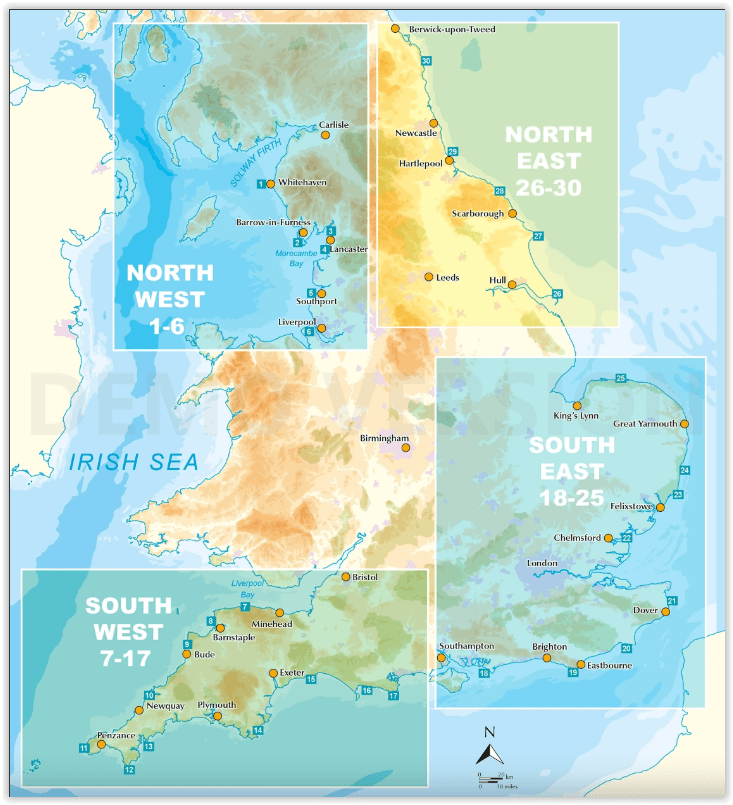
- Regio: North & North East England, North West England, South East England, South West England
- Land: England
- Lange afstand wandelroutes: England Coast Path (4500 km)
- Editie: 1
- Taal: Engels
Volledige omschrijving
Great Walks on the England Coast Path - Cicerone
Engelse omschrijving: At around 4500 km (2800 miles), the England Coast Path is the longest coastal trail in the world. This inspirational large-format guide presents a handpicked selection of 30 highlight sections, offering a taste of England's stunning and diverse shoreline. Routes range from 9 to 45km, spanning between 3 hours and 2 days, offering options to suit all abilities. They can be accessed by public transport and are walkable year round (weather permitting!).
Route descriptions are accompanied by 1:50,000 OS map extracts. Included in each walk are comprehensive listings of public transport, toilets and places to eat and drink, which highlight the excellent walking infrastructure available in many areas. Overview information on terrain, distance and timing facilitates easy planning, a route summary table helps you to choose an appropriate route, and there are also GPX files available for free download. Fascinating snippets of history and geology are interspersed throughout, and the appendices contain useful websites and further reading.
Incorporating beautiful photography of England's coastline, the guide will encourage you to explore both well-loved and less well-known parts of the English shoreline, from soaring cliffs to wildlife-rich estuaries, from huge golden beaches to atmospheric marshes. Capturing the rich heritage and glorious contrasts of England's coast, the routes offer something for everyone, whether your passion is for escape or adventure, geology or nature, castles or culture. The sea has defined England's history and the coast is a dynamic and exciting place to walk, so let these 30 routes introduce you to great walking by the sea on England's newest National Trail.
Artikelen uit dezelfde regio
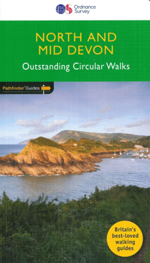
Wandelgids 068 Pathfinder guides Devon North & Mid - OS • 9780319090756
Wandelgids North & Mid Devon - OS Productomschrijving: A must-have for a day trip to North Devon, this Jarrold Pathfinder Guide maps out 28 walks that are ideal for exploring new regions and beautiful scenery. Ideal for planning a weekend walk with the family, this handy walking guide from Jarrold lets you explore with extended strolls and exhilarating hikes for young and old. - Featu…

Wandelkaart 103 The Lizard- Cornwall England - OSI • 9780319243053
Wandelkaart The Lizard - South west England - OSI Omvat ook: Falmouth & Helston. Productbeschrijving: Kaart nummer 103 in de OS Explorer kaarten reeks is de ideale kaart voor het verkennen van The Lizard, Falmouth en Helston. Hoogtepunten van het gebied zijn onder andere: Falmouth, Goonhilly Downs, Mullion Cove, Lizard Point, Bumble Rock, Cornwall Maritime Museum, Porthleven en de Sout…

Passage kaart C070 Southern North Sea Passage Chart - Imray (F&B) • 9781786792495
Passagekaart Southern North Sea Passage Chart - Imray Productomschrijving: Het noordelijke deel Van de Firth of Forth in Schotland. Tot Dover en Calais in het Zuiden. Let op: De kust van Denemarken en de Deense wateren zijn NIET opgenomen op deze kaart. In deze editie van 2014 worden de nieuwste ontwikkelingen op het gebied van windmolenparken voor de kust van Engeland en Wales weerg…

Wandelgids Part 3 SWCP Map Booklet PLymouth to pool - Cicerone • 9781786312006
Map booklet South West Coast Path - Cicerone Productomschrijving: Kaart van een deel van het zuidelijke deel van het 630 mijl (1014 km) lange South West Coast Path National Trail. Omvat het pad van Plymouth naar Poole langs de kustlijn van Devon en Dorset. Dit handige en compacte boekje met Ordnance Survey 1:25.000 kaarten toont de route en biedt alle kaarten die je nodig hebt om het pad i…

Fietsgids South West England Gravel Rides - Vertebrate Publ. • 9781839812545
South West England Gravel Rides - Vertebrate Publ. Productomschrijving: 24 gravel bike adventures in the West Country Gravel Rides South West England features 24 cycling routes, ranging from 16 to 180 kilometres, showcasing the extensive gravel trails of the West Country. Gravel enthusiast and experienced route creator Katherine Moore has taken her love of the South West and extensive …