

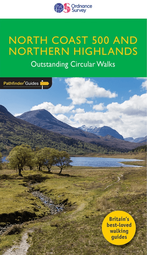
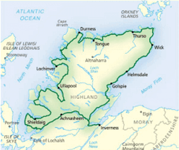
Wandelgids 083 Pathfinder North Coast 500 & Northern Highlands
Loch Coulin - Beinn Eighe and Liathach - Knockan Crag - Ben Hope

Korte omschrijving
Wandelgidsen Northern Highland's, Schotland van Ordnance Survey. Ideaal voor tochten in Schotland.
Wandelgids North Coast 500 & Northern Highlands Productomschrijving: Enhance your North Coast 500 tour with the only walking guidebook featuring routes based on or accessible from Scotland’...

Specificaties
- Uitgever: Ordnance Survey
- ISBN-13: 9780319092095
- HOOFDCATEGORIEËN: Wandelgids
- Activiteiten: Wandelen, Hiking & Trekking
- Auteur: Felicity Martin
- Regio: Northern Highland's, Schotland
- Land: Schotland
- Lange afstand wandelroutes: Cape Wrath trail (370km)
- Editie: 1
- Taal: Engels
- Reeks/Serie: Outstanding Circular Walks, Pathfinder Series, OS
- Iconische Bergketens van Europa: De Schotse Highlands
- De Schotse Munro's: Ben Hope (927 m) - Section 16
Volledige omschrijving
Wandelgids North Coast 500 & Northern Highlands
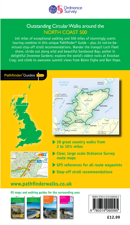
Productomschrijving: Enhance your North Coast 500 tour with the only walking guidebook featuring routes based on or accessible from Scotland’s ultimate road trip. Discover Britain’s remotest sandy beaches, Scotland’s most northerly munro, some of the oldest rocks on Earth and more with 28 breathtaking walks accessed from the North Coast 500 as well as 32 unmissable stop-off-and-stroll recommendations.
Featured North Coast 500 and Northern Highlands walks include:
- Circle Loch Coulin where Beinn Eighe and Liathach are reflected in the still waters
- Wander the astounding landscape of Knockan Crag, where some of the oldest rocks on Earth can be seen
- Climb Ben Hope, Scotland’s most northerly munro, towering above the Flow Country
- See the waterfalls and rocks walls of the Big Burn as you ascend Ben Bhraggie for views over the Dornoch Firth
- Explore the landscape and history of the Applecross peninsula with sublime views of Raasay
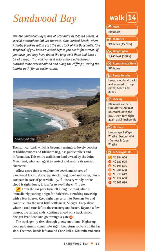
- Take a moorland and clifftop route to the vast golden sands of Sandwood Bay
- Follow meadow paths to Castle Varrich where it overlooks the stunning Kyle of Tongue
- Discover the view from the Fyrish Monument, a panorama of the Cromarty Firth and across the Black Isle to the Moray Firth
- Escape the tourists on a spectacular cliff walk at Duncansby Head, the extreme north-east tip of Scotland
The perfect companion to your North Coast 500 trip:
- 28 stunning Pathfinder walks accessed from the North Coast 500
- 32 not-to-be-missed spots to stop off and stroll as you drive the Northern Highlands
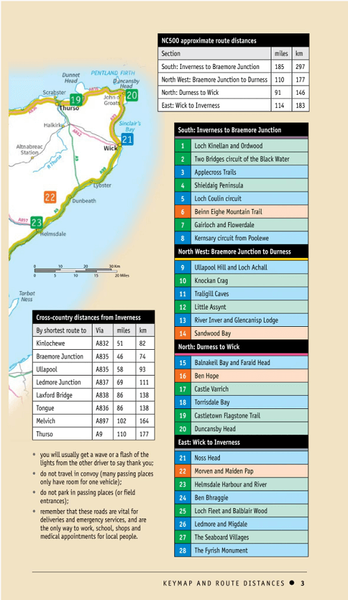
- Driving distances around the North Coast 500, plus cross-country distances from Inverness for leaving or rejoining the North Coast 500
- Walks are sequentially numbered taking a clockwise circuit around the North Coast 500
- Route planning and itinerary options plus public transport access for walkers
- Walks are graded by length and difficulty ensuring a range of routes suitable for walkers of varying experience and mobility
- Includes Ordnance Survey map extracts, GPS waypoints, parking information and detailed route descriptions for foolproof navigation
- Part of the Pathfinder series, the definitive pocket book guide to Great Britain’s great outdoors
- 1:25,000 scale (4cm to 1km or 2½ inches to one mile)
- Enhances your walk with information on rare wildlife, natural habitats and points of historical interest
Artikelen uit dezelfde regio
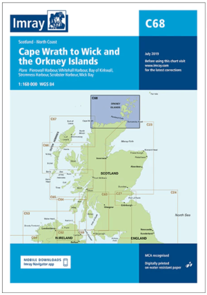
Passage kaart C068 Cape Wrath tot Wick en de Orkney-eilanden • 9781846239298
PassagekaartCape Wrath tot Wick en de Orkney-eilanden - Imray (F&B) Productomschrijving: De noordkust van Schotland van Cape Wrath tot Wick, inclusief de Pentland Firth en de Orkney-eilanden. Grotere schaalplannen van Pierowall, Kirkwall, Whitehall Harbour, Wick Bay, Stromness en Scrabster. Op schaal 1: 160.000 De Imray Charts C-serie bestrijken vaargebieden in Noordwest-Europa, en…
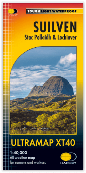
Wandelkaart Suilven - Northern Highlands XT40 ultra - Harvey maps • 9781851376483
Wandelkaart Suilven - Northern Highlands - Harvey maps Productomschrijving: De kaart omvat een groot gebied, en is een praktisch en compact zakformaat. Dit is een fantastisch en mooi gebied, met Suilven centraal. De kaart bevat de twee Munros van Ben More Assynt en Conival, alsook andere bekende bergen zoals Cul Mor, Cul Beag, Canisp en Stac Pollaidh. De kaart bedekt het gebied naar het no…
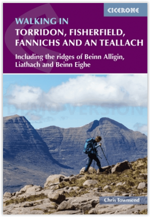
Wandelgids Walking in Torridon- Fisherfield & Fannichs - Cicerone • 9781786310286
Wandelgids Walking in Torridon - Cicerone Productomschrijving: Deze gids bevat 52 dagwandelingen in Torridon, een afgelegen en zeer geliefd gebied van de Schotse Hooglanden. De routes zijn gebaseerd rond Shieldaig en Slioch en zijn verdeeld in 3 secties: gemakkelijke wandelingen, lange en hoge wandelingen en bergbeklimmingen van meer dan 2000 voet waaronder 9 Munros, en 5 suggesties voor g…

Landkaart Wegenkaart 2 Schotland West & Western Isles - OSI • 9780319263747
Wegenkaart Schotland West & Western Isles - OSI Productomschrijving: Plan your journey with this series of road maps from OS. Showing all major road, rail and ferry links as well as settlements and selected features in 1: 250 000 scale, this is the ideal map for planning trips and holidays by car or cycle. OS Road 2 covers: Scotland's west coast, including the Western Isles (Hebrides)…
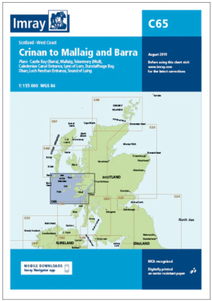
Passage kaart C065 Crinan naar Mallaig en Barra - Imray (F&B) • 9781846238413
Passagekaart Crinan naar Mallaig en Barra - Imray (F&B) Productomschrijving: De westkust van Schotland van Crinan naar Mallaig en verder naar Barra in de Buiten-Hebriden. Rasterlijnen van één minuut. Grotere schaalplannen van de Sound of Luing, Lynne of Thorne, Tobermory, Castlebay, de ingang van het Caledonisch kanaal en Oban. Op schaal 1: 155.000 De Imray Charts C-serie bestrijken …