
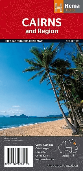
Stadskaart plattegrond Cairns Queensland & omgeving - Hema Maps
Gordonvale- Edmonton- Cairns region and the Cairns CBD
Korte omschrijving
Wandelkaarten Queensland, Noord-Oost Australië van Hema Maps. Ideaal voor tochten in Australië.
Stadskaart Cairns & omgeving - Hema Productomschrijving: Cairns CBD, City & Suburbs Map. A map that offers comprehensive and detailed coverage of Cairns and the surrounding regions at a ...

Specificaties
- Uitgever: Hema Maps
- ISBN-13: 9781865008912
- HOOFDCATEGORIEËN: Stadskaart plattegrond
- Activiteiten: Street/Road maps & city plans, Toerisme
- Regio: Queensland, Noord-Oost Australië
- Land: Australië
- Schaal: 1:22500
- Editie: 14
- Taal: Engels
- De Australische Regio's: Queensland
Volledige omschrijving
Stadskaart Cairns & omgeving - Hema
Productomschrijving: Cairns CBD, City & Suburbs Map.
A map that offers comprehensive and detailed coverage of Cairns and the surrounding regions at a detailed scale of 1:22,500. There are maps of the northern beaches and Cairns on either side, with inset maps of Gordonvale, Edmonton, the Cairns region and the Cairns CBD.
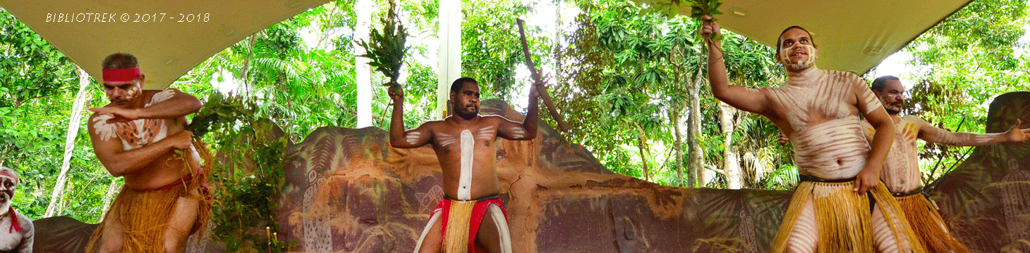
Cairns is one of Queensland’s largest cities and an important tourist destination – second only to Sydney among visitors from overseas.
The Great Barrier Reef is the major attraction and a veritable armada of craft of all shapes and sizes offers a wide range of options. Other excursions from Cairns focus on the river and rainforest environments – it’s less than an hour by either car or boat to several regional highlights including Kuranda, Port Douglas and the Bellenden Ker Range. The Flecker Botanic Gardens at the northern end of town is a fascinating repository of wet tropics flora. Not far from here, along the road to the airport, the Jack Barnes Bicentennial Mangrove Boardwalks provide an insight into the world of a mangrove forest.
One of the most popular day trips from Cairns involves an excursion to Green Island: a picture-postcard coral cay covered in vine forest. The underwater observatory is a major attraction, and diving, snorkelling and glass-bottom boat tours are available.
Another popular offshore destination is Fitzroy Island with its famous Nudey Beach. All waterbased pursuits are on offer, as well as rewarding walks with stunning views.
Back on the mainland, Kuranda – the delightful ‘Village in the Rainforest’ on top of the Kuranda Range – is awash with little shops, many in the two ‘markets’ that feature plenty of touristy mementos.
The journey up on the Kuranda Scenic Railway, from Freshwater Train Station in Cairns, takes less than two hours and is an unforgettable experience. Along the way, the train stops briefly to allow travellers to view Barron Falls. Local attractions include the Butterfly House, the Bat Rescue Centre and a 45-minute cruise on the river. A free courtesy bus runs to attractions slightly further afield, such as Rainforestation, and you’ll find easy walks through rainforest and along the Barron River. When it’s time to head back to Cairns, take to the skies with the Skyrail Rainforest Cableway. It’s definitely worth the stop to see Barron Falls from this closer vantage point, and the Red Peak Station provides an opportunity to take a guided tour along the boardwalk through the rainforest.
North of Cairns the Captain Cook Highway continues northwards along what many consider to be North Queensland’s most magnificent coastline.
Artikelen uit dezelfde regio

Landkaart Wegenkaart Great Desert Tracks Simpson Desert - Hema • 9781922668073
Wegenkaart Great Desert Tracks Simpson Desert - Hema Productomschrijving: Great Desert Tracks Simpson Desert (9th edition) - discover the Simpson Desert with detailed mapping, relevant points of interest and essential touring information for the journey. Hema's Great Desert Tracks maps are essential for anyone travelling in the Australian outback. The mapping features roads and 4WD tr…

Landkaart Wegenkaart Explorer Map Zuidoost Queensland - Hema Maps • 9321438001638
Explorer Map Zuidoost Queensland - Hema Productomschrijving: A regional map of South East Queensland (1:500,000) that stretches from the New South Wales-Queensland border to past Bundaberg, with maps of the Brisbane Region (1:300,000), Brisbane City and the Gold Coast on the opposite side. KEY FEATURES - Inset Maps (Brisbane City and Gold Coast) - Camping & rest areas - Caravan …
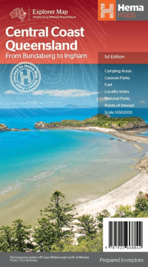
Landkaart Wegenkaart Explorer Map Central Coast Queensland - Hema • 9781922668844
Explorer Map Central Coast Queensland - Hema Productomschrijving: Central Coast Queensland Map (1st edition) - a two-sided regional map of the Central Coast of Queensland (1:550,000) that stretches from just south of Bundaberg up to Ingham in the north and as far west as Clermont. This two-sided regional map showcases the Central Coast of Queensland (1:550,000), extending from just so…
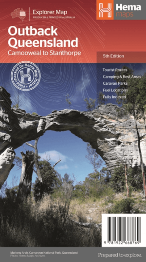
Landkaart Wegenkaart Explorer Map Queensland Outback - Hema Maps • 9781922668769
Explorer Map Queensland Outback - Hema Productomschrijving: Outback Queensland (QLD) contains mapping and visitor information for one of the most iconic regions in Australia. Mapping at a scale of 1:1,500,000 covers from the inland borders to Toowoomba in the east and Charters Towers in the north, with hill shading and elevation tinting creating a more realistic interpretation of the land…

Landkaart Wegenkaart Brisbane tot Cairns Region - Hema Maps • 9781865008714
Wegenkaart Brisbane tot Cairns Region - Hema Productomschrijving: City to City Map - via the Bruce Highway A Brisbane to the Cairns Region map at a scale of 1:1,500,000 with tourist drives map (1:3,000,000). Drive between Brisbane to Cairns with relevant touring points of interest and detailed mapping for the trip with 24-hour fuel, camping areas and caravan parks, rest areas and attra…