

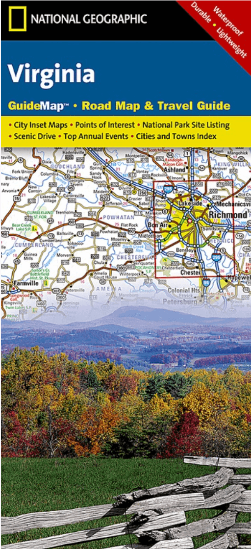
Landkaart Wegenkaart Virginia State guide map - Nat Geo
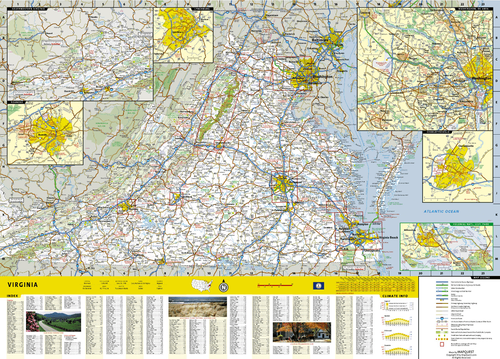
Washington DC area- Richmond- Charlottesville- Roanoke- Lynchburg

Korte omschrijving
Wegenkaart Virginia State guide map - Nat Geo Productomschrijving: National Geographic's Virginia Guide Map is an unparalleled and expertly researched guide to the "Old Dominion." The main m...

Specificaties
- Uitgever: National Geographic
- ISBN-13: 9781597750608
- HOOFDCATEGORIEËN: Wegenkaart - Landkaart
- Activiteiten: Street/Road maps & city plans
- Auteur: National Geographic
- Regio: Virginia, USA
- Land: Verenigde Staten van Amerika (USA)
- TOPO's & Stafkaarten: Topografisch wandelen
- Schaal: 1:1140000
- Taal: Engels
- Reeks/Serie: Nat Geo, State Guide Maps
Volledige omschrijving
Wegenkaart Virginia State guide map - Nat Geo
Productomschrijving: National Geographic's Virginia Guide Map is an unparalleled and expertly researched guide to the "Old Dominion." The main map shows the road network, with clear designations for free access and toll highway; interstate, state and country routes; other paved and unpaved roads; and scenic drives with their waysides stops. Major highways are shown with mileage markers. Pinpointed are hundreds of points of interest, national and state recreation areas, visitor centers, ski areas, hospital and airports. An index of counties, cities and towns will assist in finding your destination quickly.
Inset maps cover some of the largest cities and metropolitan areas, including the Washington DC area, Richmond, Charlottesville, Roanoke, Lynchburg, Colonial National Historical Park and Hampton Roads. Visitor information and inset maps are shown for Shenandoah National Park and the Blue Ridge Parkway scenic drive. Other popular points of interest, a chart of national park services and a calendar of events are also provided along with contact details for all listings.
Every State Guide Map is printed on durable synthetic paper, making them waterproof, tear-resistant and tough — capable of withstanding the rigors of any kind of travel.
Artikelen uit dezelfde regio
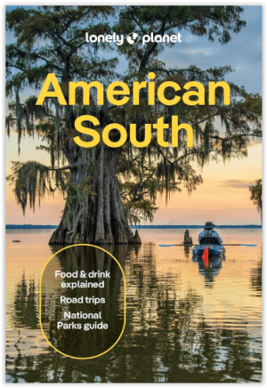
Reisgids America's South - Lonely Planet • 9781837588183
Reisgids America's South - Lonely Planet Productomschrijving: Lonely Planet's local travel experts reveal all you need to know to plan the trip of a lifetime in this latest edition of our guide to American South. Discover American South's most popular experiences and best kept secrets from getting back to nature and hiking up mist-shrouded peaks in the Great Smoky Mountains National Park; …
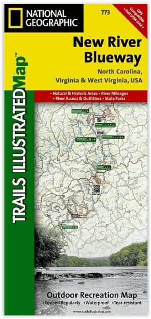
Wandelkaart 773 New River Blueway- Virginia USA - Nat Geo • 9781566952637
New River Blueway- Virginia USA - Nattional Geographic Productomschrijving: De New River stroomt meer dan 250 mijl noordwaarts vanaf haar oorsprong in de Blue Ridge Mountains van North Carolina en slingert door de bergen, glooiende heuvels en landbouwgrond in Virginia, om vervolgens door te rollen naar de steile kloven van West Virginia's kolenland. National Geographic's Trails Illustrated…
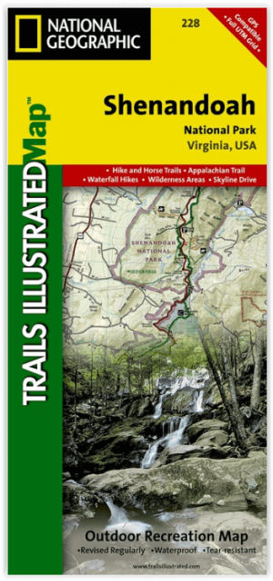
Wandelkaart 228 Shenandoah NP - Virginia USA - Nat Geo • 9781566953658
Wandelkaart Shenandoah National Park - Virginia Productomschrijving: Een uit de kuiten gewaasen topografische wandelkaart van een magestueuz Nationaal park in de staat Virginia in de Verenigde staten van Amerika. Het park is een lange en smalle bergketen die door het westen van staat Virginia loopt. Het park ligt op een bergrug van de Blue Ridge Mountains. Ten westen van de bergrug ligt de…

Wandelkaart 1503 Appalachian Trail - Deel 3 - Natgeo • 9781597756402
Wandelkaart 1503 > Appalachian Trail deel 3 > Damascus-Bailey Gap (9781597756402) Nat Geo Productomschrijving: Deze trail is een wonderbaarlijke route die van Main tot in Atlanta loopt, en ettelijke duizenden Km lang is. De route loopt door de mooiste delen van Oost USA, meerbepaald Virginia e.d. De route wordt jaarlijke door duizenden liefhebbers afgelopen, maar aangezien de route dusdani…
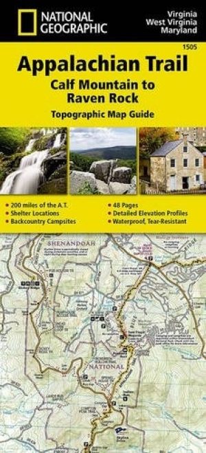
Wandelkaart 1505 Appalachian Trail - Deel 5 - Natgeo • 9781597756426
Wandelkaart 1505 > Appalachian Trail deel 5 - Calf Mt > Raven Rock (9781597756426) Nat. Geo Productomschrijving: Deze trail is een wonderbaarlijke route die van Main tot in Atlanta loopt, en ettelijke duizenden Km lang is. De route loopt door de mooiste delen van Oost USA, meerbepaald Virginia e.d. De route wordt jaarlijke door duizenden liefhebbers afgelopen, maar aangezien de route dusda…