

Landkaart Wegenkaart H3 Ierland Oost - OSI
Ireland East Road map
Korte omschrijving
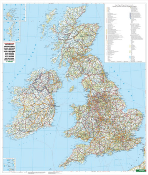
Wegenkaart Oost Ierland - OSI Productomschrijving: Ordnance Survey Ireland Eastern Road map at 1:250,000 approx 4 miles to the Inch. This map shows detailed road classification, altitud...

Specificaties
- Uitgever: Ordnance Survey Ireland
- ISBN-13: 9781908852854
- HOOFDCATEGORIEËN: Wegenkaart - Landkaart
- Activiteiten: Street/Road maps & city plans
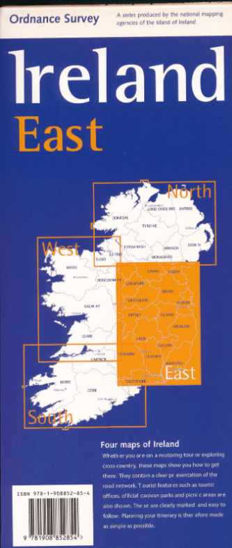
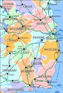
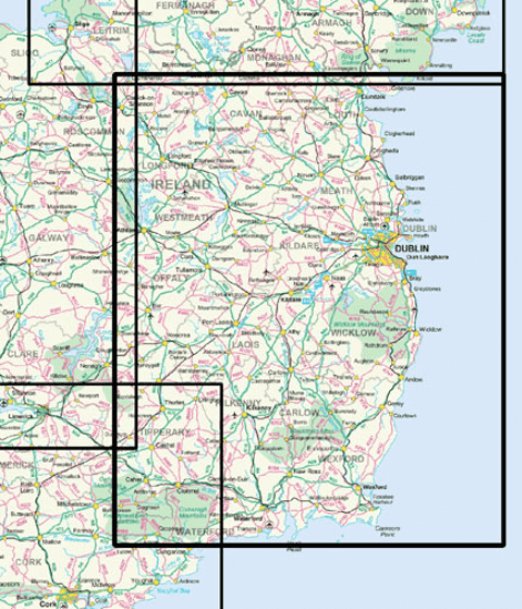
- Regio: Ierland, Oost Ierland
- Land: Ierland
- Schaal: 1:250000
- Taal: Engels
- Reeks/Serie: Discovery Series, OSI
Volledige omschrijving
Wegenkaart Oost Ierland - OSI
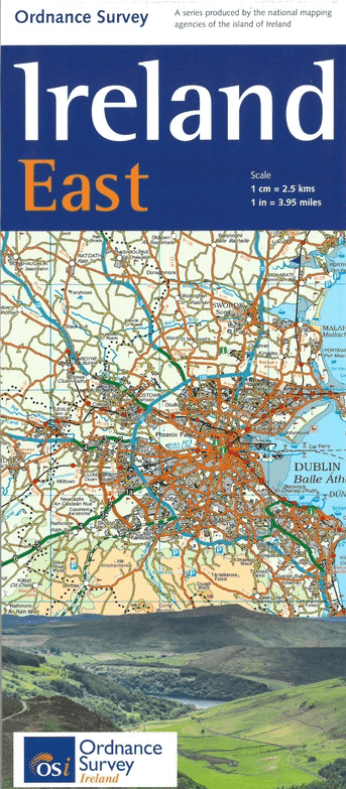
Productomschrijving: Ordnance Survey Ireland Eastern Road map at 1:250,000 approx 4 miles to the Inch.
This map shows detailed road classification, altitude colouring and tourist information, published by OSI, the Ordnance Survey of Ireland.
Topography of the island is shown by altitude colouring, with additional spot heights and names of mountain or hill ranges and other geographical features. Additional graphics show different types of woodlands etc. Road network shows six grades of roads; Railway lines are shown with stations.
A range of symbols highlights camping and caravan sites, nature reserves, National Trust and An Taisce properties or land, golf courses (indicating the number of holes), historical sites, etc.
Artikelen uit dezelfde regio

Landkaart Wegenkaart Ierland - Freytag & Berndt • 9783707925081
Wegenkaart Ierland - Freytag & Berndt Productomschrijving: Freytag & Berndt Ierland is een praktische wegenkaart voor reizigers die Ierland met auto, motor, camper of huurwagen willen verkennen. De kaart biedt een duidelijk overzicht van het volledige eiland en is geschikt voor routeplanning tussen steden, kustgebieden, nationale parken en landelijke regio’s. Met schaal 1:350.000 toon…

Wandelkaart 16 County Donegal, Fermanagh, Leitrim & Sligo - OSI Ireland • 9781912140503
Wandelkaart Donegal, Fermanagh, Leitrim & Sligo - OSI Productomschrijving: Ontdek Ierland met de Discovery Series Wandelkaarten van Ordnance Survey Ireland De Discovery Series wandelkaarten van Ordnance Survey Ireland (OSi) zijn dé keuze voor wandelaars, fietsers en avonturiers die Ierland echt willen verkennen. Deze hoogwaardige topografische kaarten bieden een gedetailleerd en nauwke…
Plano Wandkaart Groot-Brittannië & Ierland - 116 x 99 cm - F&B • 5425013064590
Plano Wandkaart Groot-Brittannië & Ierland Geplastificeerd - F&B Productomschrijving: De plano politieke wandkaarten van Freytag & Berndt brengen elk continent helder in beeld. Grote, duidelijke opgerolde kaart, zonder vouwen. Ideaal om meteen op te hangen in klaslokaal, kantoor of thuis. Landen, hoofdsteden, belangrijke steden en grenzen springen in het oog. Heldere kleuren zorgen voo…

Wandelkaart 31 County Mayo Central Discovery Series - OSI Ireland • 9781912140558
Wandelkaart Mayo Central Discovery Series - OSI Productomschrijving: Ontdek Ierland met de Discovery Series Wandelkaarten van Ordnance Survey Ireland De Discovery Series wandelkaarten van Ordnance Survey Ireland (OSi) zijn dé keuze voor wandelaars, fietsers en avonturiers die Ierland echt willen verkennen. Deze hoogwaardige topografische kaarten bieden een gedetailleerd en nauwkeurig o…

Wegenatlas Ierland official road spiraal atlas - OSI Ireland • 9781912140473
Wegenatlas Ierland official road atlas - OSI Ireland Productomschirjving: This edition contains updated road maps covering Ireland, plus City and Town Maps and Motoring Information, Distance Charts and Extensive Gazetteer (Index of Towns). The atlas covers all of the Island of Ireland using mapping information from both Ordnance Survey Ireland and Ordnance Survey Northern Ireland. …