

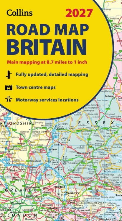
Landkaart Wegenkaart Britain road map 2027 - Harper Collins
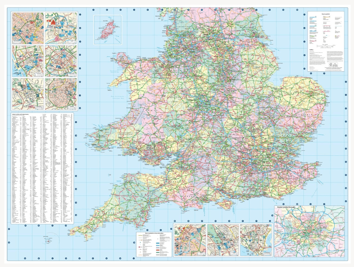
Double-sided road map of Great Britain at a scale of 8.7 miles to
Korte omschrijving
Wegenkaart Britain road map 2027 - Harper Collins Productomschrijving: Full-colour, double-sided road map of Great Britain at a scale of 8.7 miles to 1 inch. Northern England, Scotland and t...

Specificaties
- Uitgever: HarperCollins Publishers
- ISBN-13: 9780008779054
- HOOFDCATEGORIEËN: Wegenkaart - Landkaart
- Activiteiten: Street/Road maps & city plans
- Regio: Engeland, Schotland, Wales
- Land: England, Schotland, Wales
- Schaal: 1:550.000
- Taal: Engels
Volledige omschrijving
Wegenkaart Britain road map 2027 - Harper Collins
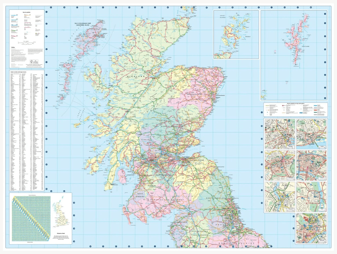
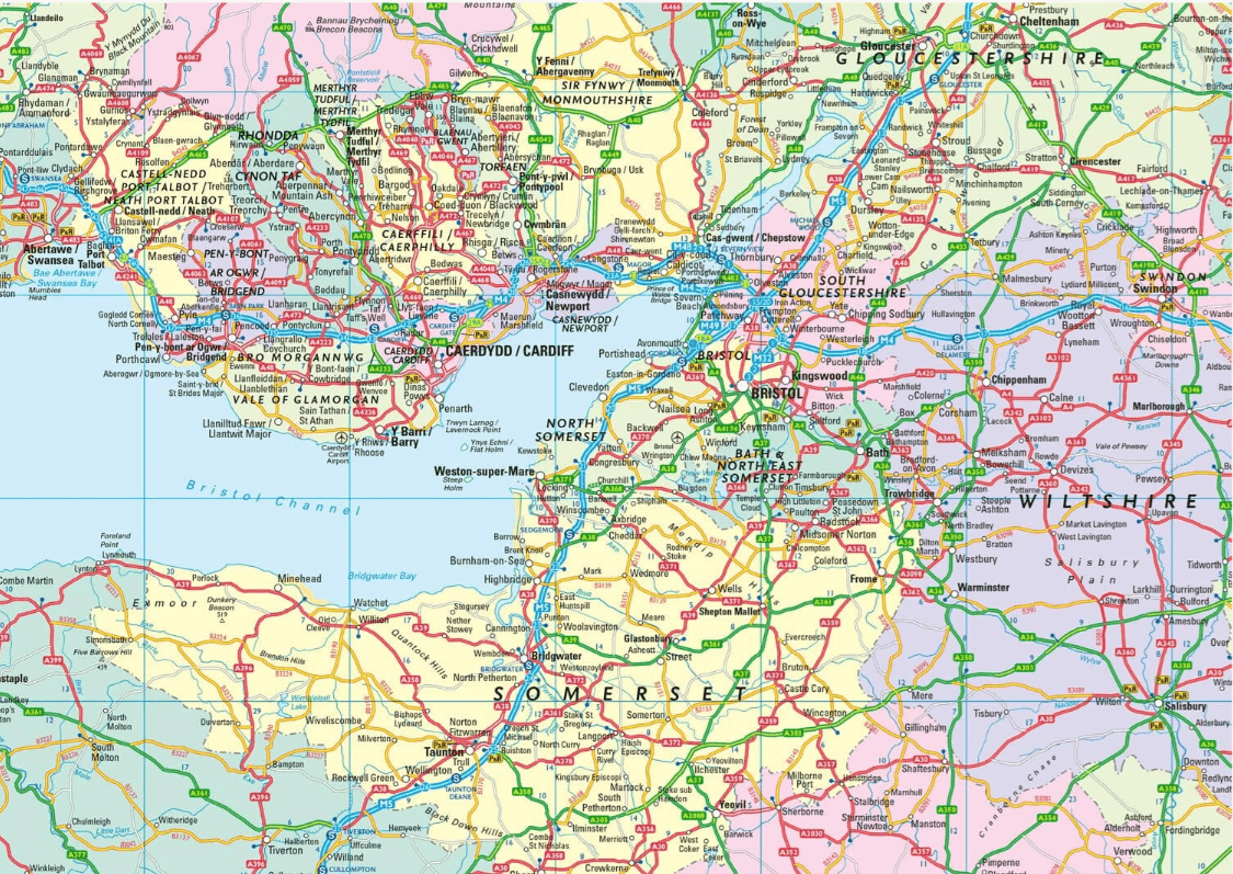
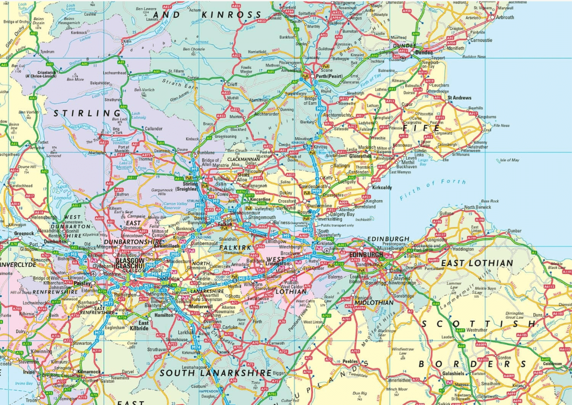
Productomschrijving: Full-colour, double-sided road map of Great Britain at a scale of 8.7 miles to 1 inch. Northern England, Scotland and the Isle of Man are on one side with Southern England and Wales on the other. With its political colouring of counties and unitary authorities,this map is ideal for business users but it is also perfect for tourists for route planning.
Main features:
Fully updated
Counties and local council areas shown in colour
Clear, detailed road network
Town and city names, rivers, railway lines and canals are clearly shown
16 city/town centre street plans
Index to place names
Mileage chart
Car ferry routes
Key in English, French and German
Artikelen uit dezelfde regio

Landkaart Wegenkaart 713 Groot-Brittannië & Ierland 26 - Michelin • 9782067270220
Wegenkaart 713 Groot-Brittannië & Ierland 2026 - Michelin Productomschrijving: Deze kaart omvat de nieuwe versie voor 2026, met alle straten, hoofdwegen, toeristische informatie en locaties voor Groot-Brittannië & Ierland 2026 - Nationale kaarten - Wegenkaarten national: een overzicht van het land voor lange trajecten - Schaal aangepast aant het land - Kaarten met jaartal voor de…

Wandelgids Wales coast path - Cicerone Press • 9781786312464
Wandelgids Wales coast path - Cicerone Productomschrijving: A single guidebook to walking the whole Wales Coast Path - 1400km (870 miles) the length of Wales from Chester to Chepstow, including Anglesey Island, described in 57 stages. The route passes through the Eryri (Snowdonia) and Pembrokeshire National Parks and many National Landscapes and can be linked with the Offa's Dyke Path for …

Fietsgids Great British Bike Rides - Vertebrate Publ. • 9781906148553
Great British Bike Rides - Vertebrate Productomschrijving: 40 classic routes for road cyclists Great British Bike Rides by Dave Barter brings together 40 of the best road rides in England, Scotland and Wales, searching out the country's most celebrated routes, toughest climbs and scenic roads. Features detailed route information, bespoke mapping and a statistical breakdown of every det…

Wandelgids Best Day Walks England - Lonely Planet Publications • 9781837586943
Wandelgids England - Lonely Planet Productomschrijving: Stretch your legs away from the city with Lonely Planet's Best Day Walks England and discover 60 easy escapes into nature with maps and directions. Lace up your walking boots and experience the freedom of the great outdoors with trails that range from a couple of hours to a full day. Immerse yourself in myths and legends as you explor…

Reisgids PassePartout Wales - Edicola Reisgidsen • 9789493300620
Reisgids Wales van Edicola Productomschrijving: Wie Wales zegt, zegt schitterende natuur, vriendelijke mensen en een rijke Keltische geschiedenis. Het land in het Verenigd Koninkrijk telt maar liefst drie nationale parken: het berggebied Snowdonia, de Brecon Beacons en de kustlijn van Pembrokeshire. Hoofdstad Cardiff is een verrassend gezellige stad die bruist van de cultuur, sport…