

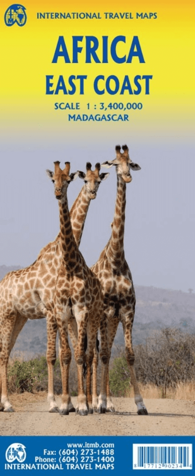
Landkaart Wegenkaart Afrika Oostkust - ITMB
Djibouti all the way south to Port Elizabeth, in South Africa
Korte omschrijving
Wegen- & stadskaarten Oostkust van Afrika en Afrika van ITMB Publishing Ltd. Ideaal voor tochten in Oost-Afrika.
Wegenkaart Afrika Oostkust - ITMB Productomschrijving: Map covering the entire coastline of the Indian Ocean portion of Africa, from Djibouti all the way south to Port Elizabeth, in South Af...

Specificaties
- Uitgever: ITMB Publishing Ltd
- ISBN-13: 9781771290234
- HOOFDCATEGORIEËN: Wegenkaart - Landkaart
- Activiteiten: Street/Road maps & city plans
- Regio: Afrika, Oostkust van Afrika
- Land: Oost-Afrika
- Schaal: 1:3400000
- Editie: 1
- Taal: Engels
- Reeks/Serie: International travel Maps
Volledige omschrijving
Wegenkaart Afrika Oostkust - ITMB
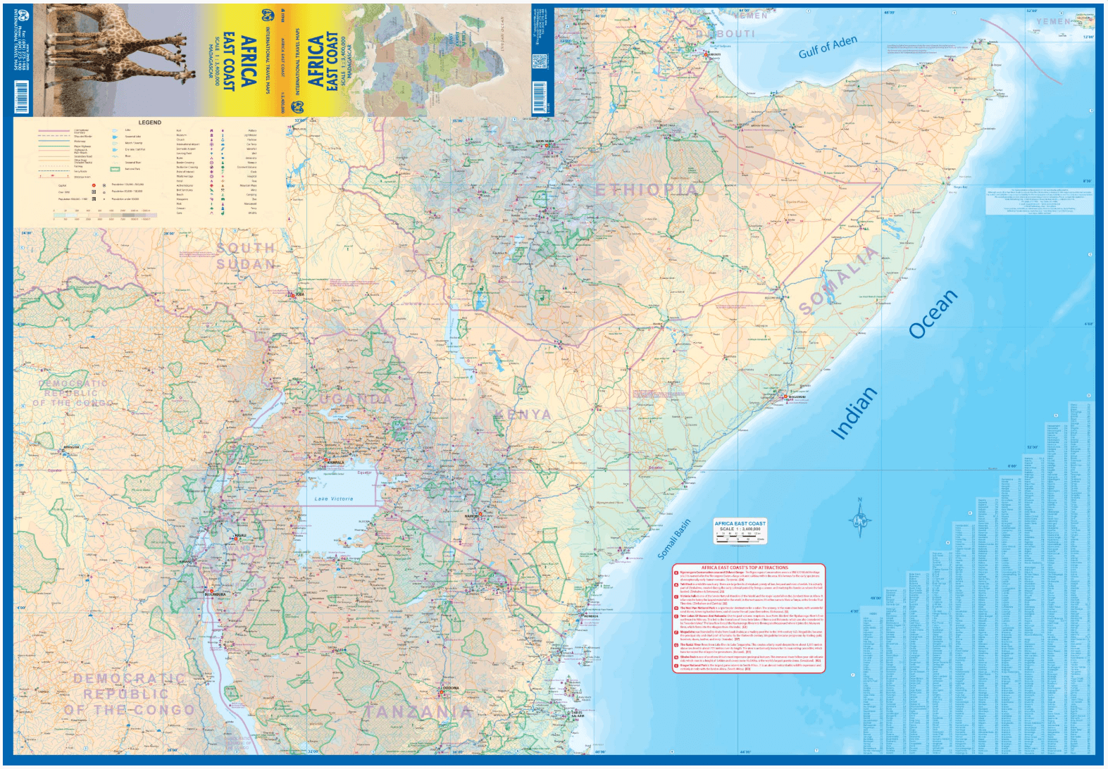
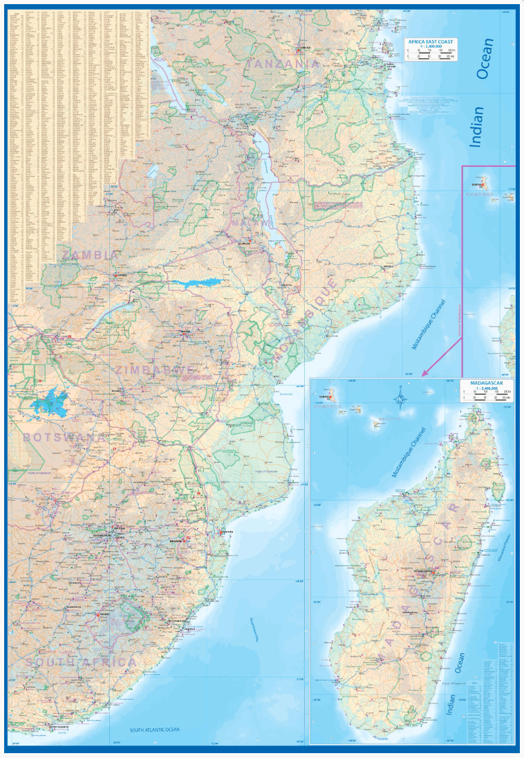
Productomschrijving: Map covering the entire coastline of the Indian Ocean portion of Africa, from Djibouti all the way south to Port Elizabeth, in South Africa. This double-sided map encompasses a vast region, including all of Djibouti, Somalia, Kenya, Uganda, Tanzania, Rwanda, Burundi, Mozambique, Malawi, Zimbabwe, Lesotho, and Swaziland (which now prefers to be called Eswatini), as well as an inset map of Madagascar.
Large portions of several other countries are included, such as South Africa and southern Ethiopia. This would be an excellent map for anyone travelling overland from Nairobi to the Cape. All road and rail routes are shown, as well as major touristic attractions, national parks and game preserves.
A Top Attractions list is included, noting Ngorogoro, Kruger, Victoria Falls, and lesser-known attractions such as the Tuli Block and Sibebe Rock.
Incl. Madagascar!
Artikelen uit dezelfde regio

Plano Politieke Wandkaart Afrika 61 x 78 cm - Nat Geo • 9780792250104
Wandkaart Afrika 61 x 78 cm - Nat Geo Productomschrijving: National Geographic's map of Africa is as attractive as it is functional. The entire continent is rendered in the Classic style with colorful, clearly defined international borders, shaded relief, and easy-to-read fonts. Place names, bodies of water, airports, major highways and roads, as well as cartographic patterns used to depic…

Plano Politieke Wandkaart Afrika 91 x 118 cm GROOT - Nat Geo • 9780792250111
Wandkaart Afrika 91 x 118 cm GROOT - Nat Geo Productomschrijving: National Geographic's map of Africa is as attractive as it is functional. The entire continent is rendered in the Classic style with colorful, clearly defined international borders, shaded relief, and easy-to-read fonts. Place names, bodies of water, airports, major highways and roads, as well as cartographic patterns used t…

Plano Politiek & Antieke Wandkaart 61 x 78 cm - Nat Geo • 9781597752596
Wandkaart 61 x 78 cm - Nat Geo Productomschrijving: National Geographic's map of Africa is as attractive as it is functional. The entire continent is rendered in the Executive style with an antique color pallet, clearly defined international borders, shaded relief, and easy-to-read fonts. Place names, bodies of water, airports, major highways and roads, as well as cartographic patterns use…

Plano Politieke Wandkaart Afrika 100 x 120 - Lovell Johns • 9781903030851
Plano Wandkaart Afrika - Lovell Johns Productomschrijving: Deze politieke kaart van Afrika toont het hele Afrikaanse continent, van Marokko tot Noord- naar Zuid-Afrika en Madagaskar in het zuiden. Elk land heeft een andere kleur waardoor het eenvoudig is om internationale grenzen te zien. In de legende onderaan de kaart staan de vlaggen van elk land. Deze politieke kaart van Afrika bevat o…

Landkaart Wegenkaart Afrika - ITMB • 9781771290173
Wegenkaart Afrika - ITMB Productomschrijving: This proper digital data base map of Africa covers the entire continent from top to bottom and east to west. All of Africa is portrayed, including the off-lying islands of Cape Verde, the Canaries, Madeira, Socotra, the Comoros and Madagascar. Although we have shown areas of border dispute, we show boundaries as they are. Finally, we have used …