

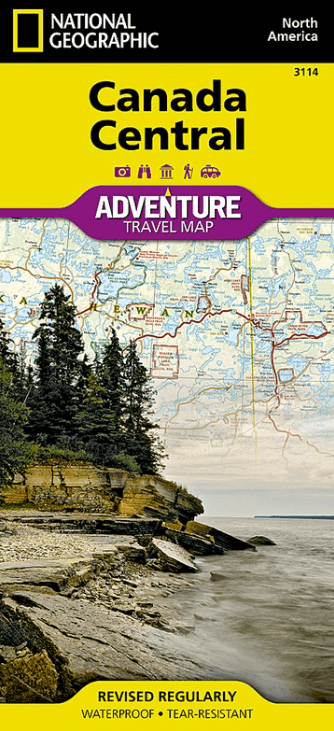
Landkaart Wegenkaart 3114 Canada Centraal - Nat Geo
Hudson Bay - Ontario - Algonquin Provincial Park - Manitoba
Korte omschrijving
Wegenkaart Canada Centraal - Nat Geo Productomschrijving: National Geographic's Canada Central Adventure Map provides global travelers with the perfect combination of detail and perspective...

Specificaties
- Uitgever: National Geographic
- ISBN-13: 9781566956369
- HOOFDCATEGORIEËN: Wegenkaart - Landkaart
- Activiteiten: Street/Road maps & city plans
- Auteur: National Geographic
- Regio: Canada, Centraal Canada
- Land: Canada
- Waterafstotende kaart: Nat Geo waterproof series
- TOPO's & Stafkaarten: Topografisch wandelen
- Schaal: 1:2100000
- Taal: Engels
- Reeks/Serie: NAT GEO Adventure travel maps
Volledige omschrijving
Wegenkaart Canada Centraal - Nat Geo
Productomschrijving: National Geographic's Canada Central Adventure Map provides global travelers with the perfect combination of detail and perspective in a highly functional travel tool. The map includes the locations of cities and towns with a user-friendly index, a clearly marked road network complete with distances and designations for roads/highways, plus secondary routes for those seeking to explore off the beaten path for destinations between Alberta and Ontario. Hundreds of points of interest and diverse and unique destinations are highlighted including World Heritage sites, national and provincial parks, bird sanctuaries, archeological sites, ski areas, hot springs, museums, and more. Whether you are staying in the Polar Bear capital of the world on Hudson Bay, visiting Ontario's award-winning wine region, or sitting beside a campfire in Algonquin Provincial Park, this map will prove a valuable resource in your travels.
On the west side of the print map, explore the diverse landscape of Manitoba, bordered by Ontario to the east, the arctic coastline of the Nunavut Territory to the north, and the U.S. states of North Dakota and Minnesota in the south. Saskatchewan, where you are never far from lake or river recreational opportunities, lies directly to the west, bordered by the prairie province of Alberta and the state of Montana. The adventure continues on side two, heading to the extreme north with the untouched Labrador Peninsula and Inuit culture of Nunavut. Cross the James Bay to explore the many provincial parks of Ontario, or journey south to the maple hills and lakes of the Algonquin Upland.
Every Adventure Map is printed on durable synthetic paper, making them waterproof, tear-resistant and tough — capable of withstanding the rigors of international travel.
Key Features:
- Waterproof and tear-resistant
- Detailed interpretive information and local travel tips
- Detailed topography complete with activity symbols, ideal for exploring the country
- City overview maps
- Hundreds of points of interest, including the location of World Heritage sites, national parks and nature reserves, aboriginal settlements.
- Thousands of place names
- Important travel aids including airports, lighthouses, ferry routes and rail lines
- Developed in cooperation with local agencies
- Updated regularly to ensure accuracy
Gekoppelde artikelen

Landkaart Wegenkaart 3113 Canada West - Nat Geo • 9781566956352
standaard versieWegenkaart West Canada - Nat Geo Productomschrijving: National Geographic's Canada West Adventure Map provides global travelers with the perfect combination of detail and perspective in a highly functional travel tool. Cities and towns are clearly indicated and easy to find in the user-friendly index. A road network complete with distances and designations for roads, motorways, and expres…
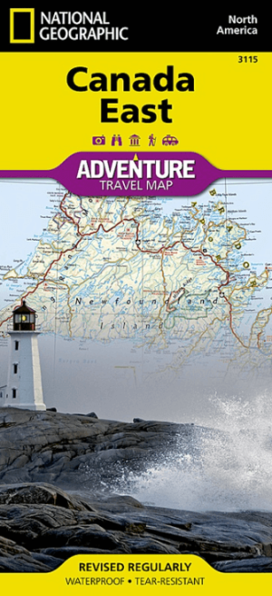
Landkaart Wegenkaart 3115 Canada Oost - Nat Geo • 9781566956376
standaard versieWegenkaart Oost Canada - Nat Geo Productomschrijving: Explore the rich cultural history and many recreation activities available in Canada's eastern territories with National Geographic's Canada East Adventure Map. Designed to meet the needs of adventure travelers with its detailed, accurate information, this map includes the location of cities and towns with a user-friendly index and a c…
Artikelen uit dezelfde regio

Reisgids Canada - Rough Guides • 9781835292471
Reisgids Canada - Rough Guides Productomschrijving: The Rough Guide to Canada is the ultimate travel guide to this immense country. In full colour throughout, with clear maps, detailed coverage, suggested itineraries and regional highlights, there are independent author recommendations for hotels, restaurants, cafés and bars from Toronto and Montréal to Vancouver, and from the east coast t…

Stadskaart plattegrond Montréal Quebeck Canada - Borch • 9783866093270
Wandelkaart Montréal Quebeck Canada - Borch Productomschrijving: Our soft-laminated folded map of Montreal in the 11th edition shows: Montreal Center 1:15 000, Olympic Park 1:15 000, Old Montreal 1:6500, Montreal & Region 1:250 000, Public Transport Montreal, Underground City Montreal, Top 30 Sights, Canada administrative & time zones. Borch Maps are easy to fold, durable and water-repelle…
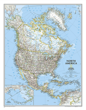

Plano Politieke Wandkaart Amerika North 60 x 77 cm - Nat Geo • 9780792250173
Wandkaart Amerika North 60 x 77 cm - Nat Geo Productomschrijving: From the far northern reaches of the Arctic Sea to the Isthmus of Panama, this Classic style political map of North America features trademark National Geographic detail and accuracy. The bright color palette features blue oceans and stunning shaded relief that has been a signature of National Geographic wall maps for ov…
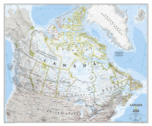
Plano Wandkaart Canada 97 x 82 cm - Nat Geo • 9781597753555
Wandkaart Canada 97 x 82 cm - Nat Geo Productomschrijving: National Geographic's map of Canada is one of the most authoritative maps of "The Great White North." This Classic style wall map features a bright color palette with blue oceans and the country's terrain detailed in stunning shaded relief that has been a hallmark of National Geographic maps for over 75 years. Thousands of place na…
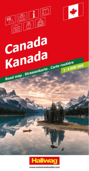
Landkaart Wegenkaart Road Map Canada - Hallwag • 9783828330245
Wegenkaart Road Map Canada - Hallwag Productomschrijving: Op zoek naar betrouwbare Hallwag wegenkaarten? Deze klassieke road maps staan bekend om hun duidelijke cartografie, praktische indeling en heldere weergave van wegen en verbindingen. Voor autoritten, vakanties, camperreizen en lange roadtrips bieden Hallwag wegenkaarten het overzicht dat je onderweg nodig hebt. Deze omvat Canada in …