

Wandelkaart Tour du Mont Blanc - Vertebrate Publ.
Starts in Les Houches south of Chamonix

Korte omschrijving
Wandelkaarten Auvergne-Rhône-Alpes, Frankrijk van Vertebrate Publishing. Ideaal voor tochten in Frankrijk.
Tour du Mont Blanc - Vertebrate Productomschrijving: Easy-to-use folding map and essential information, with custom itinerary planning for walkers, trekkers, fastpackers and trail runners ...

Specificaties
- Uitgever: Vertebrate Publishing
- ISBN-13: 9781912560974
- HOOFDCATEGORIEËN: Wandelkaart
- Activiteiten: Wandelen, Hiking & Trekking
- Regio: Auvergne-Rhône-Alpes, Frankrijk
- Land: Frankrijk
- Departement: Haute-Savoie (74)
- TOPO's & Stafkaarten: Topografisch wandelen
- Schaal: 1:40000
- Taal: Engels
- De Franse Regio's: Auvergne-Rhône-Alpes
- Iconische Bergketens van Europa: De Alpen
- Iconische Wandelroutes: Tour de Mont Blanc TMB, Frankrijk
Volledige omschrijving
Tour du Mont Blanc - Vertebrate
Productomschrijving: Easy-to-use folding map and essential information, with custom itinerary planning for walkers, trekkers, fastpackers and trail runners
The Tour du Mont Blanc Guidemap from Vertebrate Publishing is a lightweight, waterproof, durable and easy-to-use folding map with 1:40,000-scale mapping for the anticlockwise TMB route. Includes route variations, an elevation profile and route planner, safety advice, terrain information and accommodation directory.
The white dome of Mont Blanc looms over France, Italy and Switzerland, and it is no wonder that the 169-kilometre Tour du Mont Blanc (TMB) has captured the public imagination to become one of Europe’s most popular long-distance trails. The TMB appeals to people who have different levels of experience and travel at all speeds, and this Vertebrate Publishing Guidemap is unique in that it caters for four categories of user, providing custom itineraries for walkers, trekkers, fastpackers and trail runners.
This lightweight, waterproof, durable and easy-to-use folding map features all the essential information for a successful TMB, including 1:40,000-scale mapping for the anticlockwise route starting and finishing in the town of Les Houches, south of Chamonix. It also includes nine route variations, a detailed elevation profile and route planner, safety advice, terrain information and an accommodation directory.
Artikelen uit dezelfde regio

Wandelgids PN24 Parc Naturel Régional du Vercors à pied - FFR • 9782751413605
Wandelgids Parc Naturel Régional du Vercors à pied - FFR Productomschrijving: De Vercors staat bekend om zijn landschappen, uitzichten, fauna, flora, reliëf, rotsen en ravijnen. Dit gebied met een rijke geschiedenis is een populaire bestemming voor wandelaars. Tussen bossen, steile hellingen, rotsmassieven en wilde dieren kun je op verschillende routes de emoties ontdekken die verborgen l…

Wandelgids 470 Au coeur des gorges de l'Allier à pied - FFR • 9782751414008
Au coeur des gorges de l'Allier à pied - FFRP Franse Productomschrijving: L'itinéraire traverse un paysage sauvage façonné par l'Allier, entre vallées boisées et gorges profondes. De par sa conjoncture naturelle, le territoire est propice à la randonnée et au rafting. Autour des gorges, se trouve des villages pittoresques aux traits moyenâgeux (châteaux, remparts, abbayes, art roman...) t…

Wandelkaart 2728 SB Le Donjon & Saint-Léon - IGN • 9782758541622
Wandelkaart - Le Donjon & Saint-Léon Productomschrijving: Le Donjon is een gemeente in het Franse departement Allier in de regio Auvergne-Rhône-Alpes. De plaats maakt deel uit van het arrondissement Vichy. Desciptive produits: Une nouvelle cartographie pour une lisibilité optimale, avec une meilleure précision géométrique et des informations touristiques enrichies. Un nouveau format de…

Wandelgids Wandelatlas DEEL 1 Camino de Santiago - Michelin • 9782067174016
Wandelgids Camino de Santiago - Michelin Productomschrijving: Het MICHELIN boekje Chemins de Compostelle / Le Puy-en-Velay à Saint-Jean Pied de Port (kaartbasis bijgewerkt dit jaar) is een essentieel hulpmiddel voor alle wandelaars op de Camino de Santiago. Van Le Puy en Velay tot Saint Jean Pied de Port is de route van 730 km verdeeld in etappes van 4,5 tot 7,5 uur lopen. Dankzij het Kaa…
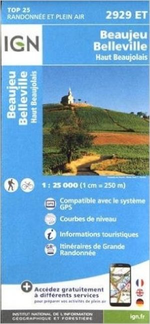
Wandelkaart 2929 ET Beaujeu - Belleville & Haut Beaujolais - IGN • 9782758534983
Wandelkaart Beaujeu- Belleville- Haut Beaujolais Rhone Alpes Omvat: Beaujeu is een gemeente in het Franse departement Rhône (regio Rhône-Alpes) De plaats maakt deel uit van het arrondissement Villefranche-sur-Saône. Productomschrijving: Tussen 2014 en 2018 vernieuwt IGN haar volledige collectie serie blauw. Een nieuwe toewijzing voor optimale leesbaarheid, met een grotere mate van geom…