

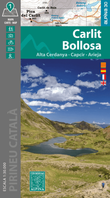
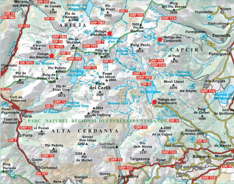
Wandelkaart Alpina 30 Carlit & Bollosa Franse pyreneeën - Alpina
Carlit - Bollosa - Alta Cerdanya - Capcir - Arieja
Korte omschrijving
Wandelkaarten Occitanië, Frankrijk en Oostelijke Pyreneeën van Editorial Alpina S.L.. Ideaal voor tochten in Frankrijk.
Wandelkaart Carlit & Bollosa - Editorial Alpina Productomschrijving: Lac des Bouillouses, De Pic Carlit van 2921 meter hoog, De Alta Cerdanya is het noordelijke deel van de bredere regio Cer...
Specificaties
- Uitgever: Editorial Alpina S.L.
- ISBN-13: 9788470111709
- HOOFDCATEGORIEËN: Wandelkaart
- Activiteiten: Wandelen, Hiking & Trekking
- Regio: Occitanië, Frankrijk, Oostelijke Pyreneeën
- Land: Frankrijk
- Nationale parken: Pyrénées NP, Frankrijk
- TOPO's & Stafkaarten: Topografisch wandelen
- Schaal: 1:30000
- Taal: Engels
- Reeks/Serie: Alpina 30
- De Nationale Parken: Pyreneeën Nationaal Park, Frankrijk
- Iconische Bergketens van Europa: De Pyreneeën
Volledige omschrijving
Wandelkaart Carlit & Bollosa - Editorial Alpina
Productomschrijving: Lac des Bouillouses, De Pic Carlit van 2921 meter hoog, De Alta Cerdanya is het noordelijke deel van de bredere regio Cerdanya, Capcir is een soort regio (Comarca) , tenslotte is de Arieja een rivier, die door het gebied loopt. Deze kaart biedt u een overzicht van al deze landschapdelen op 1 plaats in de Oostelijke Pyreneeën in de Franse regio Occotanië.
Map/Folder Catalan / Spanish / English / French
• Hiking map and guidebook
• Scale 1:30.000
• Equidistance contours: 10 m distance
• Master contours: at 50 m
• Shady relief
• Compatible with GPS
• Marked routes
• Land use symbolized at three levels
Artikelen uit dezelfde regio

Wandelgids Vallée d'Argelès-Gazost - Hautacam - Rando • 9782344054406
Wandelgids Vallée d'Argelès-Gazost - Hautacam - Rando Productomschrijving: 12 wandelingen en trektochten voor alle niveaus om de vallei van Argelès-Gazost - Hautacam te ontdekken. In het hart van het Nationaal Park van de Pyreneeën, in een 100% groene, milieuvriendelijke, verantwoordelijke en vooral duurzame omgeving, waar de toppen tot boven de 3000 meter reiken, opent zich een XXL-gebied…
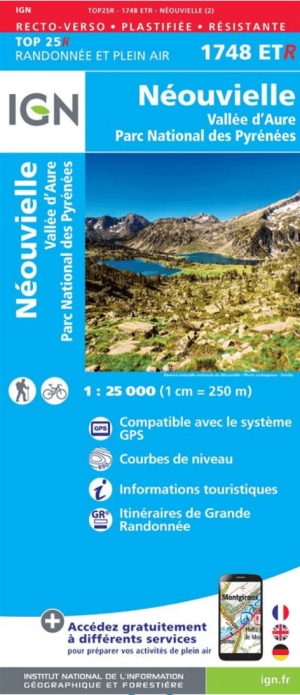
Wandelkaart 1748 ET(R) Néouvielle & Vallée d'Aure - IGN • 9782758542032
Wandelkaart Néouvielle & Vallée d'Aure - IGN Productomschrijving: Het Réserve Naturelle Nationale du Néouvielle in de Franse Pyreneeën is een spectaculair granietmassief dat bekend staat om zijn microklimaat, meer dan 70 kristalheldere meren en de hoogste bossen met pins à crochets (haakdennen) van Europa. de locatie vindt u terug in het departement van de Haut-Pyrénées in Frankrijk. Op d…
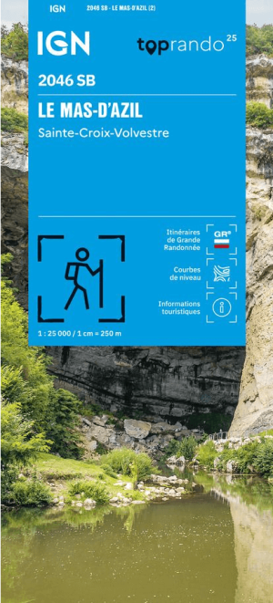
Wandelkaart 2046 SB Le Mas-d'Azil & Ste-Croix-Volvestre - IGN • 9782758557982
Wandelkaart Le Mas-d'Azil & Ste-Croix-Volvestre - IGN Productomschrijving: Deze nieuwe versie van de kaart van Le Mas-d'Azil & Ste-Croix-Volvestre van IGN, ligt in het departement van de Ariège, gelegen in de regio Occitanië Omvat: Bédeille, Suzan, Clermont, Artigat, Le Plan, Saint-Michel, Lescure, Couladère, Montberaud, Montbrun-Bocage, Taurignan-Castet, Mauvezin-de-Sainte-Croix, Thou…
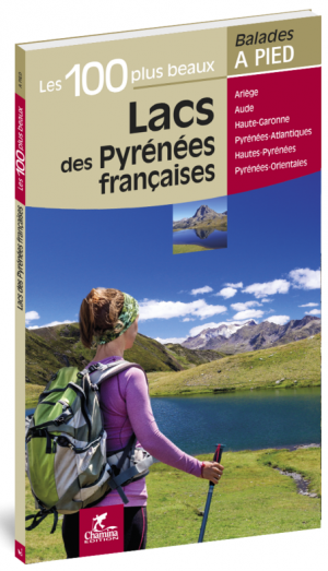
Wandelgids Les 100 plus beaux lacs à pied - Ed. Chamina • 9782844664396
Wandelgids - Les 100 plus beaux lacs à pied - Ed. Chamina Les Pyrénées françaises de Chamina Productomschrijving: Met deze gids, gaat u op zoek naar de 100 mooiste meren van de Franse Pyreneeën, verzameld in een enkele wandelgids. Eerder sportief bevat dit boek 51 routes. Het is cadeau voor berg liefhebbers en meervissers. 6 departementen worden van west naar oost doorgekruist: De Pyré…
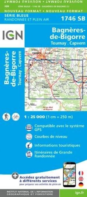
Wandelkaart 1746 SB Bagnères-de-Bigorre - IGN • 9782758539476
Wandelkaart 1746 SB - Bagnères-de-Bigorre Omvat eveneens: Tournay & Capvern Productomschrijving: Bagnères-de-Bigorre is een gemeente in het Franse departement Hautes-Pyrénées, een sublieme wandelomgeving in de prachtige hoge Franse Pyreneeen. De plaats maakt deel uit van het arrondissement Bagnères-de-Bigorre. Descriptif complèt: Une nouvelle cartographie pour une lisibilité optima…