
Wandelkaart Adventure Series Macgillycuddy's Mountains & Killarney NP - OSI
County Kerry- Carrauntoohil- Carrauntoohil- Beenkeragh- Caher

Korte omschrijving
Wandelkaarten County Kerry, Ireland van Ordnance Survey Ireland. Ideaal voor tochten in Ierland.
Wandelkaart Macgillycuddy's Mountains & Killarney NP - OSI Productomschrijving: The Adventure Series is printed on Water Resistant Paper. This map is situated in County Kerry Among the road...

Specificaties
- Uitgever: Ordnance Survey Ireland
- ISBN-13: 9781908852267
- HOOFDCATEGORIEËN: Wandelkaart
- Activiteiten: Wandelen, Hiking & Trekking
- Regio: County Kerry, Ireland
- Land: Ierland
- Nationale parken: Killarney National Park, County Kerry Ireland
- Schaal: 1:25000
- Taal: Engels
- Reeks/Serie: Adventure Series, OSI
Volledige omschrijving
Wandelkaart Macgillycuddy's Mountains & Killarney NP - OSI
Productomschrijving: The Adventure Series is printed on Water Resistant Paper. This map is situated in County Kerry Among the roads featured on this map are the following; The N22, N71, N72 and the R568. The railway line passes through Killarney NP.
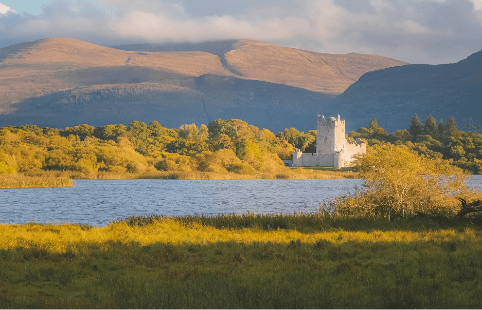
This map covers Killarney Town and Killarney National Park together with the MacGillycuddy’s Mountains. A detailed enlarged area showing Carrauntoohil, the highest peak in Ireland, and the surrounding area is included at 1:12,500. The towns of Killarney and Beaufort are marked.
The MacGillycuddy’s Reeks are the main feature of this map. Numerous summits are marked including Carrauntoohil, Beenkeragh, Caher, Knocknapeasta, The Bones Peak and the Big Gun.
Lakes are spread throughout this map. Lough Leane along with many other lakes including Muckross Lake, Lough Caragh, Lough Acoose , Lough Fadda and Lough Beg are shown. The River Flesk, River Laune and River Gearhameen are amongst the many rivers and streams marked on the map. This is a very scenic area of Kerry and ever popular with visitors throughout the year whether they are looking for relaxation or an activity based holiday.
Viewpoints are marked throughout the map.
Outdoor mountain pursuits are among the main tourist activities in the area. Mountain climbing is an important tourist activity in the MacGillycuddy’s Reeks. Walks and loops are also marked and among them are The Kerry Way, National Park Loops, Hag’s Glen Loop and the Ring of Kerry Cycle Route.
The Ring of Kerry also features along with the Gap of Dunloe and Moll’s Gap.
Locatie op kaart
Artikelen uit dezelfde regio
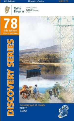
Wandelkaart 78 County Kerry - OSI • 9781912140398
Wandelkaart County Kerry - OSI Productomschrijving: Ontdek Ierland met de Discovery Series Wandelkaarten van Ordnance Survey Ireland. Omvat : Countie Kerry, Killorglin, Kebnare, Ring of Kerry. De Discovery Series wandelkaarten van Ordnance Survey Ireland (OSi) zijn dé keuze voor wandelaars, fietsers en avonturiers die Ierland echt willen verkennen. Deze hoogwaardige topografische …
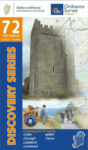
Wandelkaart 72 County Kerry, Cork & Limerick - OSI • 9781912140022
Wandelkaart 7County Kerry, Cork & Limerick - OSI Productomschrijving: Ontdek Ierland met de Discovery Series Wandelkaarten van Ordnance Survey Ireland. Omvat de Counties: Kerry, Cork & Limerick De Discovery Series wandelkaarten van Ordnance Survey Ireland (OSi) zijn dé keuze voor wandelaars, fietsers en avonturiers die Ierland echt willen verkennen. Deze hoogwaardige topografisch…

Wandelkaart 71 County Kerry (Tralee) - OSI • 9781912140671
Wandelkaart County Kerry (Tralee) - OSI Productomschrijving: Ontdek Ierland met de Discovery Series Wandelkaarten van Ordnance Survey Ireland. Omvat: Countie: Kerry (Tralee, Ballyheige, Abbeydiney, Fenit & Castlemaine) De Discovery Series wandelkaarten van Ordnance Survey Ireland (OSi) zijn dé keuze voor wandelaars, fietsers en avonturiers die Ierland echt willen verkennen. Deze …
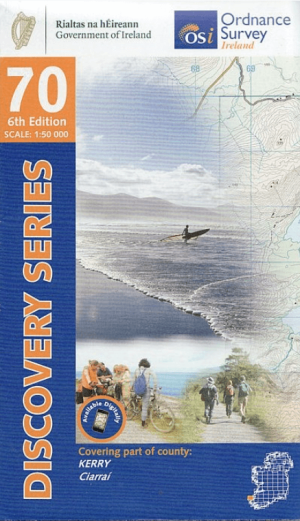
Wandelkaart 70 County Kerry (Dingle) - OSI • 9781912140251
Wandelkaart County Kerry (Dingle) - OSI Productomschrijving: Ontdek Ierland met de Discovery Series Wandelkaarten van Ordnance Survey Ireland. Omvat de Countie: Kerry (Dingle, Castegregory, Slea Head, Dunquin) De Discovery Series wandelkaarten van Ordnance Survey Ireland (OSi) zijn dé keuze voor wandelaars, fietsers en avonturiers die Ierland echt willen verkennen. Deze hoogwaardi…
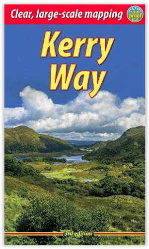
Wandelgids The Kerry Way 210 km - Rucksack Readers • 9781913817015
Wandelgids Kerry Way - Rucksack Readers Productomschrijving: De Kerry Way loopt over een afstand van ongeveer 210 km, door de meest spectaculaire berglandschappen van Ierland en begint en eindigt in de stad Killarney. Dramatische pieken en dalen, woeste heidevelden, meren en winderige bergpassen gaan prachtig samen met uitgestrekte kustpanorama's. De volledige tocht duurt negen dagen, maar…