

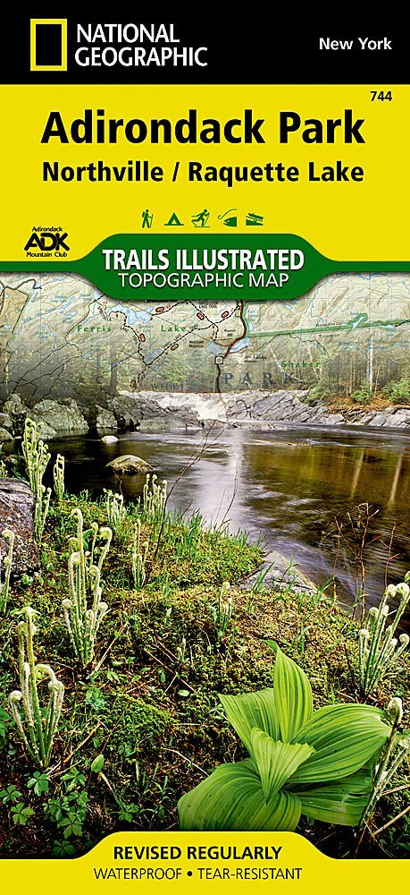
Wandelkaart 744 Adirondack Park - Northville & Raquette Lake
Raquette Lake is de oorsprong van Raquette River
Korte omschrijving
Wandelkaarten New York State, USA van National Geographic. Ideaal voor tochten in Verenigde Staten van Amerika (USA).
Wandelkaart 744 -Adirondack Park - Northville & Raquette Lake Productomschrjiving: Adirondack park of mountains, een groter bebost deel van de staat New York. In dit geval gaat het over Nort...

Specificaties
- Uitgever: National Geographic
- ISBN-13: 9781566953108
- HOOFDCATEGORIEËN: Wandelkaart
- Auteur: National Geographic
- Regio: New York State, USA
- Land: Verenigde Staten van Amerika (USA)
- Regionale parken: Adirondack Park/Mountains NY, USA
- TOPO's & Stafkaarten: Topografisch wandelen
- Schaal: 1:75000
- Taal: Engels
Volledige omschrijving
Wandelkaart 744 -Adirondack Park - Northville & Raquette Lake
Productomschrjiving: Adirondack park of mountains, een groter bebost deel van de staat New York. In dit geval gaat het over Northville & Raquette Lake. Raquette Lake is de oorsprong van Raquette River in de Adirondack Mountains in New York State.
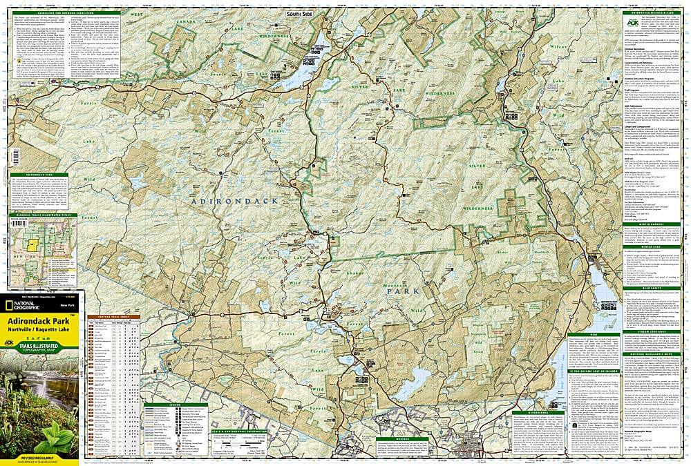
Engelse omschrijving: National Geographic's Trails Illustrated map of Adirondack Park, Northville / Raquette Lake is designed to meet the needs of outdoor enthusiasts by combining valuable information with unmatched detail of this distinct portion of the park.
Created in partnership with local land management agencies, this expertly researched map features a variety of recreation areas including Raquette, Caroga, Indian, Blue Mountain, and Piseco lakes. Some of the wilderness areas included are Silver Lake, Siamese Ponds, and Little Moose; and Ferris Lake, Shaker Mountain, and Moose River Plains are among the wild forests covered.
With miles of clearly marked trails that include mileages between intersections, this map will prove invaluable in your exploration of the region. The Central Trail Chart will help you choose a trail that's right for your activity level and recreation use whether you're hiking, horseback riding, biking, snowshoeing, cross country skiing, or snowmobiling. Recreation features are clearly marked, including campgrounds, climbing areas, fishing access, swimming areas, marinas, and ski areas. The map base includes contour lines and elevations for summits, passes and many lakes. Every Trails Illustrated map is printed on "Backcountry Tough" waterproof, tear-resistant paper. A full UTM grid is printed on the map to aid with GPS navigation.
Other features found on this map include: Baldhead Mountain, Blue Mountain, Gloversville, Indian Lake, Panther Mountain, Piseco Lake.
Locatie op kaart
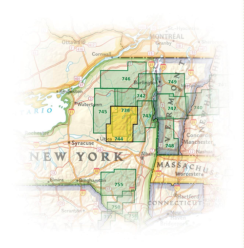
Overzichtskaarten
NAT GEO New York trail map
NAT GEO New York trail map

Producten op de overzichtskaart
Klik op een product om naar de detailpagina te gaan.
- Wandelkaart 738 Allegheny National Forest North - Nat Geo
- Wandelkaart 742 Adirondack Park - Lake Placid - Natgeo
- Wandelkaart 745 Adirondack Park - Old Forge & Oswegatchie
- Wandelkaart 746 Adirondack Park - Saranac & Paul Smiths
- Wandelkaart 747 Green Mountain National Forest- Vermont
- Wandelkaart 743 Adirondack Park - Lake George - Natgeo
- Wandelkaart 744 Adirondack Park - Northville & Raquette Lake
- Wandelkaart 748 Green Mountain National Forest
- Wandelkaart 756 Harriman- Bear Mountain & Sterling Forest parks

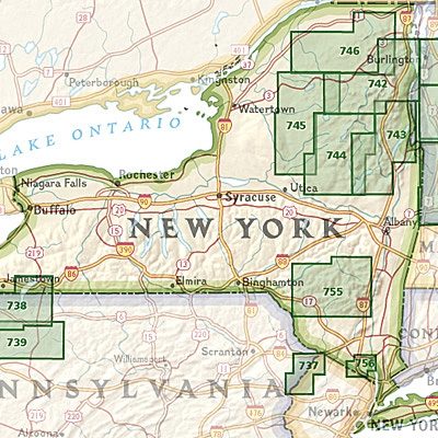
NAT GEO Maine trails map
NAT GEO Maine trails map

Producten op de overzichtskaart
Klik op een product om naar de detailpagina te gaan.
- Wandelkaart 212 Acadia National Park - Natgeo
- Wandelkaart 742 Adirondack Park - Lake Placid - Natgeo
- Wandelkaart 743 Adirondack Park - Lake George - Natgeo
- Wandelkaart 744 Adirondack Park - Northville & Raquette Lake
- Wandelkaart 746 Adirondack Park - Saranac & Paul Smiths
- Wandelkaart 747 Green Mountain National Forest- Vermont
Artikelen uit dezelfde regio

Wandelgids Wandelen in New York - Odyssee Reisgidsen • 9789461230409
Wandelen in New York - Odyssee Productomschrijving: Deze wandelgids laat je kennismaken met het New York achter de beroemde skyline. De zeventien wandelingen leiden je door interessante buurten van deze enerverende stad. Ze vertellen het verhaal over de ontwikkeling van New York: van een Nederlandse kolonie tot een palet van zeer verschillende buurten met een zeer gevarieerde bevolking. …

Reisgids New York city - Lonely Planet • 9781786570673
New York city - Lonely Planet Coverage Includes: Lower Manhattan & the Financial District, SoHo & Chinatown, East Village & Lower East Side, West Village, Chelsea & the Meatpacking District, Union Square, Flatiron District & Gramercy, Midtown, Upper East Side, Upper West Side & Central Park, Harlem & Upper Manhattan, Brooklyn, Queens. Product description: Epicenter of the arts. Dining…

Reisgids Nat Geo New York City - Kosmos Uitgeverij • 9789043939621
Reisgids New York City - Kosmos Productomschrijving: National Geographic Reisgids New York is een exclusieve gids met sublieme fotografie die u meeneemt naar de bekende en minder bekende bezienswaardigheden. De experts van National Geographic nemen een kijkje achter de schermen en dringen door tot de kern van de cultuur, de geschiedenis en bijzondere plekjes van de stad. Bezoek met de…

Stadskaart plattegrond New York city USA - Borch • 9783866093034
Wandelkaart New York city USA - Borch Productomschrijving: Our soft-laminated folded map of New York City in the 16th edition shows: Central New York City 1:15 000, Flushing Meadows 1:15 000, Five Boroughs 1:100 000, Public Transport New York City, USA administrative & time zones. Borch Maps are easy to fold, durable and water-repellent with a wipeable surface. Borch Maps show hotels, muse…

Reisgids New York City - Marco Polo • 9783829758482
Reisgids New York City - Marco Polo Productomschrijving: Marco Polo reisgids voor New York City! Handig pocket formaat, boordevol informatie, met uitneembare kaart van de stad en 20 bladzijden met plattegronden. Met 'insider tips' om het échte New York te ontdekken, de TOP 15 van bezienswaardigheden in één oogopslag, up-to-date informatie in overzichtelijke hoofdstukken: sightseeing, eten…