

Wandelkaart 48 Iona & West Mull - Schotland - OSI
The Isle of Mull- en de eilanden Ulva en Iona

Korte omschrijving
Wandelkaarten Inner hybrids (Binnen-Hebriden), Schotland van Ordnance Survey. Ideaal voor tochten in Schotland.
Wandelkaart Iona & West Mull - Inner Hybrids Schotland Productbeschrijving: Kaart nummer 48 in de OS Landranger kaart reeks heeft betrekking op de west-kust van het Isle of Mull, met inbegri...

Specificaties
- Uitgever: Ordnance Survey
- ISBN-13: 9780319261460
- HOOFDCATEGORIEËN: Wandelkaart
- Activiteiten: Wandelen, Hiking & Trekking
- Regio: Inner hybrids (Binnen-Hebriden), Schotland
- Land: Schotland
- TOPO's & Stafkaarten: Topografisch wandelen
- Schaal: 1:50000
- Taal: Engels
- Reeks/Serie: Landranger Series OSI
Volledige omschrijving
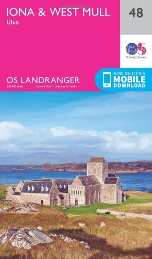
Wandelkaart Iona & West Mull - Inner Hybrids Schotland
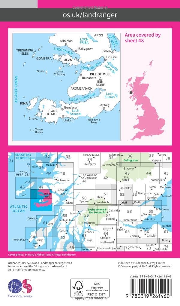
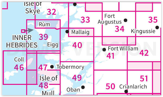
Productbeschrijving: Kaart nummer 48 in de OS Landranger kaart reeks heeft betrekking op de west-kust van het Isle of Mull, met inbegrip van de eilanden van Ulva en Iona, tal van Lochs, evenals de steden van Bally Gown, Sal, Uisken en Carsaig. Er is veel te ontdekken in dit gebied, met inbegrip van het spotten van wildlife boottochten en historische gebouwen te ontdekken.
De OS Landranger kaarten reeks heeft betrekking op Groot-Brittannië met 204 gedetailleerde kaarten, perfect voor dagtochten en korte pauzes. Elke kaart bevat alle informatie die u nodig heeft om dit lokaal gebied te leren kennen en omvat plaatsen van belang, toeristische informatie, picknickplaatsen en campings, plus doorgangsrechten informatie voor Engeland en Wales.
Productdiscription: Map sheet number 48 in the OS Landranger map series covers the west coastline of the Isle of Mull, including the isles of Ulva and Iona, plenty of Lochs, as well as the towns of Bally Gown, Salen, Uisken and Carsaig. There's a lot to explore in this area, including wildlife-spotting boat trips and historic buildings to discover.
The OS Landranger Map series covers Great Britain with 204 detailed maps, perfect for day trips and short breaks. Each map provides all the information you need to get to know your local area and includes places of interest, tourist information, picnic areas and camp sites, plus Rights of Way information for England and Wales.
Locatie op kaart
Gekoppelde artikelen
Wandelkaart 48 Iona & West Mull - Schotland - OSI • 9780319261460
standaard versieWandelkaart Iona & West Mull - Inner Hybrids Schotland Productbeschrijving: Kaart nummer 48 in de OS Landranger kaart reeks heeft betrekking op de west-kust van het Isle of Mull, met inbegrip van de eilanden van Ulva en Iona, tal van Lochs, evenals de steden van Bally Gown, Sal, Uisken en Carsaig. Er is veel te ontdekken in dit gebied, met inbegrip van het spotten van wildlife boottochten …

Wandelkaart 48 Iona & West Mull - Inner Hybrids - OSI • 9780319473719
weatherproof versieWandelkaart Iona & West Mull - Inner Hybrids Schotand Productbeschrijving: Kaart nummer 48 in de OS Landranger kaarten reeks heeft betrekking op de west-kust van het Isle of Mull, met inbegrip van de eilanden van Ulva en Iona, tal van Lochs, evenals de steden van Bally Gown, Sal, Uisken en Carsaig. De OS Landranger kaarten reeks heeft betrekking op Groot-Brittannië met 204 gedetailleerde k…
Overzichtskaarten
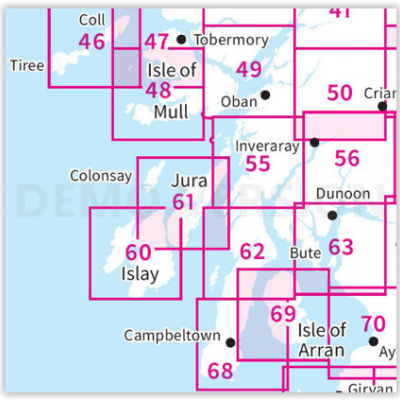
OSI Landranger & Landranger Active - Zuid-West Schotland - Schotse eilanden & Highland's
OSI Landranger & Landranger Active - Zuid-West Schotland - Schotse eilanden & Highland's

Producten op de overzichtskaart
Klik op een product om naar de detailpagina te gaan.
- Wandelkaart 46 Coll & Tiree Isles- Inner hybriden - OSI
- Wandelkaart 46 Coll & Tiree Isles- Binnen hybriden - OSI
- Wandelkaart 47 Tobermory & North Mull - Schotland - OSI
- Wandelkaart 47 Tobermory & North Mull- Argyl & Bute - OSI
- Wandelkaart 48 Iona & West Mull - Inner Hybrids - OSI
- Wandelkaart 48 Iona & West Mull - Schotland - OSI
- Wandelkaart 49 Oban & East Mull- Schotland - OSI
- Wandelkaart 49 Oban & East Mull- Argyl & Bute Schotland - OSI
- Wandelkaart 50 Glen Orchy & Loch Etive- Argyl & Bute - OSI
- Wandelkaart 50 Glen Orchy & Loch Etive- Schotland - OSI
- Wandelkaart 55 Lochgilphead & Loch Awe - OSI
- Wandelkaart 55 Lochgilphead & Loch Awe - OSI
- Wandelkaart 56 Loch Lomond & Inveraray- Trossachs NP - OSI
- Wandelkaart 56 Loch Lomond & Inveraray- Trossachs NP - OSI
- Wandelkaart 60 Islay- Inner Hybrids Schotland - OSI
- Wandelkaart 60 Islay- Inner Hybrids Schotland - OSI
- Wandelkaart 61 Jura & Colonsay - Inner Hybrids - OSI
- Wandelkaart 61 Jura & Colonsay - Schotland - OSI
- Wandelkaart 62 North Kintyre & Tarbert - Schotland - OSI
- Wandelkaart 62 North Kintyre & Tarbert - Schotland - OSI
- Wandelkaart 63 Firth of Clyde- Argyl & Bute - Schotland - OSI
- Wandelkaart 63 Firth of Clyde- Argyl & Bute - Schotland - OSI
- Wandelkaart 68 South Kintyre & Campbeltown - OSI
- Wandelkaart 68 South Kintyre & Campbeltown - OSI
- Wandelkaart 69 Isle of Arran- Inner Hybrids - OSI
- Wandelkaart 69 Isle of Arran- Inner Hybrids - OSI
- Wandelkaart 70 Ayr- Kilmarnock & Troon- Schotland - OSI
- Wandelkaart 70 Ayr- Kilmarnock & Troon- Schotland - OSI
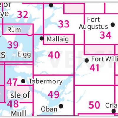
OSI Landranger & Landranger Active - Fort William- Ben Nevis & Glen Coe
OSI Landranger & Landranger Active - Fort William- Ben Nevis & Glen Coe
Producten op de overzichtskaart
Klik op een product om naar de detailpagina te gaan.
- Wandelkaart 32 Isle of Skye South & Cuillin Hills - OSI
- Wandelkaart 32 Isle of Skye south & Cuillin Hills - OSI
- Wandelkaart 33 Loch Alsh- Glen Shiel & Loch Hourn - OSI
- Wandelkaart 33 Loch Alsh- Glen Shiel & Loch Hourn - OSI
- Wandelkaart 34 Fort Augustus- Loch Ness Highland's - OSI
- Wandelkaart 34 Fort Augustus- Loch Ness Highland's - OSI
- Wandelkaart 35 Kingussie & Cairngorms NP - Highland's- OSI
- Wandelkaart 35 Kingussie & Monadhliath - Cairngorms - OSI
- Wandelkaart 39 Rum- Eigg & Muck - Inner Hybrids - OSI
- Wandelkaart 39 Rum- Eigg & Muck - Inner Hybrids - OSI
- Wandelkaart 40 Mallaig & Glenfinnan- Highland's - OSI
- Wandelkaart 40 Mallaig & Glenfinnan- Highland's - OSI
- Wandelkaart 42 Glen Garry & Loch Rannoch - OSI
- Wandelkaart 42 Glen Garry & Loch Rannoch - OSI
- Wandelkaart 46 Coll & Tiree Isles- Binnen hybriden - OSI
- Wandelkaart 46 Coll & Tiree Isles- Binnen hybriden - OSI
- Wandelkaart 47 Tobermory & North Mull - Schotland - OSI
- Wandelkaart 47 Tobermory & North Mull- Argyl & Bute - OSI
- Wandelkaart 48 Iona & West Mull - Inner Hybrids - OSI
- Wandelkaart 48 Iona & West Mull - Inner Hybrids - OSI
- Wandelkaart 49 Oban & East Mull - Argyl & Bute Schotland - OSI
- Wandelkaart 49 Oban & East Mull - Argyl & Bute Schotland - OSI
- Wandelkaart 50 Glen Orchy & Loch Etive- Argyl & Bute - OSI
- Wandelkaart 50 Glen Orchy & Loch Etive- Argyl & Bute - OSI
- Wandelkaart 51 Loch Tay & Glen Dochart- Highland's - OSI
- Wandelkaart 51 Loch Tay & Glen Dochart- Highland's - OSI
Artikelen uit dezelfde regio

Wandelkaart 373 Iona- Staffa & Ross of Mull - OSI • 9780319472408
Wandelkaart Iona- Staffa & Ross of Mull Inner Hybrids - Schotland Productbeschrijving: Kaart nummer 373 in de OS Explorer kaarten reeks heeft betrekking op de westkust van het eiland Mull en eiland van Iona. Hoogtepunten van het gebied zijn onder andere: Loch na Keal nationale Scenic area, Knockan en Fionnphort. De OS Explorer kaart voor Iona, Staffa & Ross van Mull is beschikbaar in zowel…
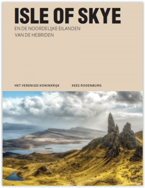
Reisgids Isle of Skye & de Noordelijke Hebriden - Edicola • 9789493160224
Reisgids Isle of Skye & de Noordelijke Hebriden - Edicola Productomschrijving: Veel mensen associëren de Hebriden met witte stranden en een azuurblauwe zee. Toch hebben de Hebriden nog veel meer te bieden dan dat: een fascinerende geschiedenis, traditionele cultuur, een eigen identiteit en een enorme diversiteit in natuurschoon en wildlife. In Isle of Skye en de noordelijke eilanden van de…

Wandelgids The Hebrides - Cicerone • 9781852847050
Wandelgids - The Hebrides - Cicerone Productomschrijving: Inspirerende gids over 50 gevarieerde wandel- en trekkingsroutes in de Hebriden, met klassiekers zoals de Skye Cuillin en de Paps van de Jura, maar ook veel minderbekende routes zoals Jura, Scarba, Islay, Colonsay, Rum, Eigg, Canna, Muck, Coll, Tiree, Mull, Skye, Raasay, Harris, Lewis, Berneray, North Uist, South Uist, Barra en St K…

Wandelkaart 39 Rum- Eigg & Muck - Inner Hybrids - OSI • 9780319261378
Wandelkaart Rum- Eigg & Muck - Inner Hybrids Schotland Productbeschrijving: OS Landranger kaart 39 heeft betrekking op de Binnen-Hebriden eilanden van rum, Eigg, Muck Canna, evenals de Sound of rum, sound of Eigg en sound of Canna. Kinloch kasteel is een uitgebreide Victoriaanse herenhuis dat is open voor rondleidingen in de zomer, maar voor de meer outdoor avonturen kunt u wilde kamp over…
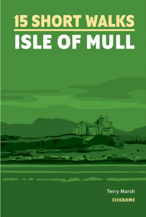
Wandelgids 15 short walks on the Isle of Mull - Cicerone • 9781786311955
Short walks on the Isle of Mull - Cicerone Productomschrijving: Wil je het beste van Isle of Mull ontdekken op de Inner-Hybrids? in Schotland. Deze gids bevat 15 van de beste korte wandelingen in het gebied (tussen 1,5 en 10,5 km), waaronder Tobermory, Aros Park, Glengorm Castle, Treshnish en de stranden van Langamull, Kilvickeon en Tireragan. Engelse omschrijving: Would you like to ex…