

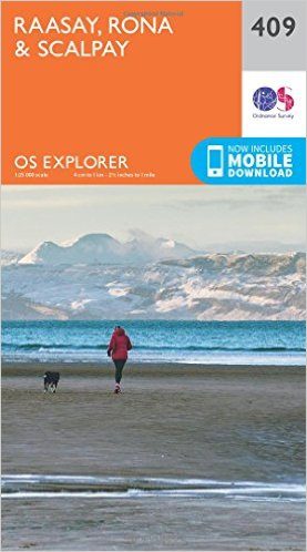
Wandelkaart 409 Raasay- Rona & Scalpay- Inner Hybrids - OSI
Omvat Raasay- Rona & Scalpayc op de Inner Hybrids

Korte omschrijving
Wandelkaarten Inner hybrids (Binnen-Hebriden), Schotland van Ordnance Survey. Ideaal voor tochten in Schotland.
Wandelkaart Raasay- Rona & Scalpay - Inner Hybrids - OSI Productbeschrijving: De Explorer-serie heeft vervangt de vroegere, groen-cover Pathfinder-kaarten. De Explorer-serie is nu compleet e...

Specificaties
- Uitgever: Ordnance Survey
- ISBN-13: 9780319246443
- HOOFDCATEGORIEËN: Wandelkaart
- Activiteiten: Wandelen, Hiking & Trekking
- Regio: Inner hybrids (Binnen-Hebriden), Schotland
- Land: Schotland
- TOPO's & Stafkaarten: Topografisch wandelen
- Schaal: 1:25000
- Taal: Engels
- Reeks/Serie: Explorer Series OS
- De beroemdste Eilandengroepen: Inner Hybrids (Schotland)
Volledige omschrijving
Wandelkaart Raasay- Rona & Scalpay - Inner Hybrids - OSI
Productbeschrijving: De Explorer-serie heeft vervangt de vroegere, groen-cover Pathfinder-kaarten. De Explorer-serie is nu compleet en heeft betrekking op ganns Engeland, Wales & Schotland. Sommige kaarten omvatten populaire gebieden zoals de nationale parken, die zijn nog steeds gebrandmerkt als Outdoor Recreatie outdoor kaarten, maar zijn nu opgenomen in deze serie, de cartografie is ook hetzelfde als die van de Explorer kaarten.
De Explorer-kaarten bieden een aanzienlijke verbetering ten opzichte van de Pathfinder-serie, met een groter gebruik van kleur, grotere oppervlakte per kaart en sterkere nadruk op de informatie voor wandelaars en toeristen.
National Scenic Areas: The Cuillin Hills & Trotternish.
Productdiscription: The Explorer series has replaced the earlier, green-cover Pathfinder maps. The Explorer series is now complete and covers all of England, Wales & Scotland. Some sheets for popular areas like the National Parks are still branded as Outdoor Leisure (OL) maps, but are now included in this series as the cartography is the same as that in the Explorer Maps. The Explorer maps offer a substantial improvement on the Pathfinder series, with greater use of colour, larger area per map, and stronger emphasis on information for ramblers and tourists.

Locatie op kaart
Overzichtskaarten
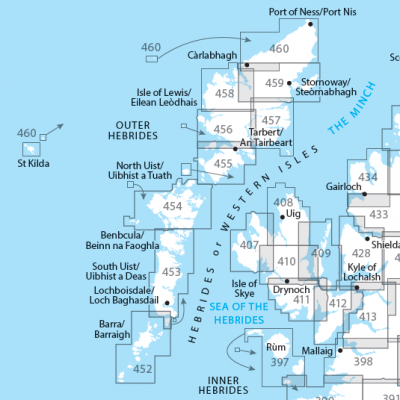
OSI Explorer & Explorer Active - Hebriden - Isle of Skye
OSI Explorer & Explorer Active - Hebriden - Isle of Skye

Producten op de overzichtskaart
Klik op een product om naar de detailpagina te gaan.
- Wandelkaart 372 Coll & Tiree- Ayrshire & Lanark - OSI
- Wandelkaart 374 Isle of Mull North & Tobermroy - OSI
- Wandelkaart 375 Isle of Mull East- Argyl- Schotland - OSI
- Wandelkaart 397 Rum- Eigg- Muck- Canna & Sanday - OSI
- Wandelkaart 407 Isle of Skye & Dunvegan- Highland's - OSI
- Wandelkaart 408 Isl of Skye- Trotternish & The Storr - OSI
- Wandelkaart 409 Raasay- Rona & Scalpay- Inner Hybrids - OSI
- Wandelkaart 410 Isle of Skye- Portree & Bracadale - OSI
- Wandelkaart 411 Isle of Skye- Cuillin Hills Schotland- OSI
- Wandelkaart 412 Isle of Skye & Sleat- Schotland - OSI
- Wandelkaart 413 Knoydart- Loch Hourn & Loch Duich - OSI
- Wandelkaart 452 Barra & Vatersay- Western isles Highlands - OSI
- Wandelkaart 453 Benbecula & South Uist- Western Isles - OSI
- Wandelkaart 454 North Uist & Berneray- Outer Hybrids - OSI
- Wandelkaart 455 South Harris- Outer Hybrids Schotland - OSI
- Wandelkaart 456 North Harris & Loch Seaforth Outer Hibrids - OSI
- Wandelkaart 457 South East Lewis- Outer Hybrids Schotland - OSI
- Wandelkaart 458 West Lewis- Outer Hybrids Schotland - OSI
- Wandelkaart 459 Central Lewis & Stornoway - Outer hybrides - OSI
- Wandelkaart 460 North Lewis- Outer Hybrids Schotland - OSI
Artikelen uit dezelfde regio

Wandelkaart 48 Iona & West Mull - Inner Hybrids - OSI • 9780319473719
Wandelkaart Iona & West Mull - Inner Hybrids Schotand Productbeschrijving: Kaart nummer 48 in de OS Landranger kaarten reeks heeft betrekking op de west-kust van het Isle of Mull, met inbegrip van de eilanden van Ulva en Iona, tal van Lochs, evenals de steden van Bally Gown, Sal, Uisken en Carsaig. De OS Landranger kaarten reeks heeft betrekking op Groot-Brittannië met 204 gedetailleerde k…

Wandelgids The Hebrides - Cicerone • 9781852847050
Wandelgids - The Hebrides - Cicerone Productomschrijving: Inspirerende gids over 50 gevarieerde wandel- en trekkingsroutes in de Hebriden, met klassiekers zoals de Skye Cuillin en de Paps van de Jura, maar ook veel minderbekende routes zoals Jura, Scarba, Islay, Colonsay, Rum, Eigg, Canna, Muck, Coll, Tiree, Mull, Skye, Raasay, Harris, Lewis, Berneray, North Uist, South Uist, Barra en St K…
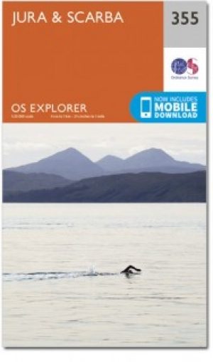
Wandelkaart 355 Jura & Scarba- Inner Hibrids - OSI • 9780319472262
Wandelkaart Jura & Scarba - Inner Hibrids Schotland Productbeschrijving: De eilanden van de Jura en Scarba zijn functioneel ingetekend op OS Explorer kaart 355. Alleen Jura is bewoond, met Craighouse, die de enige winkel bezit op het eiland. Er zijn twee nationale landschappelijke gebieden - het zuidelijke deel van de Jura en het eiland van Scarba, die per boot kunnen worden bezocht. De OS…

Wandelkaart 397 Rum- Eigg- Muck- Canna & Sanday - OSI • 9780319246375
Wandelkaart Rum- Eigg- Muck- Canna & Sanday - Inner Hybrids Productbeschrijving: OS Explorer kaart 397 toont de Binnen-Hebriden eilanden rum, Eigg, Muck, Canna en Sanday. Al de belangrijkste eilanden zijn bewoond, hoewel de bevolking vrij laag is. Ze zijn populair bij vakantiegangers en wildlife watchers. De OS Explorer kaart voor Rum, Eigg, Muck, Canna & Sanday is beschikbaar in zowel de …

Wandelkaart 373 Iona- Staffa & Ross of Mull - OSI • 9780319472408
Wandelkaart Iona- Staffa & Ross of Mull Inner Hybrids - Schotland Productbeschrijving: Kaart nummer 373 in de OS Explorer kaarten reeks heeft betrekking op de westkust van het eiland Mull en eiland van Iona. Hoogtepunten van het gebied zijn onder andere: Loch na Keal nationale Scenic area, Knockan en Fionnphort. De OS Explorer kaart voor Iona, Staffa & Ross van Mull is beschikbaar in zowel…