

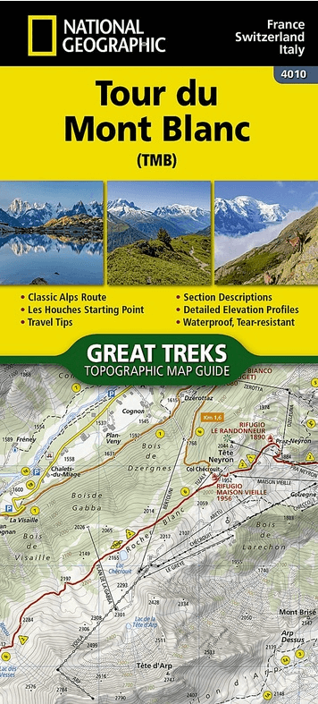
Wandelkaart 4010 Tour du Mont Blanc - Nat Geo
Tussen Aosta Valley and Haute-Savoie - Mont Blanc

Korte omschrijving
Wandelkaarten Auvergne-Rhône-Alpes, Frankrijk van National Geographic. Ideaal voor tochten in Frankrijk, Italië en Zwitserland.
Wandelkaart Tour du Mont Blanc - Nat Geo Productomschrijving: Located in the northwestern Alps, between the Aosta Valley and Haute-Savoie, Mont Blanc is the highest mountain in Europe at 4,8...

Specificaties
- Uitgever: National Geographic
- ISBN-13: 9781566959544
- HOOFDCATEGORIEËN: Wandelkaart
- Activiteiten: Wandelen, Hiking & Trekking
- Auteur: National Geographic
- Regio: Auvergne-Rhône-Alpes, Frankrijk
- Land: Frankrijk, Italië, Zwitserland
- TOPO's & Stafkaarten: Topografisch wandelen
- Taal: Engels
- Reeks/Serie: Great Treks Topographic Map Guides
- De Franse Regio's: Auvergne-Rhône-Alpes
- Iconische Wandelroutes: Tour de Mont Blanc TMB, Frankrijk
Volledige omschrijving
Wandelkaart Tour du Mont Blanc - Nat Geo
Productomschrijving: Located in the northwestern Alps, between the Aosta Valley and Haute-Savoie, Mont Blanc is the highest mountain in Europe at 4,808 meters (15,774 feet). The central part of the Mont Blanc Massif, always snow-covered, consists of a mountain range that crosses Italy, France, and Switzerland.
The Tour du Mont-Blanc (TMB) runs counterclockwise with start and finish in Les Houches, France. It covers approximately 170 km with clear signage, a 10,000-meter elevation gain (positive and negative), and takes 10 to 12 days to walk passing through France, Switzerland, and Italy. Travelers will have a chance to admire the spectacular landscapes: vast glacier areas, meadows rich in diverse flora, fascinating lunar-like rock landscapes, alpine pastures, charming villages, and refuges offering a comfortable place to rest
The Tour du Mont-Blanc Topographic Map Guide booklet makes a perfect traveling companion when traversing this famous route. A detailed description of each trail section is included that tells travelers about the many landmarks encountered along the way.
Every Great Treks map is printed on "Backcountry Tough" waterproof, tear-resistant paper. A full Lat/Long grid is printed on the map to aid with GPS navigation. Every map purchase helps support the National Geographic Society, an impact driven, nonprofit organization with global reach that uses the power of science, exploration, education, and storytelling to illuminate and protect the wonder of our world.

Artikelen uit dezelfde regio
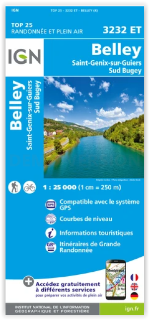
Wandelkaart 3232 ET Belley- St-Genix-sur-Guiers & Sud Bugey - IGN • 9782758555452
Wandelkaart Belley- St-Genix-sur-Guiers & Sud Bugey - IGN Productomschrijving: Deze locaties liggen in de Franse departementen Ain en Savoi. ze zijn te vinden in de regio van de Auvergen-Rhône-Alpes. Omvat: Belley, Saint Genix sur Guiers, Sud Bugey, Saint-Genix-les-Villages, Dolomieu, Saint-Clair-de-la-Tour, Brangues, Saint-Victor-de-Morestel, La Bâtie-Montgascon, Les Avenières Veyrins…

Wandelgids 0420 Autour des Gorges de la Loire GRP - FFR • 9782751406188
TOPO Wandelgids GRP - Autour des Gorges de la Loire - FFR Ref. 420 - Autour des gorges de la Loire - du Forez au Roannais Productomschrijving: Wandelgids GRP - Ref. 420 - 150km wandelen in het spoor van de Neandertaler. variaties van 1.2 of 7 dagen wandelen. U zal verschillende gebouwen tegen het lijf lopen langs de rivier, en na verloop van tijd, kliffen en rotsen voor om en bij de 3…
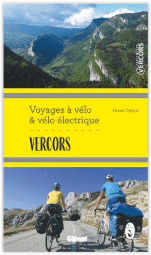
Fietsgids Vercors - voyages à vélo & vélo électrique - Glénat • 9782344044780
Fietsgids Vercors - voyages à vélo & vélo électrique Productomschrijving: 20 tot 25 dagen verdeeld over 6 tochten met de fiets en/of elektrische fiets, en dat van 2 tot 8 dagen om het erfgoed en de natuurlijke rijkdommen van het park op een andere manier te ontdekken Een gebied per fiets ontdekken is milieuvriendelijker dan ooit en in overeenstemming met de tijd . En vandaag de dag wordt m…
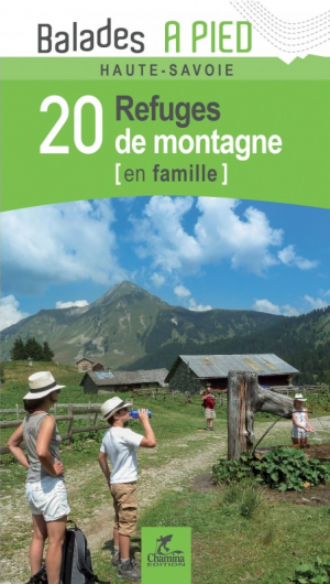
Wandelgids Haute-Savoie - 20 refuges de montagne - Ed. Chamina • 9782844663795
Wandelgids - Haute-Savoie - 20 refuges de montagne - Ed. Chamina Productomschrijving: Deze schuilplaatsen zijn niet enkel gereserveerd voor ervaren bergbeklimmers, of GR wandelaars. Dit zijn verblijfplaatsen toegankelijk voor het grootste mensen, waar u kunt iets kunt drinken tijdens een wandeling, eten met familie of als herstelmaatregel of tussenstop voor een nacht voordat u op uw pad do…

Wandelkaart Bornes- Aravis & Val d'Arly - Didier Richard • 9782344037270
Bornes- Aravis & Val d'Arly - Didier Richard Productomschrijving: Deze kaart, of beter deze pocket-sized kaart van Bornes- Aravis & Val d'Arly omvat de volledige regio op deze ene kaart. Daarenboven is ze ook echt light-weight. Met toeristen informatie, outdoor activiteiten, GR-routes zijn allemaal ingetekend op de kaart. Wegen en spoorwegen staan ook genotteerd, en de kaart is tevens comp…