

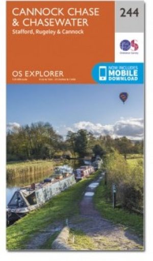
Wandelkaart 244 Cannock Chase & Chasewater- England - OSI
Omvat de Cannock Chase AONB

Korte omschrijving
Wandelkaarten Staffordshire, England van Ordnance Survey. Ideaal voor tochten in England.
Wandelkaart Cannock Chase & Chasewater - Staffordshire England Omvat ook: Stafford, Rugeley & Cannock. Productbeschrijving: Met betrekking tot de Cannock Chase AONB, is de OS Explorer ka...

Specificaties
- Uitgever: Ordnance Survey
- ISBN-13: 9780319471166
- HOOFDCATEGORIEËN: Wandelkaart
- Activiteiten: Wandelen, Hiking & Trekking
- Regio: Staffordshire, England
- Land: England
- Waterafstotende kaart: Ordnance Survey ACTIVE Explorer Weatherproof Maps
- TOPO's & Stafkaarten: Topografisch wandelen
- AONB - Area of Outstanding Beauty/National Landscape: Cannock Chase AONB
- Schaal: 1:25000
- Taal: Engels
- Reeks/Serie: Explorer ACTIVE Series OSI
Volledige omschrijving
Wandelkaart Cannock Chase & Chasewater - Staffordshire England
Omvat ook: Stafford, Rugeley & Cannock.
Productbeschrijving: Met betrekking tot de Cannock Chase AONB, is de OS Explorer kaart 244 ideaal voor het verkennen van dit gebied. Er zijn honderden kleinere routes, plus diverse recreatieve paden, waardoor dit gebied vooral populair is voor mountainbikers. De OS Explorer kaart voor Cannock Chase & Chasewater is beschikbaar in zowel de standaard papieren versie als de weerbestendige 'Actief' versie.
Productdiscription: Covering the Cannock Chase AONB. OS Explorer Map 244 is ideal for exploring this area. There are hundreds of smaller trails, plus several Recreational Paths, making this area especially popular for mountain bikers. The OS Explorer map for Cannock Chase & Chasewater is available in both the standard paper version and weatherproof 'Active' version.
Locatie op kaart
Gekoppelde artikelen

Wandelkaart 244 Cannock Chase & Chasewater- Severn - OSI • 9780319244371
standaard versieWandelkaart Cannock Chase & Chasewater - Severn England Productbeschrijving: Stafford, Rugeley & Cannock. 244 / Cannock Chase & Chasewater, Severn, England - Met betrekking tot de Cannock Chase Area of Outstanding Natural Beauty AONB. OS Explorer kaart 244 is ideaal voor het verkennen van dit gebied. Er zijn honderden kleinere routes, plus diverse recreatieve paden, waardoor dit gebied…
Wandelkaart 244 Cannock Chase & Chasewater- England - OSI • 9780319471166
weatherproof versieWandelkaart Cannock Chase & Chasewater - Staffordshire England Omvat ook: Stafford, Rugeley & Cannock. Productbeschrijving: Met betrekking tot de Cannock Chase AONB, is de OS Explorer kaart 244 ideaal voor het verkennen van dit gebied. Er zijn honderden kleinere routes, plus diverse recreatieve paden, waardoor dit gebied vooral populair is voor mountainbikers. De OS Explorer kaart voor…
Artikelen uit dezelfde regio

Wandelgids 50 walks in Staffordshire England - AA Publ. • 9780749583767
50 walks in Staffordshire England - AA Productomschrijving: Staffordshire, gelegen in het hart van Engeland, is een graafschap vol natuurlijke schoonheid en historische rijkdom. De wandelgids "50 Walks in Staffordshire" biedt een scala aan routes die je langs glooiende heuvels, rustige bossen, pittoreske dorpjes en fascinerende historische bezienswaardigheden leiden.Wat Kun Je Verwachten? …

Wandelkaart 118 Stoke-on-Trent & Macclesfield - OSI • 9780319474419
Wandelkaart Stoke-on-Trent & Macclesfield - West Midlands Productbeschrijving: Stoke-on-Trent, beroemd om zijn keramiek en aardewerk, is een stad in het graafschap Staffordshire met veel te bieden. Hoogtepunten zijn de 25 aardewerk fabrieks winkels, Italiaanse tuinen en de award-winnende musea. U kunt ook de OS Landranger kaart 118 gebruiken om één van de omliggende steden zoals Macclesfie…

Wandelkaart 118 Stoke-on-Trent & Macclesfield - OSI • 9780319262160
Wandelkaart Stoke-on-Trent & Macclesfield - England - OSI Productbeschrijving: Stoke-on-Trent, beroemd om zijn keramiek en aardewerk, is een stad in het graafschap Staffordshire en heeft veel te bieden. Hoogtepunten zijn de 25 aardewerk fabriek winkels, Italiaanse tuinen en de award-winnende musea. De OS Landranger kaarten reeks heeft betrekking op Groot-Brittannië met 204 gedetailleerde k…

Wandelkaart 127 Stafford & Telford - Ironbridge England - OSI • 9780319474501
Wandelkaart Stafford & Telford- Ironbridge - Staffordshire England Productbeschrijving: OS Landranger kaart 127 toont Stafford & Telford en omvat ook Cannock, Ironbridge, Newport, Adbaston, Market Drayton, steen, Huddersfield, Haughton en deel van de Europese lange afstand pad E2. De OS Landranger kaarten reeks heeft betrekking op Groot-Brittannië met 204 gedetailleerde kaarten, perfect vo…

Wandelgids 081 Pathfinder guides Staffordshire - OS • 9780319092057
Wandelgids Staffordshire - OS Productomschrijving: 185 miles of superb country walking from the moorland of The Roaches and Three Shire Heads in the Peak District to the rolling woodlands and open countryside explored from Kinver. There's waterside walking along the Shropshire Union Canal and best the Trent, Heathland rambles across Cannock Chase and beautiful walks within easy reach of L…