

Wandelkaart 231 Southwold & Bungay- Suffolk - OSI
De Sufolk kust- Southwold Halesworth- Bungay & Kessingland
Korte omschrijving
Wandelkaarten Suffolk East Anglia van Ordnance Survey. Ideaal voor tochten in England.
Wandelkaart Southwold & Bungay - Suffolk England Omvat ook: Halesworth & Kessingland. Productbeschrijving: Kaart nummer 231 in de OS Explorer kaarten reeks heeft betrekking op de Sufolk ...

Specificaties
- Uitgever: Ordnance Survey
- ISBN-13: 9780319471036
- HOOFDCATEGORIEËN: Wandelkaart
- Activiteiten: Wandelen, Hiking & Trekking
- Regio: Suffolk East Anglia
- Land: England
- Waterafstotende kaart: Ordnance Survey ACTIVE Explorer Weatherproof Maps
- TOPO's & Stafkaarten: Topografisch wandelen
- Schaal: 1:25000
- Taal: Engels
- Reeks/Serie: Explorer ACTIVE Series OSI
- De Engelse Graafschappen: Suffolk
Volledige omschrijving
Wandelkaart Southwold & Bungay - Suffolk England
Omvat ook: Halesworth & Kessingland.
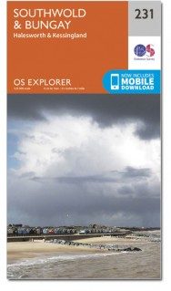
Productbeschrijving: Kaart nummer 231 in de OS Explorer kaarten reeks heeft betrekking op de Sufolk kust, Southwold, Halesworth, Bungay en Kessingland, deel van de rivier Waveney, en de rivier Blyth. De recreatieve paden in het gebied bevatten: Angles Way, Sandlings Walk en de Suffolk Coast Path. De OS Explorer kaart voor Southwold & Bungay is beschikbaar in zowel de standaard papieren versie als de weerbestendige 'Actief' versie.
Productdiscription: Map sheet number 231 in the OS Explorer series covers the Sufolk coast, Southwold, Halesworth, Bungay and Kessingland, part of the River Waveney, and the River Blyth. Recreational paths in the area include: Angles Way, Sandlings Walk and the Suffolk Coast Path. The OS Explorer map for Southwold & Bungay is available in both the standard paper version and weatherproof 'Active' version.
Locatie op kaart
Gekoppelde artikelen

Wandelkaart 231 Southwold Bungay & Halesworth - OSI • 9780319244241
standaard versieWandelkaart Southwold- Bungay- Halesworth & Kessingland Omvat ook: Halesworth & Kessingland. Productbeschrijving: Kaart nummer 231 in de OS Explorer reeks heeft betrekking op de Sufolk kust, Southwold, Halesworth, Bungay en Kessingland, deel van de rivier Waveney, en de rivier Blyth. Recreatieve paden in het gebied bevatten: Angles Way, Sandlings Walk en de Suffolk Coast Path. De OS Ex…

Wandelkaart 231 Southwold & Bungay- Suffolk - OSI • 9780319471036
weatherproof versieWandelkaart Southwold & Bungay - Suffolk England Omvat ook: Halesworth & Kessingland. Productbeschrijving: Kaart nummer 231 in de OS Explorer kaarten reeks heeft betrekking op de Sufolk kust, Southwold, Halesworth, Bungay en Kessingland, deel van de rivier Waveney, en de rivier Blyth. De recreatieve paden in het gebied bevatten: Angles Way, Sandlings Walk en de Suffolk Coast Path. De O…
Artikelen uit dezelfde regio

Wandelkaart 210 Newmarket- Haverhill & Barrow - OSI • 9780319244036
Wandelkaart Newmarket- Haverhill & Barrow - Suffolk Omvat ook: Barrow, Clare & Kedington Productomschrijving: Kaart nummer 210 in de OS Explorer kaarten reeks is ideaal voor het ontdekken van het gebied rond het Oosten van het graafschap Cambridgeshire en ten westen van Suffolk, rond de stad van Newmarket raceway. U kunt er de Stour Valley bewandelen naast de rivier de Stour, of u kunt…

Wandelkaart 211 Bury St Edmunds & Stowmarket - OSI • 9780319470831
Wandelkaart Bury St Edmunds & Stowmarket - Suffolk Omvat ook: Debenham & Elmswell. Productbeschrijving: Deze twee-zijdige kaart toont Bury St Edmunds tot Debenham, met inbegrip van Stowmarket. Er zijn een aantal recreatieve paden met inbegrip van St Edmund's way die hier voorbijlopen, de Adelborst Railway trail en deel van de Mid Suffolk trail. Er zijn ook vele kleine steden en dorpen …

Wandelgids Day Walks in East Anglia - Vertebrate Publ. • 9781839810114
Day Walks in East Anglia - Vertebrate Productomschrijving: Day Walks in East Anglia by Anna Paxton features 20 routes in Norfolk and Suffolk suitable for hillwalkers of all abilities. Together with stunning photography, each route features Ordnance Survey 1:25,000 maps, easy-to-follow directions, distance and navigation information, refreshment stops and local information. Researched a…

Wandelkaart 156 Saxmundham- Aldeburgh & Southwold - OSI • 9780319475713
Wandelkaart Saxmundham- Aldeburgh & Southwold - OSI Productomschrijving: Aan de oostkust toont OS Landranger kaart 156 de steden Saxmundham, Aldeburgh en Southwold. In het binnenland vindt u zeer fotogenieke dorpen, maar het beste van dit gebied is ongetwijfeld de kust. Veel van de stranden zijn eerder kiezel dan zand, maar het strand van Walberswick bij Southwold heeft mooie zandgebieden.…
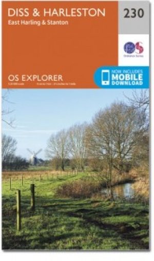
Wandelkaart 230 Diss- Harleston & East Harling - OSI • 9780319244234
Wandelkaart Diss- Harleston- East Harling - Suffolk England Productbeschrijving: - East Harling & Stanton. 230 / Diss, Harleston, East Harling, Suffolk, England - Na de rivier Waveney is deze OS Explorer kaart 230 een ' double-sided map, die East Harling, Diss en Harleston omvat. Hoogtepunten van het gebied vormen deel van de Norfolk kust pad National Trail, Footpath, Hereward way, Ped…