
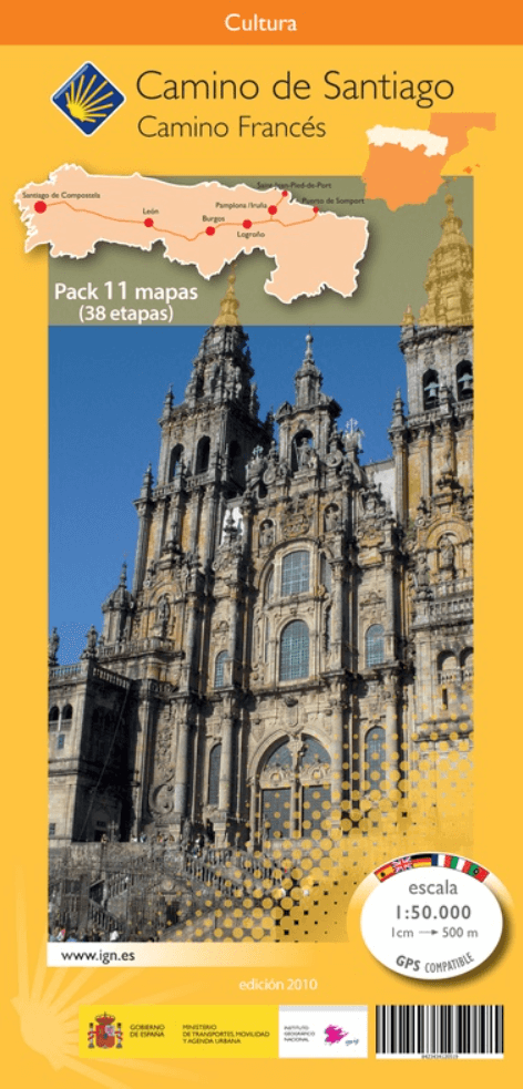
Wandelkaart 11(SET) Camino Frances > Complete route - CNIG
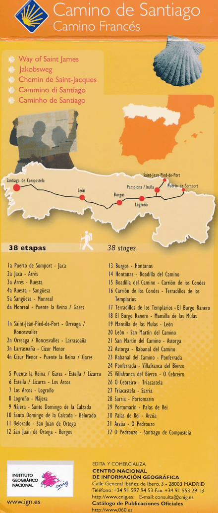
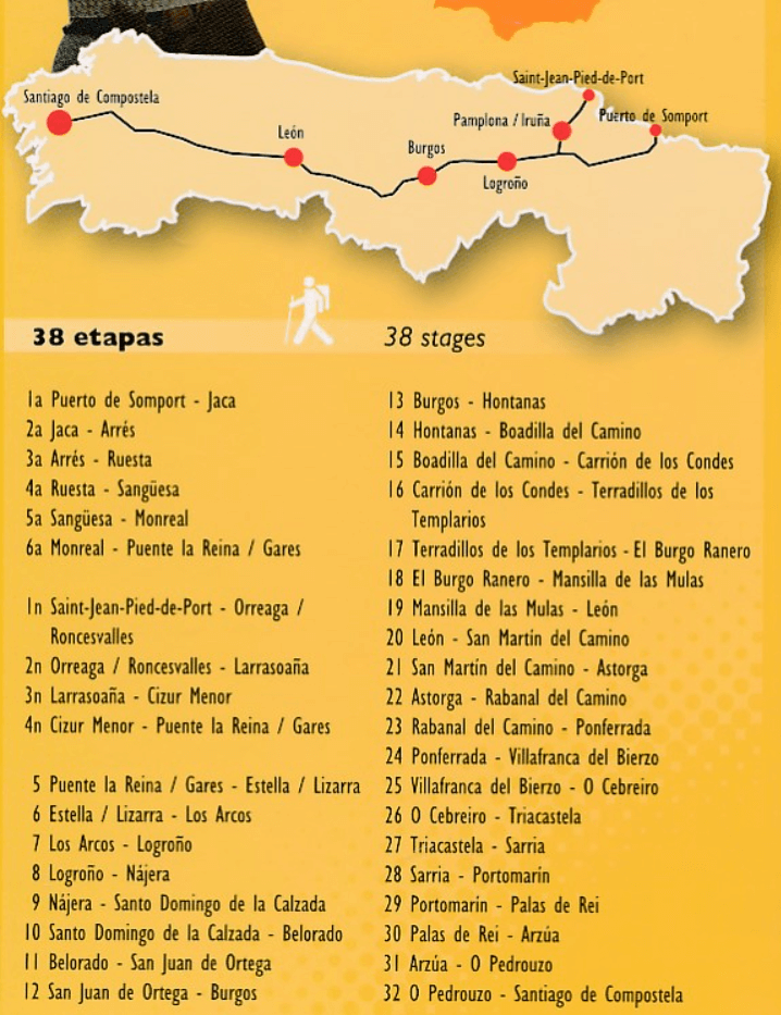
10 kaarten - Overzichtskaart 38 Etappes - Camino Frances
Korte omschrijving
Wandelkaarten Asturië Oost, Spanje, Asturië West, Spanje en Galicië, Spanje van Centro Nacional de Informacion Geografica. Ideaal voor tochten in Spanje.
KaartenSET Camino Frances > Camino de Santiago - CNIG Productomschrijving: Doos met 11 kaartbladen (10 van de etappes en een van de complete route). Elk blad, aan twee zijden bedrukt, b...

Specificaties
- Uitgever: Centro Nacional de Informacion Geografica
- ISBN-13: 8423434120519
- HOOFDCATEGORIEËN: Kaartenset, Wandelkaart
- Activiteiten: Wandelen, Hiking & Trekking
- Regio: Asturië Oost, Spanje, Asturië West, Spanje, Galicië, Spanje
- Land: Spanje
- Bedevaart routes: Camino Francés
- TOPO's & Stafkaarten: Topografisch wandelen
- Schaal: 1:50000
- Editie: 1
- Taal: Spaans
- Reeks/Serie: CNIG - Camino Santiago wandelkaarten
- De Spaanse Regio's: Galicië
Volledige omschrijving
KaartenSET Camino Frances > Camino de Santiago - CNIG
Productomschrijving: Doos met 11 kaartbladen (10 van de etappes en een van de complete route).
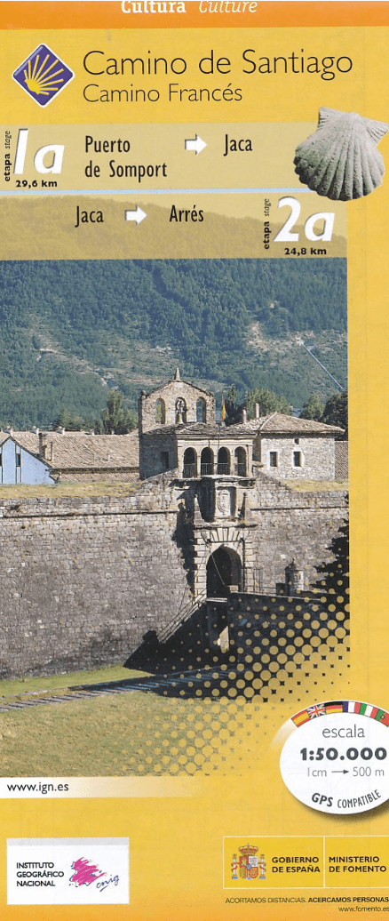
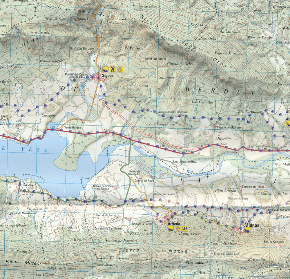
Elk blad, aan twee zijden bedrukt, bevat 4 kaarten 1: 50.000 die overeenkomen met opeenvolgende etappes van de Camino de Santiago (Camino Francés). De route loopt van de grens van de Pyreneeën tot in Santiagho de compostella. De kaarten zijn topografisch met hoogte lijnen, met toeristische informatie en UTM grid voor navigatie indien nodig.
Engelse omschrijving: The whole of Way of St James to Santiago de Compostela in a set of 11 maps: 10 double-sided topographic maps at 1:50,000 plus an overview map of northern Spain, published by the Spanish civilian survey organization. Descriptions in 6 languages; English, French, Spanish, German, Italian & Portuguese
Each 1:50,000 map is double-sided and has four 57 x 35cm panels with full topographic mapping of the area through which the route passes. Contours are at 50m intervals, with additional shading and colouring/graphics to show several different types of land cover (forests, meadows, olive groves, vineyards, etc.) An overprint highlights the route and its variants. Although the maps, given their scale, are primarily designed for walkers, where appropriate alternatives for cyclists are also marked. Icons indicate various related historical monuments. The maps have a 1km UTM grid, plus margin ticks for latitude and longitude.
Each title also has route profiles for the sections covered by it, plus panels presenting the route annotated with various facilities available in local towns and villages: accommodation, restaurants, food shops, access to trains or busses, bicycle repair shops, etc. The last map has just two panels with 1:50,000 maps but provides on the reverse an aerial view of Santiago de Compostela showing the route from the city's outskirts to the centre, plus a detailed street plan of the centre at 1:3,500 approx. highlighting its famous buildings and recommending four sightseeing routes.
Completing the set is a double-sided, somewhat basic map of northern Spain at 1:500,000 showing the network of main roads plus railways. The overprint highlights only the main route, as presented on the 1:50,000 maps - the coastal variant is not covered. Topography is indicated by relief shading with names of main mountain ranges.
De individuele kaart nrs zijn als volgt:
DEEL 1 - 9788441615373
DEEL 2 - 9788441615380
DEEL 3 - 9788441615397
DEEL 4 - 9788441615403
DEEL5 - 9788441615410
DEEL6 - 9788441615427
DEEL7 - 9788441615434
DEEL8 - 9788441615441
DEEL9 - 9788441615458
DEEL10 - 9788441615465
Artikelen uit dezelfde regio
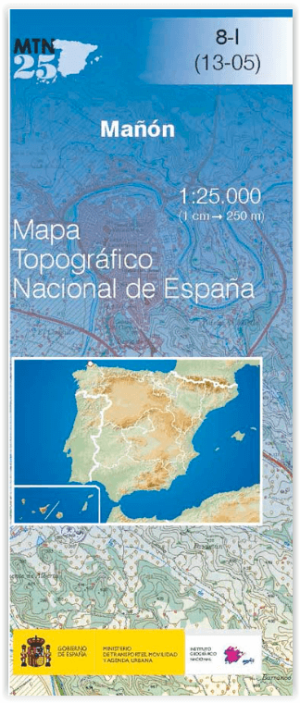
Wandelkaart 0008.1 Mañón, A Coruña (provincie) in Galicië - CNIG • 9788441652439
Wandelkaart Mañón, A Coruña (provincie) in Galicië - CNIG Productomschrijving: De Topografische Wandelkaarten, met reeks MTN25 van CNIG! Deze omvat: Mañón, A Coruña (provincie) in Galicië Ben je een fervent wandelaar, trekker of outdoor liefhebber die graag het ruigere Spanje ontdekt, weg van de platgetreden paden? Dan zijn de MTN25-kaarten van de officiële Spaanse uitgever Centro …
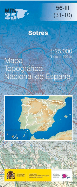
Wandelkaart 0056.3 Sotres, Asturië - CNIG • 9788441653719
Wandelkaart Sotres, Asturië - CNIG Productomschrijving: De Topografische Wandelkaarten, met reeks MTN25 van CNIG! Deze omvat: Sotres is een gemeente in de provincie & Regio Asturië Kaarten van de officiële Spaanse uitgever Centro Nacional de Información Geográfica (CNIG) precies wat je zoekt. Deze topografische kaarten op schaal 1:25.000 bieden ongeëvenaarde nauwkeurigheid en d…
Wandelgids Camino Portugues - Camino Guides Brierley • 9781912216321
Camino Portugues - Camino Guides Brierley Productomschrijving: Deze pelgrimsgids beschrijft de Camino Portugués van Lissabon via Porto naar Santiago de Compostela. De hoofdroute, de Camino Central, loopt in 24 etappes en beslaat ongeveer 638 km. Belangrijke plaatsen onderweg zijn Lissabon, Santarém, Tomar, Coimbra, Porto, Tui, Pontevedra, Caldas de Reis, Padrón en uiteindelijk Santiago de …
Fietsgids De Zilverroute – Via de la Plata - Benjaminse • 9789077899205
De Zilverroute – Via de la Plata - Benjaminse Productomschrijving: De Zilverroute is de 1036 km-lange pelgrimsroute van Sevilla naar Santiago de Compostela. De Zilverroute is gebaseerd op de oude romeinse weg de Via de la Plata die liep van Sevilla naar Astorga. Naar overlevering werd over deze weg zilver vervoerd naar Sevilla. Onder de oeverheersing door de moslims werd deze weg door de c…

Wandelgids Spaanse bedevaart - Cordula Rab - Elmar • 9789038925516
Spaanse St. Jacobsroute - Cordula Rab in 41 etappes Productomschrijving: Deze wandelgids beschrijft de Spaanse St. Jacobsroute in 41 wandelingen met routebeschrijvingen voor elk deel van de 41 etappes langs de weg. Met gedetailleerde & praktische informatie over de bezienswaardigheden langs de route. Met tips voor het plannen van deze mooie maar toch wel vercommercialiseerde, en culturele…