
Wandelkaart 11 Banff Up-Close - Gemtrek
Een Canadese uitvalsbasis voor wandelaars in het wild

Korte omschrijving
Wandelkaarten Alberta, Canada van Gem Trek Publishing. Ideaal voor tochten in Canada.
Wandelkaart - Banff Up-Close - Gemtrek Productomschrijving: Banff, een begrip in Alberta en wereldwijd, als skigebied en als wandelgebied in de zomermaanden. Banff heeft maar een klein stukj...

Specificaties
- Uitgever: Gem Trek Publishing
- ISBN-13: 9781895526776
- HOOFDCATEGORIEËN: Wandelkaart
- Activiteiten: Wandelen, Hiking & Trekking
- Regio: Alberta, Canada
- Land: Canada
- Nationale parken: Banff NP Alberta Canada
- Schaal: 1:35000
- Editie: 3
- Taal: Engels
Volledige omschrijving
Wandelkaart - Banff Up-Close - Gemtrek
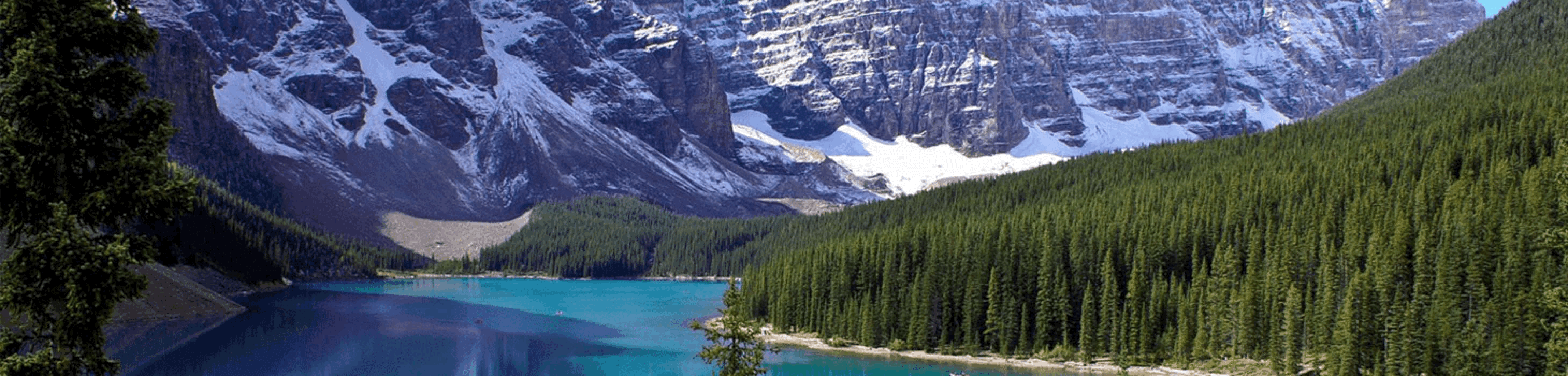
Productomschrijving: Banff, een begrip in Alberta en wereldwijd, als skigebied en als wandelgebied in de zomermaanden. Banff heeft maar een klein stukje dat echt kan worden betreden als skigebied, de meerderheid van de skiërs gaan in de richting van Lake Louis zo'n 35km verder richting Jasper National park, die zelf zo'n 400km van Banff ligt. In Banff ligt een klein dorpje met name "Banff Village" waar jaarlijks vele duizenden toersiten neerstrijken. Maar weinigen weten, dat 99% van Bangf bestaat uit back country, wild en ongerepte natuur, waar vele duizenden km aan wandelpaden doorlopen.
Uiteraard gaan wilde paden gepaard met wilde dieren, en in het geval van Banff en Mount Assiniboine, is dat des te meer belangrijk om serieus voor op te letten. Begeeft u zich in de backcountry van Banff, zoals er uiteraard jaarlijk een pak zijn, dan gaat u best met een 3 a 4- tal mensen, en niet alleen. Met meerdere mensen, ligt het lawaai hoger, en blijven wilde dieren uit schrik weg, ook beren nemen de vlucht. Indien u alleen gaat, en een beer u niet heeft horen komen, door ondermeer de wind die in uw nadeel waait, dan zou u wel eens oog in oog kunnen komen te staan, met een zeer territoriaal beest, die zijn omgeving wel eens zou kunnen beschermen. Wees voorbereid!
Beschrijving uitgever:
This map-and-guide-in-one is designed for people who are only going to be in Banff for one to three days, and want to know what the highlights are and how to find them. On the front is a detailed relief-shaded topographic map of the Banff townsite area, from the Sundance and Sulphur Mountain areas in the south, north to Mt. Brewster and east to Lake Minnewanka.All the hiking and biking trails are labeled and distances are marked. Popular trails covered on the map include Tunnel Mountain, Sundance Canyon, Cory and Edith Passes and Cascade Amphitheatre.
On the back of the map are descriptions of the sights, museums and scenic drives in Banff, with hours of operation and admission fees noted to make it easier to plan your day. We've also included a hand-picked list of the best seven walks and day hikes in the area. The highlights of each trail are noted, as well as distance, elevation gain and directions to the trailhead. Ten color photos accompany the descriptions of sights and hikes on the back of the map. Everything the visitor needs to make the most of their time in Banff.
In addition to the standard features, this map also includes:
* Contour lines at 25-metre intervals (80 feet)
* Relief shading
* Full color on two sides
* Printed on a waterproof, tear-resistant material
Locatie op kaart
Overzichtskaarten
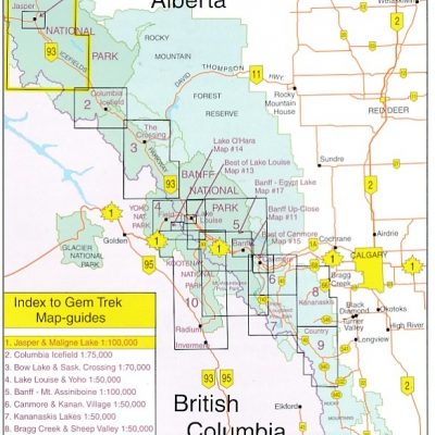
GEMTREK Wandelkaarten 1 - 17
GEMTREK Wandelkaarten 1 - 17

Producten op de overzichtskaart
Klik op een product om naar de detailpagina te gaan.
- Wandelkaart 02 Columbia Icefield- Canada - Gemtrek
- Wandelkaart 04 Banff Egypt Lake - Alberta Canada - Gemtrek
- Wandelkaart 05 Banff & Mount Assiniboine - Gem Trek Pub
- Wandelkaart 08 Bragg Creek and Sheep Valley - Gem Trek
- Wandelkaart 10 Kootenay National Park - Gemtrek
- Wandelkaart 11 Banff Up-Close - Gemtrek
- Wandelkaart 14 Lake O'Hara- BC Canada - Gemtrek
- Wandelkaart 15 Bow Lake & Saskatchewan river Crossing - Gem Trek
Artikelen uit dezelfde regio

Reisgids Canada NED - insight guide • 9789066554849
Reisgids - Canada - insight guide Productomschrijving: Canada is het op één na grootste land ter wereld en strekt zich uit over een afstand van 5500 km tussen de Atlantische Oceaan en de Grote Oceaan. De variatie van landschappen is dan ook ongekend groot en ondanks deze enorme afmetingen zijn de auteurs en fotografen op de bekende, onovertroffen en veelvuldig bekroonde Insight Guide-wijze…

Reisgids Banff- Jasper & Glacier NP - Lonely Planet • 9781786575920
Banff- Jasper & Glacier NP - Lonely Planet Covers: Banff National Park, Jasper National Park, Glacier National Park, Lake Louise, Lake Minnewanka, Bow Valley, Backcountry, Kananaskis Country, Lake O’Hara, Jasper Town, Blackfeet Indian Reservation and more. Product description: Lonely Planet Banff, Jasper & Glacier National Parks is your passport to the most relevant, up-to-date advice …

Reisgids West Canada (ENG) - Marco Polo • 9781914515934
Reisgids West Canada - Marco Polo Productomschrijving: Let Marco Polo Canada West guide you around this beautiful region. Explore Western Canada with this handy, pocket-sized, authoritative guide, packed with Insider Tips. Discover boutique hotels, authentic restaurants, the region's trendiest places, and get tips on shopping and what to do on a limited budget. There are plenty of ide…
Wandelkaart 65 Lake Louise & Moraine Lake - Gem trek Pub • 9781990161162
Wandelkaart Lake Louise & Moraine Lake - Gem trek Productomschrijving: Gem Trek's 1:35,000 Lake Louise and Moraine Lake Map is a waterproof and tear-resistant relief-shaded topographic map of the Lake Louise area of Banff National Park in the Canadian Rockies. Like all Gem Trek maps, the Lake Louise and Moraine Lake Map features detailed cartography and accurate hiking trails with distanc…

Wandelkaart Canmore Up-Close Alberta Canada - Gem Trek Publ. • 9781990161209
Wandelkaart Canmore Up-Close - Gem Trek Publ. Productomschrijving: Gem Trek’s 1:35,000 Canmore Up-Close Map is a detailed relief-shaded topographic map of Canmore and the Bow Valley area. This edition has been updated to show all new subdivisions and recent changes to the trail network. On the back of the Canmore Up-Close Map are descriptions of recommended sights and detailed descrip…