
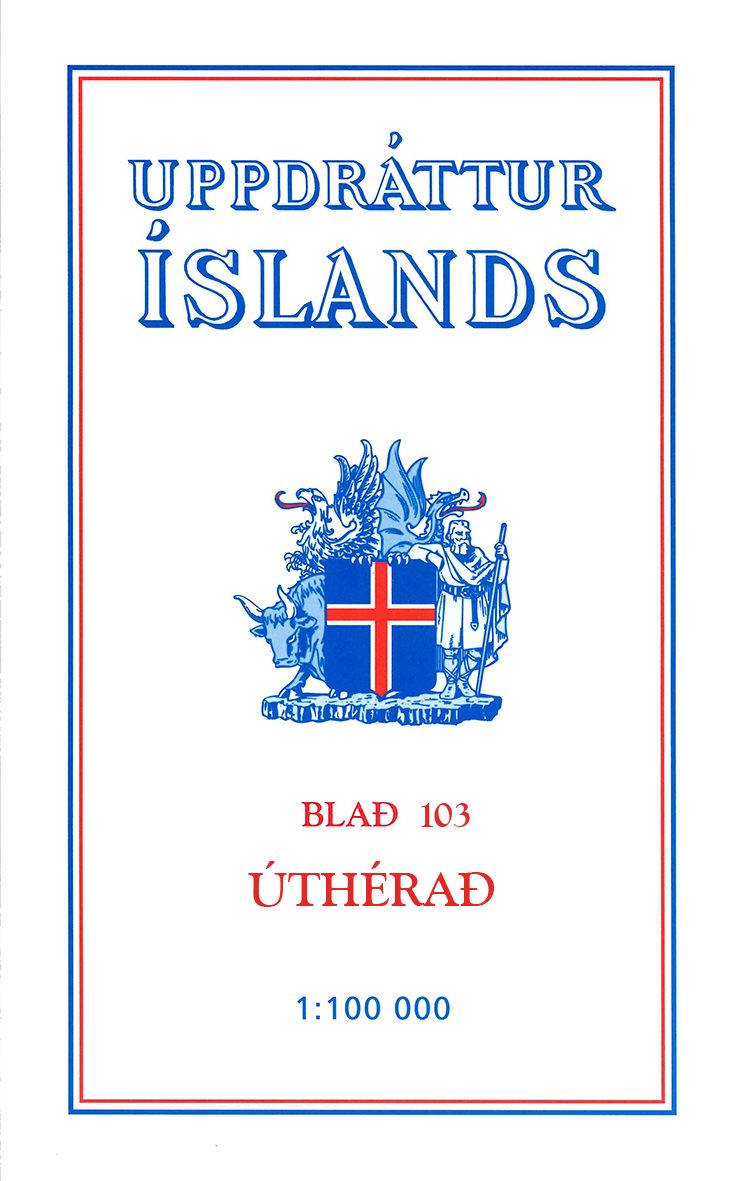
Wandelkaart 103 Utherad Iceland - Ferdakort
This is one of the maps in the topographic survey of Iceland
Korte omschrijving
Wandelkaarten Austurland, IJsland en Oostland, IJsland van Idnu Bokautgafa (Ferdakort). Ideaal voor tochten in Ijsland.
Wandelkaart 103 - Utherad Iceland - Ferdakort Productomschrijving: Deze serie topografische kaarten van IJsland zijn goed gedetailleerd. Alle topografische details zijn erop terug te vinden....

Specificaties
- Uitgever: Idnu Bokautgafa (Ferdakort)
- ISBN-13: 5690000234694
- HOOFDCATEGORIEËN: Wandelkaart
- Activiteiten: Wandelen, Hiking & Trekking
- Regio: Austurland, IJsland, Oostland, IJsland
- Land: Ijsland
- TOPO's & Stafkaarten: Topografisch wandelen
- Schaal: 1:100000
- Taal: Engels
- De Scandinavische Landen: IJsland
- De beroemdste Eilandengroepen: IJsland
- Grote Eilanden: IJsland
Volledige omschrijving
Wandelkaart 103 - Utherad Iceland - Ferdakort
Productomschrijving: Deze serie topografische kaarten van IJsland zijn goed gedetailleerd. Alle topografische details zijn erop terug te vinden.
This is one of the maps in the topographic survey of Iceland with the scale 1:100,000. The series was last revised in the early eighties. Contour interval is 20 meters. In addition to the usual features shown on survey mapping, the maps also include a large amount of information indicating the type of the terrain and land use (block or smooth surfaced lava, clay, boulders, sand and dunes, cultivated area, meadows, pastures, bogs, wetlands, etc.) and details not often found on maps: physicians' residences, parsonages, etc. Each map covers an area of 44 x 40 km / 27 x 25 miles. Margin ticks give latitude and longitude in steps of 6'. Map legend includes English.
Locatie op kaart
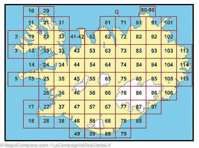
Overzichtskaarten

Idnu (Ferdakort Iceland)
Idnu (Ferdakort Iceland)

Producten op de overzichtskaart
Klik op een product om naar de detailpagina te gaan.
- Wandelkaart 2 Saudlauksdalur Iceland - Ferdakort
- Wandelkaart 3 Hornstrandir Iceland - Ferdakort
- Wandelkaart 10 Straumnes Iceland - Ferdakort
- Wandelkaart 11 Stigahlid Iceland - Ferdakort
- Wandelkaart 12 Thingeyri Iceland - Ferdakort
- Wandelkaart 14 Breidafjordur Iceland - Ferdakort
- Wandelkaart 15 Snaefellsnes Iceland - Ferdakort
- Wandelkaart 17 Miðnestorg & Sandgerði - Ferdakort
- Wandelkaart 18 Reykjanes Iceland - Ferdakort
- Wandelkaart 23 Gufudalur Iceland - Ferdakort
- Wandelkaart 24 Fellsstrond Iceland - Ferdakort
- Wandelkaart 25 Hnappadalur Iceland - Ferdakort
- Wandelkaart 26 Borgarfjordur Iceland - Ferdakort
- Wandelkaart 27 Hoofdstad Reykjavik Iceland - Ferdakort
- Wandelkaart 28 Krisuvik Iceland - Ferdakort
- Wandelkaart 31 Ofeigsfjordur Iceland - Ferdakort
- Wandelkaart 32 Kuvikur Iceland - Ferdakort
- Wandelkaart 34 Laxardalur Iceland - Ferdakort
- Wandelkaart 35 Nordurardalur Iceland - Ferdakort
- Wandelkaart 36 Botnsheidi Iceland - Ferdakort
- Wandelkaart 38 Eyrarbakki Iceland - Ferdakort
- Wandelkaart 43 Blonduos Iceland - Ferdakort
- Wandelkaart 44 Grimstunga Iceland - Ferdakort
- Wandelkaart 45 Eiriksjokull Iceland - Ferdakort
- Wandelkaart 46 Hlodufell Iceland - Ferdakort
- Wandelkaart 47 Skalholt Iceland - Ferdakort
- Wandelkaart 48 Oddi Iceland - Ferdakort
- Wandelkaart 49 Vestmannaeyjar Iceland - Ferdakort
- Wandelkaart 53 Vidimyri Iceland - Ferdakort
- Wandelkaart 54 Godadalir Iceland - Ferdakort
- Wandelkaart 62 Eyjafjordur 62 Iceland - Ferdakort
- Wandelkaart 64 Vatnahjallavegur Iceland - Ferdakort
- Wandelkaart 65 Hofsjokull Iceland - Ferdakort
- Wandelkaart 66 Holtam & Afrettur Iceland - Ferdakort
- Wandelkaart 68 Skaftartunga Iceland - Ferdakort
- Wandelkaart 69 Hjorleifshofdi Iceland - Ferdakort
- Wandelkaart 71 Tjornes Iceland - Ferdakort
- Wandelkaart 72 Husavik Iceland - Ferdakort
- Wandelkaart 73 Lundarbrekka Iceland - Ferdakort
- Wandelkaart 74 Kidagil Iceland - Ferdakort
- Wandelkaart 79 Grimsstadir Iceland - Ferdakort
- Wandelkaart 80-90 Melrakkasletta Iceland - Ferdakort
- Wandelkaart 81 Oxarfjordur Iceland - Ferdakort
- Wandelkaart 82 Dettifoss Iceland - Ferdakort
- Wandelkaart 83 Myvatn Iceland - Ferdakort
- Wandelkaart 85 Kverkfjoll Iceland - Ferdakort
- Wandelkaart 88 Ingoshofdi Iceland - Ferdakort
- Wandelkaart 92 Burfellsheidi Iceland - Ferdakort
- Wandelkaart 93 Mordudalur Iceland - Ferdakort
- Wandelkaart 94 Jokuldalsheidi Iceland - Ferdakort
- Wandelkaart 97 Kalfafellsstadur Iceland - Ferdakort
- Wandelkaart 101 Langanes Iceland - Ferdakort
- Wandelkaart 103 Utherad Iceland - Ferdakort
- Wandelkaart 105 Hamarsfjordur Iceland - Ferdakort
- Wandelkaart 115 Breiddalsvik Iceland - Ferdakort
Artikelen uit dezelfde regio

Wandelkaart 97 Kalfafellsstadur Iceland - Ferdakort • 5690000234663
Wandelkaart 97 - Kalfafellsstadur Iceland - Ferdakort Productomschrijving: Deze serie topografische kaarten van IJsland zijn goed gedetailleerd. Alle topografische details zijn erop terug te vinden. This is one of the maps in the topographic survey of Iceland with the scale 1:100,000. The series was last revised in the early eighties. Contour interval is 20 meters. In addition to the u…

Wandelkaart 88 Ingoshofdi Iceland - Ferdakort • 5690000234595
Wandelkaart 88 - Ingoshofdi Iceland - Ferdakort Productomschrijving: Deze serie topografische kaarten van IJsland zijn goed gedetailleerd. Alle topografische details zijn erop terug te vinden. This is one of the maps in the topographic survey of Iceland with the scale 1:100,000. The series was last revised in the early eighties. Contour interval is 20 meters. In addition to the usual f…
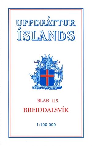
Wandelkaart 115 Breiddalsvik Iceland - Ferdakort • 5690000234755
Wandelkaart 115 - Breiddalsvik Iceland - Ferdakort Productomschrijving: Deze serie topografische kaarten van IJsland zijn goed gedetailleerd. Alle topografische details zijn erop terug te vinden. This is one of the maps in the topographic survey of Iceland with the scale 1:100,000. The series was last revised in the early eighties. Contour interval is 20 meters. In addition to the usua…

Wandelkaart 26 Borgarfjordur Iceland - Ferdakort • 5690000234069
Wandelkaart 26 - Borgarfjordur Iceland - Ferdakort Productomschrijving: Deze kaarten zijn niet direkt op voorraad. De levertijd is echter normaal gezien slechts enkele dagen. De kaarten die u niet kunt vinden op ons overzicht, zijn niet leverbaar. Deze serie topografische kaarten van IJsland zijn goed gedetailleerd. Alle topografische details zijn erop terug te vinden. This is one of t…

Wandelkaart 85 Kverkfjoll Iceland - Ferdakort • 5690000234564
Wandelkaart 85 - Kverkfjoll Iceland - Ferdakort Productomschrijving: Deze serie topografische kaarten van IJsland zijn goed gedetailleerd. Alle topografische details zijn erop terug te vinden. This is one of the maps in the topographic survey of Iceland with the scale 1:100,000. The series was last revised in the early eighties. Contour interval is 20 meters. In addition to the usual …