

Wandelgids Walking the Tour of the Lake District - Cicerone
113 km route van Windermere rond het Engelse Lake District

Korte omschrijving
Wandelgidsen Cumbria, England van CICERONE Press. Ideaal voor tochten in England.
Walking the Tour of the Lake District - Cicerone press Productomschrijving: 113 km route van Windermere rond het Engelse Lake District - Een wandelgids van een schilderachtige, zevendaagse c...

Specificaties
- Uitgever: CICERONE Press
- ISBN-13: 9781786310491
- HOOFDCATEGORIEËN: Wandelgids
- Activiteiten: Wandelen, Hiking & Trekking
- Regio: Cumbria, England
- Land: England
- Nationale parken: Lake District NP, Cumbria England
- Editie: 2
- Taal: Engels
- De Nationale Parken: Lake district National Park, England
- Iconische Wandelroutes: Lake district, Cumbria England
- Wandelen in de Bossen & natuurgebieden van Europa: Lake district, England
Volledige omschrijving
Walking the Tour of the Lake District - Cicerone press
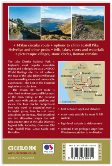
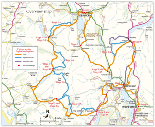
Productomschrijving: 113 km route van Windermere rond het Engelse Lake District - Een wandelgids van een schilderachtige, zevendaagse cirkelvormige route van 93 mijl vanuit Windermere rond het Engelse Lake District. De tour geeft een voorproefje van de belangrijkste valleien van Lakeland en bezoekt Ambleside, Elterwater, Coniston, Eskdale, Wasdale, Black Sail, Buttermere, Keswick, Rosthwaite, Grasmere en Patterdale. Met alternatieven op hoog niveau.
Engelse omschrijving: A guidebook to walking a scenic, seven-day circular 93 mile route from Windermere around England's Lake District. The tour gives a flavour of the main Lakeland valleys, visiting Ambleside, Elterwater, Coniston, Eskdale, Wasdale, Black Sail, Buttermere, Keswick, Rosthwaite, Grasmere and Patterdale. With high-level alternatives.
Seasons:April to end of October recommended. The main centres are busy during school holidays, so avoid if possible.
Centres:
Windermere, Ambleside, Elterwater, Coniston, Eskdale, Wasdale, Buttermere, Keswick, Rosthwaite, Grasmere, Patterdale.
Difficulty:
Seven-day, 93 mile walk. Visits valleys rather than peaks. Well within the capabilities of the averagely fit walker.
Must See: The landscape, escaping the crowds, traditional events (sheep dog trials, local shows), peak-bagging, local speciality foods, literary heritage walks.
Locatie op kaart
Artikelen uit dezelfde regio
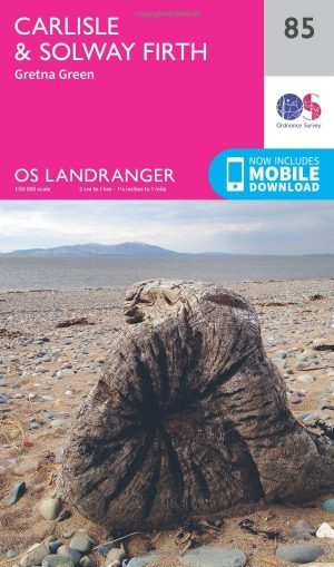
Wandelkaart 85 Carlisle & Solway Firth- Cumbria England - OSI • 9780319261835
Wandelkaart Carlisle & Solway Firth - Cumbria England Productbeschrijving: Deze kaart van Carlisle & Solway Firth omvat ook Gretna Green, Annan, Canonbie, Brydekirk, Dalton, Kirkbride, Silloth, Wigton, Thursby evenals deel van het Lake District National Park en deel van Hadrianus Wall path. De OS Landranger kaarten reeks heeft betrekking op Groot-Brittannië met 204 gedetailleerde kaart…

Wandelkaart 89 West Cumbria England - OSI • 9780319261873
Wandelkaart West Cumbria - England Productbeschrijving: West Cumbria staat bekend om zijn aantrekkelijke landschap en het Lake District National Park & Wast Water Lakes, die zich uitstrekken over 3 mijl langs de Washdale valley. De OS Landranger kaart nummer 89 van West Cumbria omvat ook Cockermouth, Workington, Maryport, Dovenby, Uldale, Ennerdale Bridge, Egermont, Gosforth, Keswick, Scaf…
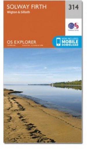
Wandelkaart 314 Solway Firth- Cumbria England - OSI • 9780319471869
Wandelkaart Solway Firth - Cumbria England Omvat ook: Wigton & Silloth, aansluitend ligt het NP Lake District. Productbeschrijving: OS Explorer 314 toont de Solway Firth, Annan, Wigton en Silloth. Het omvat ook een deel van het nationale Scenic gebied van Nith estuarium, en de Solway Coast gebied van buitengewone natuurlijke schoonheid AONB. Er is ook de Cumbria Costal Way, Allerdale R…
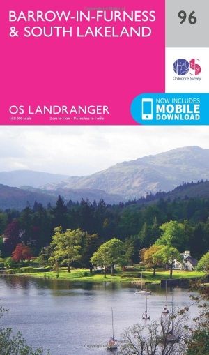
Wandelkaart 96 Barrow-in-Furness & South Lakeland - OSI • 9780319261941
Wandelkaart Barrow-in-Furness & South Lakeland - England Productbeschrijving: OS Landranger kaart 96, is de ideale kaart voor het plannen van wandelingen in deze prachtige kuststreek van het Lake District. Buitenshuis kunnen liefhebbers kiezen tussen dramatische lakeside Panorama's of kust paden. Hoogtepunten van het gebied zijn Piel kasteel, Walney Island, Ulverston en Coniston Water …

Wandelkaart 85 Carlisle & Solway Firth- Cumbria England - OSI • 9780319474082
Wandelkaart Carlisle & Solway Firth - Cumbria England Productbeschrijving: Deze kaart van Carlisle & Solway Firth omvat ook Gretna Green, Annan, Canonbie, Brydekirk, Dalton, Kirkbride, Silloth, Wigton, Thursby evenals deel van het Lake District National Park en deel van de Hadrianus Wall path. De OS Landranger kaarten reeks heeft betrekking op Groot-Brittannië met 204 gedetailleerde kaarte…