

Wandelgids The Moray Coast Trail - Rucksack Readers
Moray Coast Trail > Grantown naar Forres - Dava Way - Moray way
Korte omschrijving
Wandelgidsen Highlands, Schotland en Noord Oost Schotland van RUCKSACK READERS. Ideaal voor tochten in Schotland.
The Moray Coast Trail - with Dava way and Moray way Productomschrijving: Deze nieuwe editie behandelt twee contrasterende routes in detail in het noordoosten van Schotland: De Moray Coast Tr...

Specificaties
- Uitgever: RUCKSACK READERS
- ISBN-13: 9781898481980
- HOOFDCATEGORIEËN: Wandelgids
- Activiteiten: Wandelen, Hiking & Trekking
- Auteur: Sandra Bardwell
- Regio: Highlands, Schotland, Noord Oost Schotland
- Land: Schotland
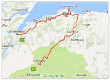
- Lange afstand wandelroutes: The Moray Coast Trail, N.O. Schotland (72 km)
- Schaal: 1:40000
- Editie: 2
- Taal: Engels
Volledige omschrijving
The Moray Coast Trail - with Dava way and Moray way
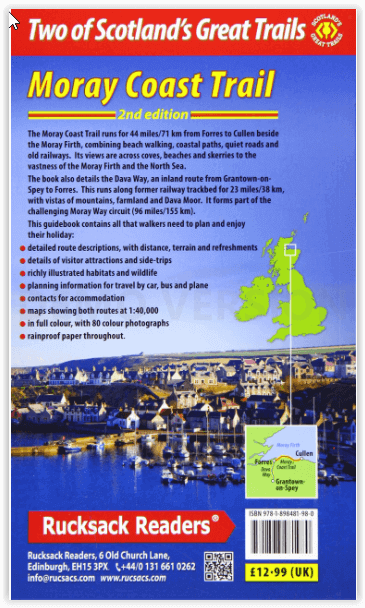
Productomschrijving: Deze nieuwe editie behandelt twee contrasterende routes in detail in het noordoosten van Schotland: De Moray Coast Trail van Forres naar Cullen, en de Dava Way, een binnenlandse route van Grantown naar Forres. De Moray Coast Trail bestaat uit 44 mijl/71 km strandwandelen, over kustpaden, rustige wegen en oude spoorwegen. Het uitzicht strekt zich uit over inhammen, stranden en scheren tot de uitgestrektheid van de Moray Firth en de Noordzee. De Dava Way strekt zich uit over 23 mijl/38 km landinwaarts met vergezichten over bergen, heidevelden en landbouwgrond. Wij geven ook uitleg over de Moray Way, een route die de meeste van de twee bovengenoemde routes combineert met een deel van de Speyside Way om een 96 mijl lang circuit van aanzienlijke schoonheid en historisch belang te vormen.
Engelse omschrijving: This new edition covers in detail two contrasting routes in north-east Scotland: the Moray Coast Trail from Forres to Cullen, and the Dava Way, an inland route from Grantown to Forres. The Moray Coast Trail consists of 44 miles/71 km of beach walking, on coastal paths, quiet roads and old railways. Its views are across coves, beaches and skerries to the vastness of the Moray Firth and the North Sea. The Dava Way extends for 23 miles/38 km inland with vistas of mountain, moorland and farmland. We also explain the Moray Way, a route that combines most of the above two routes with part of the Speyside Way to form a 96-mile circuit of considerable beauty and historical interest.
The new edition features large-scale mapping (scale 1:40,000), several significant route updates and many fresh photos. We expect to release it in early March, and if you subscribe your email address you will be the first to hear when it’s available. This book is in our pocket-friendly format, with perfect binding instead of concealed wiro. Unlike many paperbacks, it can be opened flat without splitting the spine.
This guidebook contains all you need to plan and enjoy your holiday on and near the Moray Firth:
- detailed description of the Moray Coast Trail from west to east, and Dava Way from south to north
- summaries of distance, terrain and refreshments for each section
- details of visitor attractions and side-trips
- richly illustrated habitats and wildlife
- planning information for travel by car, bus and plane
- contacts for accommodation
- maps showing both routes at 1:40,000
- in full colour, with 80 photographs
- rucksack-friendly and on rainproof paper.
Artikelen uit dezelfde regio
Wandelkaart 383 Morvern & Lochaline- Schotland - OSI • 9780319472491
Wandelkaart Morvern & Lochaline- Highland Schotland Omvat ook: Kingairloch. Productbeschrijving: Kaart blad nummer 383 in de OS Explorer kaarten reeks omvat Morvern en Lochaline in de Schotse Hooglanden. Dit schilderachtige gebied beschikt over vele Lochs om te verkennen, met inbegrip van Loch Linnhe, Loch Aline en Loch Sunart samen met de Sound of Mull. De steden Kingairloch en Lochal…

Wandelkaart 51 Loch Tay & Glen Dochart- Highland's - OSI • 9780319261491
Wandelkaart Loch Tay & Glen Dochart - Highland's Schotland Productbeschrijving: Glen Dochart is een brede en rustige glen waar mensen komen om te vissen, te golfen en wandelen in het prachtige Schotse landschap. Het strekt zich uit van Loch Lyon in het westen tot Loch Tay in het Oosten. De kaart OS Landranger 51 omvat ook de Tay Forest Park, Loch Lednock Reservoir, Loch Voil, Glen Lyon, Be…
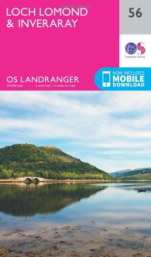
Wandelkaart 56 Loch Lomond & Inveraray- Trossachs NP - OSI • 9780319261545
Wandelkaart Loch Lomond & Inveraray - Schotland Productbeschrijving: Gezegd dat dit de toegangspoort tot de hooglanden is, heeft Inveraray een breed scala aan attracties in aanbod van Inveraray Castle en tuinen tot wandelen in de nabijgelegen Glens Shira en Aray. OS Landranger kaart 56 toont ook de West Highland Way, die op zijn beurt langs de oevers van Loch Lomond in het Trossachs Nation…
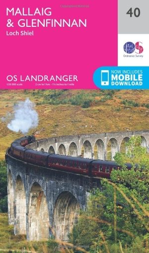
Wandelkaart 40 Mallaig & Glenfinnan- Highland's - OSI • 9780319261385
Wandelkaart Mallaig & Glenfinnan - Highland's Schotland Productbeschrijving: De haven van Mallaig ligt langs de beroemde weg naar de eilanden en is een uitstekende uitvalsbasis om de hooglanden en Loch Morar vanuit te verkennen. Op de oevers van Loch Shiel gelegen is Glenfinnan, een kleine maar mooi dorp met een prachtig landschap. De OS Landranger kaarten reeks heeft betrekking op Gro…
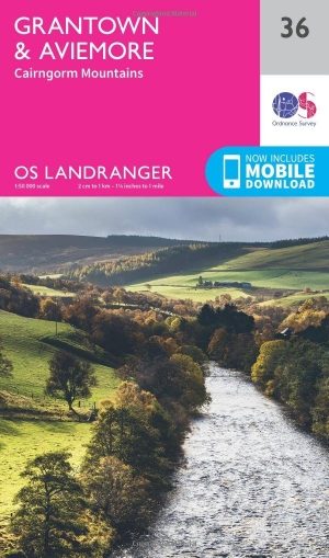
Wandelkaart 36 Grantown & Aviemore - Cairngorms - OSI • 9780319261347
Wandelkaart Grantown & Aviemore - Cairngorms Schotland Productbeschrijving: Kaart nummer 36 in de OS Landranger kaarten reeks, is de ideale kaart voor de planning van dagexcursies en vakanties in het Cairngorms National Park, Grampian Mountains en het gebied rond Aviemore. Ook op de kaart is de Speyside way, Ben Macdui (Beinn MacDuibh), Meall een ' Bhuachaille, Strathavon, Kinveachy bos, D…