

Wandelgids The Cape Wrath trail - Cicerone
through the Scottish Highlands from Fort William to Cape Wrath
Korte omschrijving
Wandelgidsen Highlands, Schotland van CICERONE Press. Ideaal voor tochten in Schotland.
Cape Wrath trail - Fort William to Cape Wrath - Cicerone Productomschrijving: Een gids voor de Cape Wrath Trail, een lange afstandstocht door de Schotse Hooglanden van Fort William naar Cap...

Specificaties
- Uitgever: CICERONE Press
- ISBN-13: 9781786311344
- HOOFDCATEGORIEËN: Wandelgids
- Activiteiten: Wandelen, Hiking & Trekking
- Auteur: Lain Harper
- Regio: Highlands, Schotland
- Land: Schotland
- Lange afstand wandelroutes: Cape Wrath trail (370km)
- Editie: 4
- Taal: Engels
Volledige omschrijving
Cape Wrath trail - Fort William to Cape Wrath - Cicerone
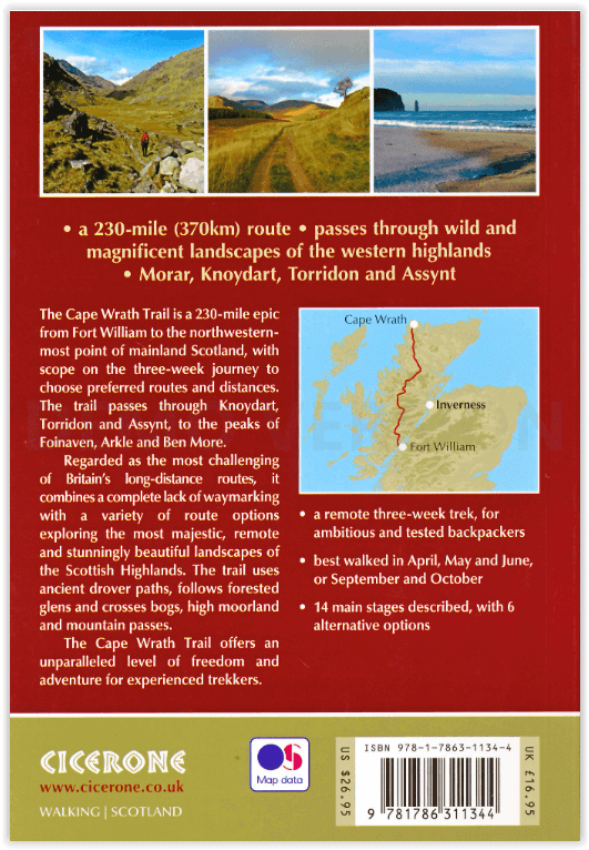
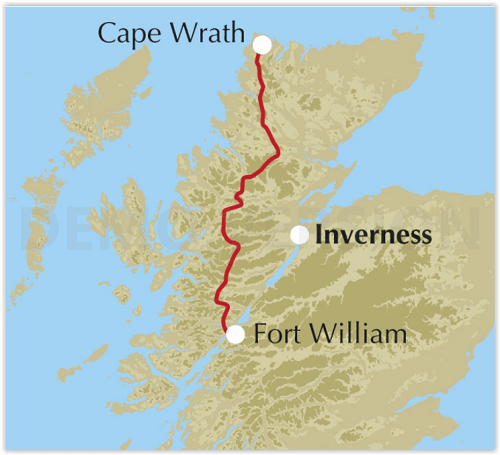
Productomschrijving: Een gids voor de Cape Wrath Trail, een lange afstandstocht door de Schotse Hooglanden van Fort William naar Cape Wrath. De Cape Wrath Trail is een 370 km lange, 3 weken durende uitdaging door wilde en prachtige landschappen, zoals Morar, Knoydart, Torridon en Assynt. Het doorkruist zo'n leeg land, het is alleen voor de ervaren backpacker.
Engelse omschrijving: A guidebook to the Cape Wrath Trail, a long-distance trek through the Scottish Highlands from Fort William to Cape Wrath. The Cape Wrath Trail is a 230 mile, 3-week challenge through wild and magnificent landscapes, such as Morar, Knoydart, Torridon and Assynt. Crossing such empty country, it is for the experienced backpacker only.
Seasons:
April, May and June are ideal months to walk the trail. September and October are also good, but there may be diversions due to deer stalking and military operations at the cape. In July and August the days are superbly long and the weather can be fine, but midges will be in full flight. The limited accommodation along the trail may also be booked up at this time of year.
Centres:
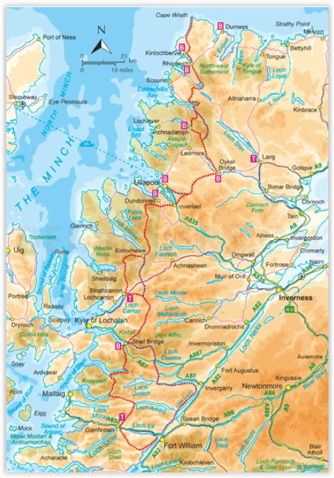
Fort William, Glenfinnan, Barisdale, Kinloch Hourn, Shiel Bridge, Strathcarron, Kinlochewe, Dundonnell, Ullapool, Bridge of Orchy, Inchnadamph, Kylesku, Rhiconich, Kinlochbervie, Durness.
Difficulty:
The Cape Wrath Trail is regarded as the toughest long distance backpacking trail in Britain. It crosses remote, sparsely populated, potentially dangerous mountain country. There are no pack carrying services and often no clear paths. Limited re-supply points require self sufficiency for many days together. Not a route for beginners or those unfamiliar with remote, rugged mountain areas.
Must See:
Glenfinnan monument and viaduct, the gloriously remote rough bounds of Knoydart, Barisdale, Forcan ridge, Falls of Glomach, Beinn Eighe, Lochan Fada, Shenavall, An Teallach, Glen Douchary, Glen Oykel, Ben More, Glencoul, Arkle, Foinaven, Sandwood Bay, Cape Wrath lighthouse.
Locatie op kaart
Artikelen uit dezelfde regio
Wandelkaart 450 Wick & The Flow Country- Schotland - OSI • 9780319473023
Wandelkaart Wick & The Flow Country - Highland's Schotland Omvat ook: Lybster, Latheron & Dunbeath. Productbeschrijving: OS Explorer kaart 450 behandelt Wick en Moray Firth, met inbegrip van Lybster, Latheron en Dunbeath. Wick bestaat al sinds ten minste 1266 en biedt de wereld kortste straat, Ebenezer plaats. De Flow Country is een groot gebied van moerassig, laaggelegen land; het For…
Wandelkaart 431 Glen Urquhart & Strathglass- Schotland OSI • 9780319472835
Wandelkaart Glen Urquhart & Strathglass - Highland's Schotland Omvat ook: Drumnadrochit & Muir of Ord. Productbeschrijving: Ten westen van de Highland hoofdstad van Inverness, toont OS Explorer kaart 431 toont Drumnadrochit noordelijk naar Muir of Ord. Het omvat de nationale Scenic gebied van Strathfarrar, het Orrin Reservoir, en een kleine hoeveelheid van de Great Glen way. De OS Expl…
Fietskaart Highland Perthshire Schotland - Harvey maps • 9781851375080
Fietskaart Highland Perthshire Schotland - Harvey maps Productomschrijving: Een kaart van Highland Perthshire over duurzaame fietsen. Een duidelijke en gemakkelijk te lezen waterdichte kaart met voorgestelde fietsroutes uitgezet. Gemaakt in samenwerking met Perth & Kinross council, ByCycle, en Perth and Kinross country Trust. Nieuwe generatie HARVEY Superwalker, XT25 waterproof, werden…
Wandelgids The Speyside Way - Rucksack Readers • 9781898481997
Wandelgids - The Speyside Way - Rucksack Readers Producomschrijving: De Speyside Way loopt over een afstand van 128 km van de vissershaven Buckie naar Aviemore in de uitlopers van de Cairngorms. U volgt de lieflijke vallei van de rivier de Spey en wandelt door een landschap dat rijk is aan malt whisky en wilde dieren, langs paden langs de rivier, spoorwegbeddingen en bos- en heidepaden. De…
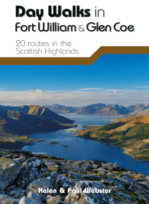
Wandelgids Day Walks in Fort William & Glen Coe - Vertebrate publ • 9781912560646
Day Walks in Fort William & Glen Coe Scotland Productomschrijving: 20 routes in the Scottish Highlands Day Walks in Fort William & Glen Coe features 20 routes between 4.4 and 14.4 miles (7km and 23.2km) in length, spread across the Scottish Highlands. Researched and written by experienced and knowledgeable authors Helen and Paul Webster, founders of the Walkhighlands website, the walk…