

Wandelgids Part 2 SWCP Map Booklet St Ives to Plymouth - Cicerone
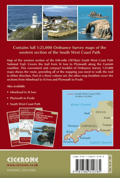
From St Ives to Plymouth along the west Cornwall and Devon coast


Korte omschrijving
Wandelgidsen South West England, Devon, England en Cornwall, England van CICERONE Press. Ideaal voor tochten in England.
Map Booklet Part 2 SWCP - St Ives to Plymouth - Cicerone Productomschrijving: Map of part of the southern section of the 630 mile (1014km) South West Coast Path National Trail. Covers:...

Specificaties
- Uitgever: CICERONE Press
- ISBN-13: 9781786312785
- HOOFDCATEGORIEËN: Wandelgids
- Activiteiten: Wandelen, Hiking & Trekking
- Regio: Cornwall, England, Devon, England, South West England
- Land: England
- Lange afstand wandelroutes: South West Coast Path - SWCP (1014 km)
- Schaal: 1:25000
- Editie: 2
- Taal: Engels
- Reeks/Serie: Map Booklet, Cicerone
- Iconische Wandelroutes: South West coast Path, Cornwall UK
Volledige omschrijving
Map Booklet Part 2 SWCP - St Ives to Plymouth - Cicerone
Productomschrijving: Map of part of the southern section of the 630 mile (1014km) South West Coast Path National Trail.
Covers: the trail from St Ives to Plymouth along the west Cornwall and Devon coastline. This convenient and compact booklet of Ordnance Survey 1:25,000 maps shows the route, providing all of the mapping you need to walk the trail in either direction.
Seasons:
This National Trail may be walked year-round: be aware that winter accommodation availability may be limited, while high summer will be extremely busy and the weather often hot.
Centres:
Many centres are passed along the route, including Penzance, Falmouth, Mevagissey, Polperro, Plymouth.
Difficulty:
The South West Coast path is a long walk! Most paths are easy to moderate, with some walks along rugged and exposed coastal cliff paths and some steep gradients.
Must See:
Areas of Outstanding Natural Beauty, the Jurassic Coast Natural World Heritage Site, numerous Heritage Coasts, National and Local Nature Reserves, Sites of Special Scientific Interest and National Trust holdings.

Artikelen uit dezelfde regio

Reisgds Devon & Cornwall + map (ENG) - Marco Polo • 9781914515415
Reisgds Devon & Cornwall - Marco Polo Productomschrijving: Let Marco Polo Devon and Cornwall guide you around these beautiful English counties. Discover boutique hotels, authentic restaurants and ideas for travel with kids with this handy, pocket-sized, authoritative guide, packed with Insider Tips. Let Marco Polo show you all this beautiful region has to offer!

Wandelkaart 113 Okehampton- Devon England - OSI • 9780319243145
Wandelkaart Okehampton - Devon England - OSI Omvat ook: Hatherleigh, North Tawton & Lapford Productomschrijving: Kaart nummer 113 in de OS Explorer kaarten reeks is ideaal voor het ontdekken van het Hatherleigh, North Tawton en Lapford gebied rond het noorden van Dartmoor national park. Dit gebied van Devon is rijk aan natuur en daarom perfect voor al degenen die gepassioneerd zijn ove…

Wandelkaart 139 Bideford- Ilfracombe & Barnstable- Devon • 9780319470114
Wandelkaart Bideford- Ilfracombe & Barnstable - Devon England Productbeschrijving: Kaart nummer 139 in de OS Explorer reeks omvat Ilfracombe, Bideford, Barnstaple, Westward Ho!, Woolacombe, en Lundy Island, en toont een deel van de South West Coast Path. De OS Explorer kaart voor Bideford, Ilfracombe & Barnstaple is beschikbaar in zowel de standaard papieren versie als de weerbestendige 'A…

Reisgids Time Out Devon & Cornwall - Crimson Pub. • 9781846702433
Reisgids - Time Out Devon & Cornwall - Crimson Pub. Productomschrijving: Devon en Cornwall zijn uniek, glorieus mooi en rijk aan geschiedenis en dieren in het wild. Ze bieden alles van traditionele vissersdorpen en zandstranden tot wandelingen in de wildernis en kastelen. Accommodaties variëren van campings en huisjes tot boerderijen en boetiekhotels. Of het nu gaat om gezinsvriendelijke o…

Fietsgids South West England Gravel Rides - Vertebrate Publ. • 9781839812545
South West England Gravel Rides - Vertebrate Publ. Productomschrijving: 24 gravel bike adventures in the West Country Gravel Rides South West England features 24 cycling routes, ranging from 16 to 180 kilometres, showcasing the extensive gravel trails of the West Country. Gravel enthusiast and experienced route creator Katherine Moore has taken her love of the South West and extensive …