

Wandelgids Malvern Hills Short walks - Cicerone
15 van de beste korte wandelingen in de Malvern Hills AONB
Korte omschrijving
Wandelgidsen Derbyshire & Peak District, England, Worcestershire, West England en Hereford, England van CICERONE Press. Ideaal voor tochten in England.
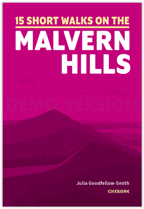
Wandelgids Malvern Hills Short walks - Cicerone Productomschrijving: Julia Goodfellow-Smith heeft 15 van de beste korte wandelingen in de Malvern Hills AONB gekozen, waaronder Worcestershire...

Specificaties
- Uitgever: CICERONE Press
- ISBN-13: 9781786311399
- HOOFDCATEGORIEËN: Wandelgids
- Activiteiten: Wandelen, Hiking & Trekking
- Auteur: Julia Goodfellow-Smith
- Regio: Derbyshire & Peak District, England, Hereford, England, Worcestershire, West England
- Land: England
- AONB - Area of Outstanding Beauty/National Landscape: Malvern Hills AONB
- Editie: 1
- Taal: Engels
Volledige omschrijving
Wandelgids Malvern Hills Short walks - Cicerone
Productomschrijving: Julia Goodfellow-Smith heeft 15 van de beste korte wandelingen in de Malvern Hills AONB gekozen, waaronder Worcestershire Beacon. Elke wandeling is voorzien van goed leesbare Ordnance Survey-kaarten, een duidelijke routebeschrijving en veel afbeeldingen, plus informatie over mooie plekjes en rustplaatsen. Geen moeilijk terrein of ingewikkelde navigatie betekent dat iedereen van de wandelingen kan genieten.
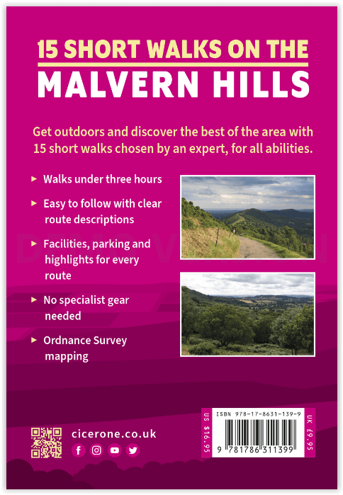
Engelse omschrijving: Julia Goodfellow-Smith has chosen 15 of the best short walks in the Malvern Hills AONB, including Worcestershire Beacon. Each walk comes with easy-to-read Ordnance Survey maps, clear route description and lots of images, plus information on beauty spots and refreshment stops. No challenging terrain or complicated navigation means walks can be enjoyed by everyone.
Seasons
The Malvern Hills can be enjoyed at any time of year but it can be windy on the peaks and it's always a good idea to take a waterproof.
Centres
Great Malvern is the main town in the area. The walks are also easily accessible from Ledbury and Worcester.
Difficulty
This book includes walks that are almost flat, as well as some that are more challenging. The Malvern Hills can be enjoyed by people of all levels of ability and fitness. For most routes, no special footwear is needed, although a few can get muddy, as indicated in the descriptions.
Must See
Worcestershire Beacon, highest peak in Worcestershire and the Malvern Hills, Herefordshire Beacon (British Camp) - an Iron Age hill fort that dominates the skyline and is the highest peak in Herefordshire, Malvern Priory, the springs all around Malvern (also known as wells) - Malvinha and Holy Well are in the book.

Artikelen uit dezelfde regio

Fietskaart 03 Peak District cycling map - Goldeneye • 9781859653043
Fietskaart Peak District cycling map - Goldeneye Productomschrijving: Het Peak District is een nationaal park van formaat pal in het centrum van Engeland. deze kaart biedt u een overzicht van alle fietsroutes in- en door het park. Het Peak District is dan ook goed gekend voor zijn heuvel, bergen, waterwegen, wandel- en fietsroutes. Egelse omschrijving: The Peak District offers some of …
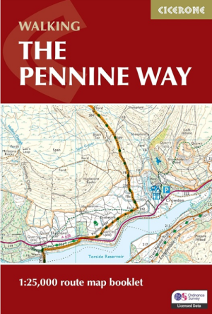
Wandelgids Map Booklet Pennine Way - Cicerone • 9781786311412
Map Booklet Pennine Way - Cicerone Productomschrijving: Map of the 270 miles (435km) Pennine Way National Trail, between Edale in the Peak District and Kirk Yetholm in the Scottish Borders. This booklet is included with the Cicerone guidebook to the trail, and shows the full route on OS 1:25,000 maps. This popular long-distance route typically takes three weeks to complete. Seasons: …

Fietsgids Pennine Bridleway Cycling guide - Vertebrate Publ. • 9781839810428
Pennine Bridleway Cycling guide - Vertebrate Productomschrijving: From Derbyshire through the Yorkshire Dales to Cumbria Pennine Bridleway by Hannah Collingridge is a guidebook to this National Trail taking you from Derbyshire through the Yorkshire Dales to Cumbria, following the Pennine Hills AONB. Together with stunning photography, the route features Ordnance Survey 1:50,000 maps, e…

Wandelkaart 204 Worcester & Droitwich Spa - OSI • 9780319243978
Wandelkaart Worcester & Droitwich Spa - Worcestershire Productbeschrijving: In de buurt van de kruispunten van de rivier Teme en de rivier de Severn, de stad van Worcester en de omliggende steden, vallen onder OS Explorer kaart 204. Dit gebied heeft nederzettingen die dateren uit het Neolithicum, dit gebied huist deel van de Malven Hills, plus een aantal kleinere groene ruimtes om te ontde…

Wandelgids 063 Pathfinder guides Peak District England - OS • 9780319090275
Wandelgids Peak District England - OS Productomschrijving: The Pathfinder Guide for the Lake District is the ideal companion to gaining an appreciation of England's most mountainous region with its balanced range of walks across the whole of the National Park. There are a total of 28 outstanding circular walks in the Lake District National Park from 3 to 10 miles with easy-to-follow route…