
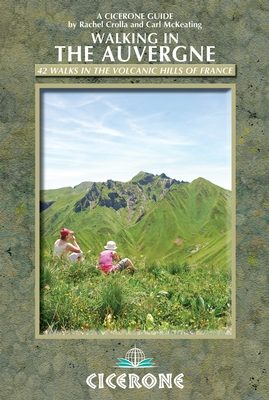
Wandelgids 42 walks in volcanic hills of France - Cicerone
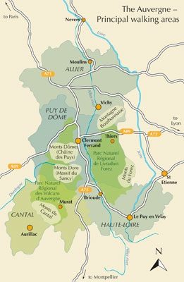
Vijf gebieden Cantal- Chaine des Puys- Mont Dores & Haute-Loire


Korte omschrijving
Wandelgidsen Auvergne-Rhône-Alpes, Frankrijk van CICERONE Press. Ideaal voor tochten in Frankrijk.
Wandelgids - 42 walks in volcanic hills of France - Cicerone Productomschrijving: Deze gids over de Auvergne beschrijft 42 wandelingen tussen 5 en 20 km, die wandelaars helpt om een vaak-ver...

Specificaties
- Uitgever: CICERONE Press
- ISBN-13: 9781852846510
- HOOFDCATEGORIEËN: Wandelgids
- Activiteiten: Wandelen, Hiking & Trekking
- Regio: Auvergne-Rhône-Alpes, Frankrijk
- Land: Frankrijk
- Editie: 1
- Taal: Engels
- De Franse Regio's: Auvergne-Rhône-Alpes
Volledige omschrijving
Wandelgids - 42 walks in volcanic hills of France - Cicerone
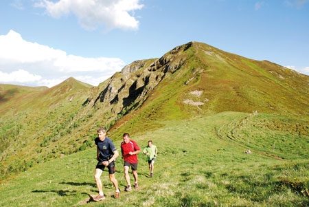
Productomschrijving: Deze gids over de Auvergne beschrijft 42 wandelingen tussen 5 en 20 km, die wandelaars helpt om een vaak-vergeten regio in Centraal-Frankrijk te kunnen verkennen. Vijf gebieden: Cantal, Chaine des Puys, Mont Dores, Haute-Loire en Montagne Bourbonnaise. De vulkanische geografie biedt een prachtige achtergrond. Basissen in Vichy, Clermont-Ferrand en Puy-en-Velay. Dit oude vulkanische landschap werd gevormd meer dan 70.000 jaar geleden, de Auvergne biedt een schat aan toegankelijk wandelen tegen een achtergrond van spectaculaire berglandschappen.
Detail: This guidebook to the Auvergne describes 42 walks between 5 and 20km, helping walkers to explore an often-forgotten region in central France. Five areas are covered: Cantal, Chaine des Puys, Mont Dores, Haute-Loire and Montagne Bourbonnaise. The volcanic geography provides a stunning backdrop. Bases in Vichy, Clermont-Ferrand and Puy-en-Velay.
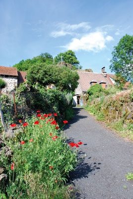
Product description: An ancient volcanic landscape formed over 70,000 years ago, the Auvergne offers a wealth of accessible walking against a backdrop of spectacular mountain scenery.The Auvergne region rises out of the Massif Central and spans the area from the spa towns of Vichy and Clermont-Ferrand to the historic Le Puy-en-Velay. The landscape bears witness to the seismic volcanic eruptions of bygone ages, the result of which is that the area boasts mountainous terrain set alongside a wealth of more gentle ground, all of which is open to exploration and discovery.
Guidebook to the Auvergne describing 42 walks between 5 and 20km in the quiet volcanic hills of central France. Five areas are covered: Cantal, Chaine des Puys, Mont Dores, Haute-Loire and Montagne Bourbonnaise. The volcanic geography provides a stunning backdrop to routes suitable for all walkers. Bases in Vichy, Clermont-Ferrand and Puy-en-Velay.
Seasons:
All the routes can be enjoyed from May to October. The summer months are usually hot and sunny, but the winters see snowbound villages and skiing on the higher Auvergne peaks.
Centres:
Cities: Puy-en-Velay and Vichy; villages: Orcival for the Monts Dore and Dômes, Murat for the Cantal, Mayet-de-Montagne for the Bourbonnaise.
Difficulty:
Grade 1: Short easy walks with few navigational problems and little ascent; Grade 2: Walks that will not be taxing for a fit and experienced hiker. They may be longer, have moderate height gain or require good navigation skills; Grade 3: Challenging walks for experienced hikers. Steep terrain may be encountered with considerable ascents or longer mountain days.
Must See:
Fascinating volcanoes: Puy de Dôme, de la Vache and Pariou; high summits: Plomb du Cantal, Puy Mary and Puy de Sancy; magnificent abbeys and churches: Chaise Dieu, Lavaudieu and Orcival; chateaux: Montgilbert and Lavoûte-sur-Loire; attractive bases: Le Puy-en-Velay and Vichy; lakes Guery and Pavin, the Grand Cascade and Volvic spring.
Locatie op kaart
Artikelen uit dezelfde regio

Wandelgids 0531 De la Maurienne à l'Ubaye - FFR • 9782751412226
Wandelgids Grande Traversée des Alpes - Maurienne à l'Ubaye Productomschrijving: 9 dagen van Modane naar Larche op de GR® 5, en hetzelfde voor de Ubaye tocht. Vanaf Modane en de Maurienne-vallei daalt de route af naar de Mont Thabor en de waterscheiding tussen de noordelijke en zuidelijke Alpen. Briançon en zijn vestingwerken komen in zicht. De stad is gebouwd op de kruising van de Dur…

Wandelgids PR28 Le Massif Glières-Parmelan à pied - FFR • 9782751404405
Wandelgids PR28 - Le Massif Glières-Parmelan à pied Productbeschrijving: Hier combineert men het geheugen met de pastorale activiteiten van sport en toerisme, in een subtiel en ongerepte flora en fauna, dat de charme van deze omgevingen maakt. Dit grondgebied, met een gemiddelde hoogte van 1500 m, strekt zich uit over ongeveer 85 km2, en dat van FFR, de Franse wandelorganisatie FFRP, dit z…

Wandelgids 650 Sentier Compostelle - Genève à Le-Puy - FFR • 9782751412479
Bedevaartgids - Sentier Saint-Jacques-de-Compostelle - Genève-Le-Puy Productomschrijving: Van Genève via het Rhônedal, een reis tussen de Alpen en het Centraal Massief over de mythische Chemin du Puy naar Compostella. Vanuit Genève volgt de pelgrim zijn route door een heuvelachtig landschap van omheinde landbouwgronden met uitzicht op de besneeuwde toppen van de Jura. De Rhône toont ve…
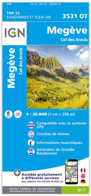
Wandelkaart 3531 OT Megève & Col des Aravis - IGN • 9782758553489
Wandelkaart Megève & Col des Aravis - IGN Productomschrijving: Megève & Col des Aravis zijn gemeentes in het Franse departement Haute-Savoie, in de regio Auvergne-Rhône-Alpes. De plaats maakt deel uit van het arrondissement Bonneville. Omvat: Val de Chaise, Notre-Dame-de-Bellecombe, Ugine, Manigod, Le Bouchet-Mont-Charvin, Thénésol, Marthod, Saint-Nicolas-la-Chapelle, Allondaz, Crest-V…
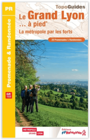
Wandelgids GR169 Le Grand Lyon à pied - FFR • 9782751414077
Le Grand Lyon à pied - FFRP Productomschrijving: Le Grand Lyon, un territoire vivant qui a su préserver un équilibre entre ville et nature. 12 000 hectares d'espaces naturels, allant des Monts d'Or aux monts du Lyonnais en passant par le Parc protégé de Miribel-Jonage. Le GR® 169, réalisable en 8 à 10 jours, fait le tour de la Métropole en passant par les forts du 19ème siècle par la …