

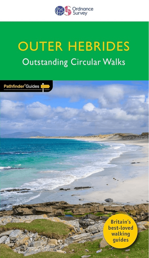
Wandelgids 085 Pathfinder guides Outer hebrides Schotland - OS
Butt of Lewis - Vatersay - Callanish Standing Stones
Korte omschrijving
Wandelgidsen Western Isles, Outer Hebrides en Outer Hibrids, Schotland van Ordnance Survey. Ideaal voor tochten in Schotland.
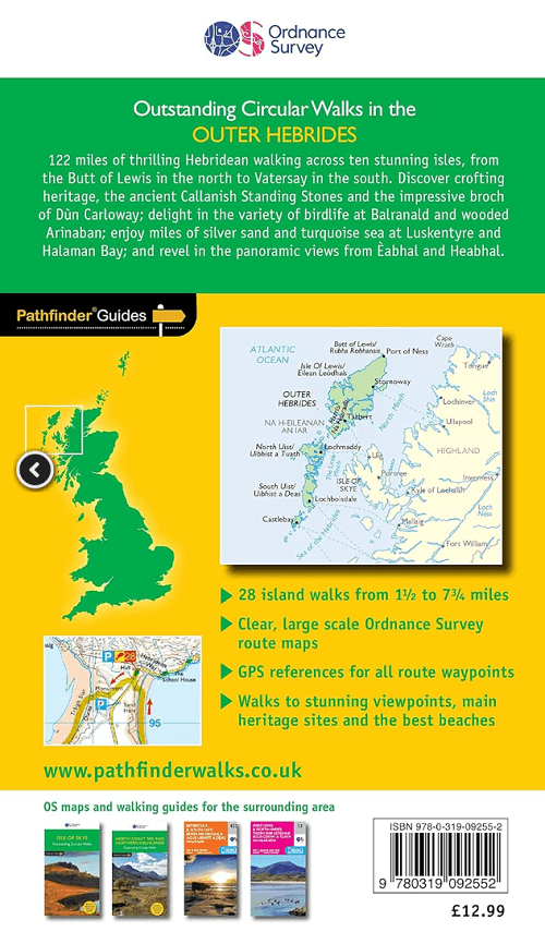
Wandelgids Outer hebrides Schotland - OS Productomschrijving: 122 miles of thrilling Hebridean walking across ten stunning isles, from the Butt of Lewis in the north to Vatersay in the sout...

Specificaties
- Uitgever: Ordnance Survey
- ISBN-13: 9780319092552
- HOOFDCATEGORIEËN: Wandelgids
- Activiteiten: Wandelen, Hiking & Trekking
- Auteur: Felicity Martin, Terry Marsch
- Regio: Outer Hibrids, Schotland, Western Isles, Outer Hebrides
- Land: Schotland
- Taal: Engels
- Reeks/Serie: Outstanding Circular Walks, Pathfinder Series, OS
- De beroemdste Eilandengroepen: Outer Hybrids (Schotland)
Volledige omschrijving
Wandelgids Outer hebrides Schotland - OS
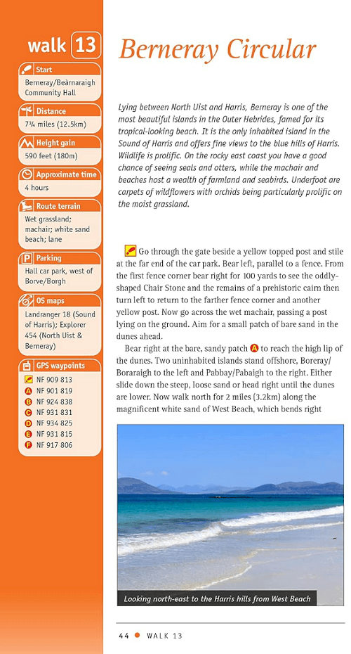
Productomschrijving: 122 miles of thrilling Hebridean walking across ten stunning isles, from the Butt of Lewis in the north to Vatersay in the south. Discover crafting heritage, the ancient Callanish Standing Stones and the impressive broch of Dùn Carloway; delight in the variety of birdlife at Balranald and wooded Arinaban; enjoy miles of silver sand and turquoise sea at Luskentyre and Halaman Bay; and revel in the panoramic views from Èabhal and Heabhal.
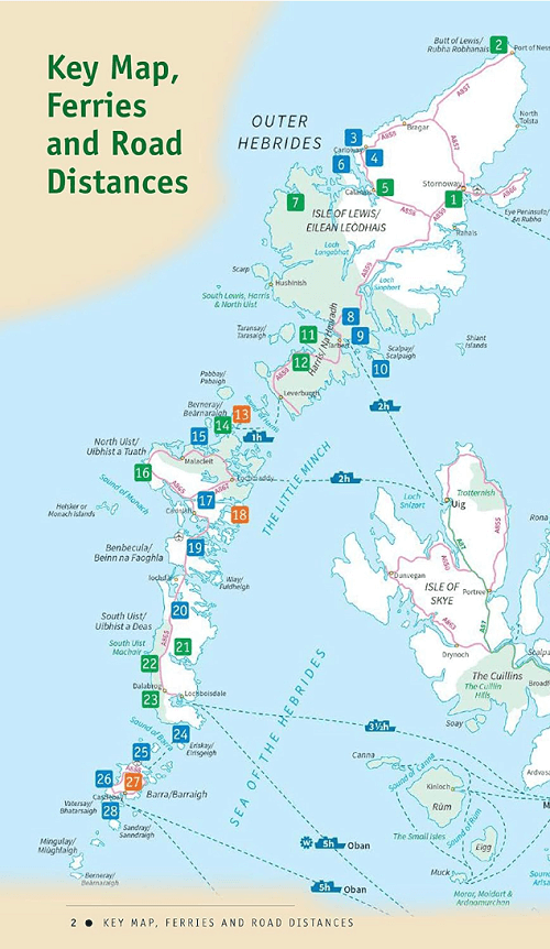
Walks are presented sequentially geographically, starting in Stornoway, heading up to the Butt of Lewis and then working southwards along the main touring route down the island chain. Walks are professionally authored and depicted with GPS waypoints, Ordnance Survey maps and beautiful photography.
OS Pathfinder Guides: Outstanding Circular Walks
- The definitive pocket book guide to Great Britain’s great outdoors
- 28 mostly circular walks in one guidebook, ranging from 3-12½ miles
- Walks are graded by length and difficulty ensuring a range of routes suitable for walkers of varying experience and mobility
- Includes OS Explorer 1:25 000 scale map extracts for every route (4cm to 1km or 2½ inches to one mile)
- Discover GPS waypoints, parking information and detailed route descriptions for foolproof navigation
- Enhances your walk with information on rare wildlife, natural habitats and points of historical interest
Artikelen uit dezelfde regio

Wandelkaart 8 Stornoway & North Lewis- Outer Hybrids - OSI • 9780319261064
Wandelkaart Stornoway & North Lewis - Schotland Productbeschrijving: OS Landranger Kaart 8 dekt Stornoway en Noord Lewis, en omvat ook Bac, Tunga, Arnol, Siadar, Beinn Dhail, Muirneag, Stacaiseal en port Nis. Steòrnabhagh is de grootste stad in de Buiten-Hebriden en de belangrijkste veerboot-haven, dus heeft het een goede locatie voor het verkennen van de eilanden. Top bezienswaardigehden …
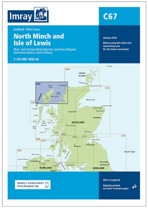
Passage kaart C67 North Minch en Lewis eiland, Outer Hybrids • 9781846239632
Passagekaart North Minch en Lewis eiland, Outer Hybrids Schotland Productomschrijving: Voor deze editie zijn magnetische variatiecurves toegevoegd. De kaart is volledig geactualiseerd.. (Freytag & Berndt) - 1:155.000 Kaart omvat: De westkust van Schotland van Rubha Reidh tot Cape Wrath, en het eiland Lewis, inclusief North Harris en een deel van South Harris. Rasterlijnen van één minuu…

Wandelgids The Hebrides - Cicerone • 9781852847050
Wandelgids - The Hebrides - Cicerone Productomschrijving: Inspirerende gids over 50 gevarieerde wandel- en trekkingsroutes in de Hebriden, met klassiekers zoals de Skye Cuillin en de Paps van de Jura, maar ook veel minderbekende routes zoals Jura, Scarba, Islay, Colonsay, Rum, Eigg, Canna, Muck, Coll, Tiree, Mull, Skye, Raasay, Harris, Lewis, Berneray, North Uist, South Uist, Barra en St K…

Wandelgids Hebridean Way long-distance walking route - Cicerone • 9781852847272
Wandelgids - Hebridean Way long-distance walking route - Cicerone Productomschrijving: Gelanceerd in 2017, biedt de Hebridean Way onze wandelaars de mogelijkheid om de magie van de Schotse Hebriden in een inspirerende reis ervaring te ontdekken. De bewegwijzerde route strekt zich uit voor 247km (155 mijl) van Sao naar Stornaway, en koppelt 10 van de belangrijkste eilanden van het archipel …

Wandelkaart 456 North Harris & Loch Seaforth Outer Hibrids - OSI • 9780319246993
Wandelkaart North Harris & Loch Seaforth - Outer Hibrids Schotland Productbeschrijving: OS Explorer kaart 456 toont North Harris (Na Hearadh), Scarp en Loch Seaforth op de Buiten-Hebriden. Het grootste deel van dit gebied is een nationale Scenic Area, met verspreide dorpen en aanzienlijke pieken. Er zijn enkel een paar wegen, en de meeste ervan zijn slechts een spoor, waardoor veel ruimte …