

Wandelgids 082 Pathfinder guides Orkney & Shetland Islands - OS
Hoxa Head - Scapa Flow - Hoy - Rousay & South Ronaldsay


Korte omschrijving
Wandelgidsen Orkney Islands en Shetland eilanden van Ordnance Survey. Ideaal voor tochten in Schotland.
Wandelgids Orkney & Shetland Islands - OS Productomschrijving: This new title to Orkney and Shetland presents the most northerly Pathfinder® Guide walks in our series: 28 outstanding walks ...

Specificaties
- Uitgever: Ordnance Survey
- ISBN-13: 9780319092088
- HOOFDCATEGORIEËN: Wandelgids
- Activiteiten: Wandelen, Hiking & Trekking
- Regio: Orkney Islands, Shetland eilanden
- Land: Schotland
- Taal: Engels
- Reeks/Serie: Outstanding Circular Walks, Pathfinder Series, OS
- De beroemdste Eilandengroepen: Orkney Islands (Schotland), Schetland Islands (Schotland)
Volledige omschrijving
Wandelgids Orkney & Shetland Islands - OS
Productomschrijving: This new title to Orkney and Shetland presents the most northerly Pathfinder® Guide walks in our series: 28 outstanding walks – 23 circular and five there-and-back routes visiting eleven islands across both archipelagos. The size and nature of the islands lend themselves best to short and half-day walks where unhurried and free-range walking is encouraged and the endless distractions of scenery, seabirds, wildflowers and sea watching are best appreciated and enjoyed at a relaxed pace.
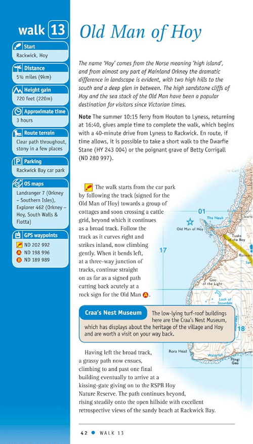
In Orkney, the first walk is a short stroll around Hoxa Head with its extensive views across Scapa Flow and subsequent routes go on to explore more widely over Mainland Orkney and take in the islands of Hoy, Rousay and South Ronaldsay, concluding with a ramble along the breathtaking clifftops of Yesnaby to enjoy the Yesnaby Castle and North Gaulton sea stacks, in addition to the fine 2,500-year-old Broch of Borwick.
Among the other walks on Orkney you are guided round the sights of Kirkwall, taken to prehistoric Mid Howe Chambered Cairn, lead across a tidal causeway to Birsay, and to a good whale watching point overlooking the Pentland Firth from Cantick Head.
In Shetland, the first walk sets out from Sandsayre jetty to the tiny island of Mousa, renowned for two outstanding marvels – a very distinctive Iron Age broch and an RSPB reserve of international importance for petrels and other seabirds. Walks range across Shetland from wild and remote Hermaness, on the far northern tip of Unst, down to Sumburgh Head, its most southerly point, where in addition to visiting the lighthouse, the itinerary also includes the historically fascinating multi-period settlement complex of Jarlshof. In between, you can walk on the extensive silver sands of Banna Minn and St Ninian’s Isle, enjoy cultural heritage in Lerwick and Scalloway, and experience the rich natural beauty and airy peacefulness of Fethaland and the Sands of Breckon.
28 outstanding walks across Orkney and Shetland: walks range from 1¾ to 6¾ miles with clear, large scale Ordnance Survey route maps, GPS waypoints, where to park, and places of interest en route. These all-new routes have been researched and written by expert outdoor writer Terry Marsh and showcase beautiful photography of scenes from the walks. Pathfinder® Guides are Britain’s best-loved walking guides. Printed with weather-resistant covers featuring durable rounded corners, they are the perfect companion for country walking throughout Britain.
With 80 titles in the series, and 2000 routes to choose from, a wealth of walks is available throughout England, Scotland and Wales from Land's End to Unst and the Lleyn Peninsula to Southwold..
Artikelen uit dezelfde regio

Wandelgids Orkney Islands Short Walks - Cicerone • 9781786311931
Orkney Islands Short Walks - Cicerone Productomschrijving: Graham Uney heeft 15 van de beste korte wandelingen op de Orkney-eilanden uitgekozen. Elke wandeling is voorzien van goed leesbare Ordnance Survey-kaarten, een duidelijke routebeschrijving en veel afbeeldingen, plus informatie over mooie plekjes en stops voor verfrissingen. Geen moeilijk terrein of ingewikkelde navigatie betekent d…

Wandelkaart 6 Orkney Islands Mainland - Schotland - OSI • 9780319261040
Wandelkaart Orkney Islands Mainland - Schotland Productbeschrijving: Het vasteland van Orkney word gedekt door OS Landranger kaart 6. De neolithische Skara Brae staat op de must-see lijst om te bezoeken, of u kunt een bezoek brengen aan de mysterieuze Ring van Brodgar stenen. De eilanden zijn een toevluchtsoord voor wilde dieren, dus het is ook een populair gebied voor het spotten van zeev…

Wandelgids Orkney & Shetland Isles walking guide - Cicerone • 9781786311825
Wandelgids Orkney & Shetland Isles - Cicerone Productomschrijving: Walking guidebook to 80 routes on the Orkney, Shetland and Fair Isles. Day walks include routes on Hoy, Rousay, Foula, Yell and Unst as well as the mainlands. Walks range from 1 to 16 miles and provide options for walkers of all abilities. Information on interesting sites, getting there and getting around the islands inclu…

Wandelkaart 2 Shetland- Sullom Voe & Whalsay - OSI • 9780319473252
Wandelkaart Shetland- Sullom Voe & Whalsay - Schotland Productbeschrijving: OS Landranger kaart 2 toont het Shetland vasteland, Whalsay, delen van Yell en Fetlar en de haven van Sullom Voe die door de olie-industrie worden gebruikt. Natuur en geschiedenis zijn de grootste trektpleister naar het gebied, met resten van menselijke bewoning die datteren uit het stenen tijdperk, gecombineerd me…
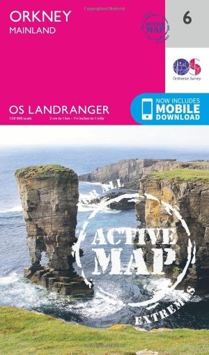
Wandelkaart 6 Orkney Islands Mainland - Schotland - OSI • 9780319473290
Wandelkaart Orkney Islands Mainland - Schotland Productbeschrijving: Het vasteland van Orkney wordt gedekt door OS Landranger kaart 6. De neolithische Skara Brae staat op de must-see lijst, of u kunt een bezoek brengen aan de mysterieuze Ring van Brodgar. De eilanden zijn een toevluchtsoord voor wilde dieren, dus het is ook een populair gebied voor het spotten van zeevogels, waaronder pape…