
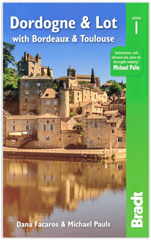
Reisgids Dordogne & Lot with Bordeaux & Toulouse - Bradt guides
Inclusief Bordeaux & Toulouse
Korte omschrijving
Reisgidsen Occitanië, Frankrijk van Bradt guides. Ideaal voor tochten in Frankrijk.
Reisgids Dordogne & Lot with Bordeaux & Toulouse - Bradt Productomschrijving: Bradt's Dordogne & Lot, met Bordeaux & Toulouse is de meest gedetailleerde gids voor de hele regio, met een dekk...

Specificaties
- Uitgever: Bradt guides
- ISBN-13: 9781784779009
- HOOFDCATEGORIEËN: Reisgids
- Activiteiten: Toerisme
- Regio: Occitanië, Frankrijk
- Land: Frankrijk
- Departement: Dordogne (24), Lot (46)
- Editie: 1
- Taal: Engels
- De Franse Regio's: Occitanië
Volledige omschrijving
Reisgids Dordogne & Lot with Bordeaux & Toulouse - Bradt
Productomschrijving: Bradt's Dordogne & Lot, met Bordeaux & Toulouse is de meest gedetailleerde gids voor de hele regio, met een dekking die de Lot-et-Garonne en Tarn-et-Garonne omvat, naast Dordogne, Lot en Bordeaux. Dana Facaros en Michael Pauls (auteurs van de oorspronkelijke Cadogan gids voor het gebied) hebben meer dan dertig jaar in de Lot-vallei gewoond en zijn de perfecte gidsen voor de landschappen, steden, eten, kunst, architectuur en, natuurlijk, de wijn van de regio: De 8.800 wijnchâteaux van Bordeaux produceren gemiddeld 650 miljoen flessen per jaar!
Engelse omschrijving: Bradt’s Dordogne & Lot, with Bordeaux & Toulouse is the most detailed guide to the entire region, with coverage that includes the Lot-et-Garonne and Tarn-et-Garonne in addition to Dordogne, Lot and Bordeaux. Dana Facaros and Michael Pauls (authors of the original Cadogan guide to the area) have lived in the Lot valley for over thirty years and are the perfect guides to the region’s landscapes, towns, food, art, architecture and, of course, wine: Bordeaux’s 8,800 wine châteaux produce on average 650 million bottles a year!
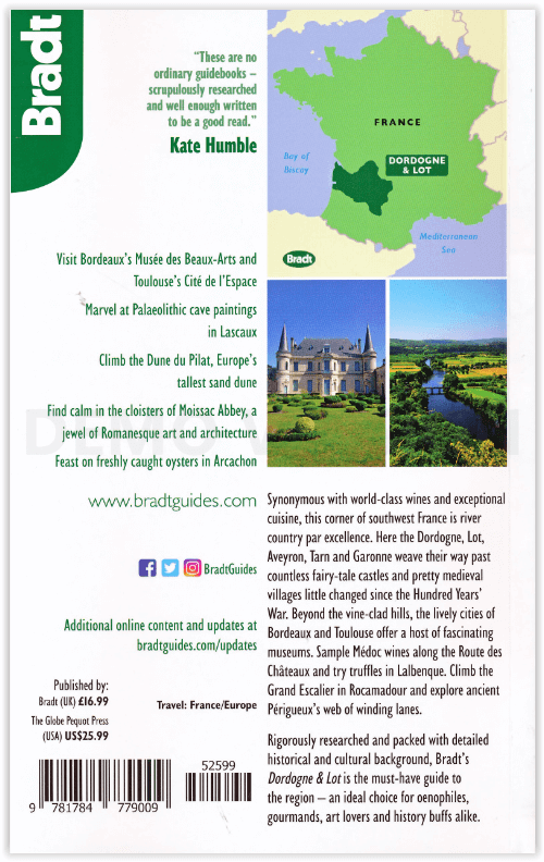
Their guide starts with Bordeaux, the capital of the Nouvelle-Aquitaine region as well as the world capital of wine, along with the départements of the Gironde, Dordogne, Lot, Lot-et-Garonne, and Tarn-et-Garonne in between. This is a land of great wines and stunning rivers, encompassing long sandy beaches along the Côte d’Argent (with Europe’s biggest sand dune on the south end), forests and rolling hills. Here, too, are the UNESCO-listed Prehistoric Sites and Decorated Caves of the Vézère Valley, and extraordinary Palaeolithic masterpieces (Lascaux, Font de Gaume and Pech Merche). History has been made here, evidenced in medieval castles and bastides, and beautiful old cities such as Sarlat, Périgueux, St-Emilion, Cahors and Figeac. Hundreds of unspoiled villages dot landscapes that are among the most idyllic in France, while Romanesque churches, including the great abbey at Moissac, are a feast for art lovers.
Outdoor activities are well covered, too, including cycling, sailing, surfing, canoeing, kayaking and walking the numerous Grand Randonnées (including three main routes of the Camino de Santiago) that pass through here, along with scores of other paths. And last but not least, the food is good: think truffles, oysters, duck, saffron, strawberries and melons, walnut groves and orchards. The weekly markets are gorgeous, and the summers are filled with wine, music and theatre festivals. All of this and more is covered by expert authors Dana Facaros and Michael Pauls in this new title from Bradt, offering all the information you need both prior to departure and while on the road.
Locatie op kaart
Artikelen uit dezelfde regio
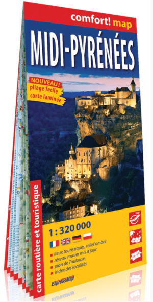
Landkaart Wegenkaart Midi-Pyrénées (Franstalig) - ExpressMap • 9788380460584
Wegenkaart Midi-Pyrénées (Franstalig) - ExpressMap Productomschrijving: ExpressMap is de uitgever van comfort! maps, geplastificeerde kaarten die eenvoudig te vouwen zijn, zelfs met één hand. Een uniek en innovatief product. Comfortabel, waterbestand, onverscheurbaar, comfort! maps blijven hun kwaliteit lang behouden. Duurzame kaarten, nuttig om een uitstap te plannen en handig voor onderw…

Fietsgids Canal des 2 mers de l'Atlantique é Méditerranée à vélo • 9782844666512
Canal des 2 mers de l'Atlantique é Méditerranée à vélo - Chamina Productomschrijving: Deze gids biedt een verbinding tussen de Atlantische Oceaan en de Middellandse Zee via groene wegen en fietsroutes. Deze nieuwe editie van het Canal des 2 mers à vélo is volledig bijgewerkt en bevat een nieuwe alternatieve route van Blaye naar Bordeaux, zonder gebruik te maken van de veerboot tussen Blaye…
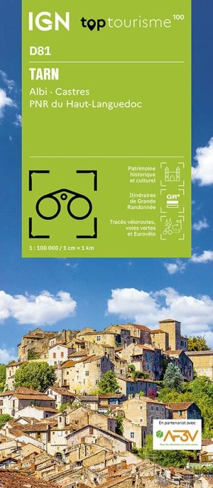
Wandelkaart Fietskaart TOP100 D81 Tarn - IGN • 9782758555667
Wandelkaart Tarn - IGN Productomschrijving: Een nieuwe reeks met een nieuwe departementale indeling. De reeks bevat fietsroutes in samenwerking met de vereniging AF3V - VéloRoutes et Voies Vertes. Dankzij de schaal van 1:100.000 (1 cm = 1 km) is de nieuwe TOP 100 de ideale kaart om een regio te voet, op de fiets of met de auto te ontdekken. De kaart bevat een breed scala aan toeristische i…

Wandelgids Ariège Couserans Vicdessos & Haute-Ariège - Rando • 9782344034750
Wandelgids Ariège - Couserans- Vicdessos & Haute-Ariège Productomschrijving: Een nieuwe editie van deze referentie-topogids om de bergen van de Ariège te ontdekken of te herontdekken. De bergen die even mooi zijn als veeleisend. De haut-Ariége is een wandelgebied niet voor de watjes onder ons, hiervoor heeft u kuiten met ballen nodig. Franse omschrijving: Une nouvelle édition de ce top…

Wandelgids Grands lacs autour Forêt d'Orient PNR à pied - Chamina • 9782844662262
Wandelgids Grands lacs autour Forêt d'Orient PNR à pied - Chamina Productomschrijving: Het grondgebied betreft: in het oosten van Troyes ligt in het departement van de Aube. De regio van de grote meren van de Champagne werd gevormd door een kalkachtige vlakte, geschikt voor de landbouw, een klei-vlakte, een gebied van meren en bossen, en van de côte des Bar, coteaux wijngaarden van de Cham…