
Reisgids D-Day Landings Normandie - Bradt
A Travel Guide to Normandy's Beaches and Battlegrounds
Korte omschrijving
Wandelgidsen Normandië, Frankrijk van Bradt guides. Ideaal voor tochten in Frankrijk.
D-Day Landings Normandie - Bradt Productomschrijving: D-Day Landings: a Travel Guide to Normandy's Beaches and Battlegrounds, uitgegeven ter ere van de 80e verjaardag van de militaire missie...

Specificaties
- Uitgever: Bradt guides
- ISBN-13: 9781804691700
- HOOFDCATEGORIEËN: Reisgids
- Activiteiten: Toerisme
- Auteur: Alastair McKenzie, Mary Anne Evans
- Regio: Normandië, Frankrijk
- Land: Frankrijk
- Editie: 1
- Taal: Engels
- De Franse Regio's: Normandië
Volledige omschrijving
D-Day Landings Normandie - Bradt
Productomschrijving: D-Day Landings: a Travel Guide to Normandy's Beaches and Battlegrounds, uitgegeven ter ere van de 80e verjaardag van de militaire missie die de Tweede Wereldoorlog veranderde, is Bradts nieuwe gids voor het bezoeken van stranden, gedenktekens, musea, slagvelden en andere sites die verband houden met D-Day en de Slag om Normandië (Operatie Overlord). Het is een eenvoudig te volgen, draagbare gids voor onafhankelijke reizigers en bevat kaarten en rij-instructies om bezoekers te helpen terug te gaan in de tijd en de geschiedenis van de Tweede Wereldoorlog te verkennen.
Engelse omschrijving: Published to commemorate the 80th anniversary of the military mission that changed World War II, D-Day Landings: a Travel Guide to Normandy’s Beaches and Battlegrounds is Bradt’s new guidebook to visiting beaches, memorials, museums, battlefields and other sites associated with D-Day and the Battle of Normandy (Operation Overlord). A simple-to-follow, portable guide for independent travellers, it includes maps and driving instructions to help visitors go back in time to explore World War II history.
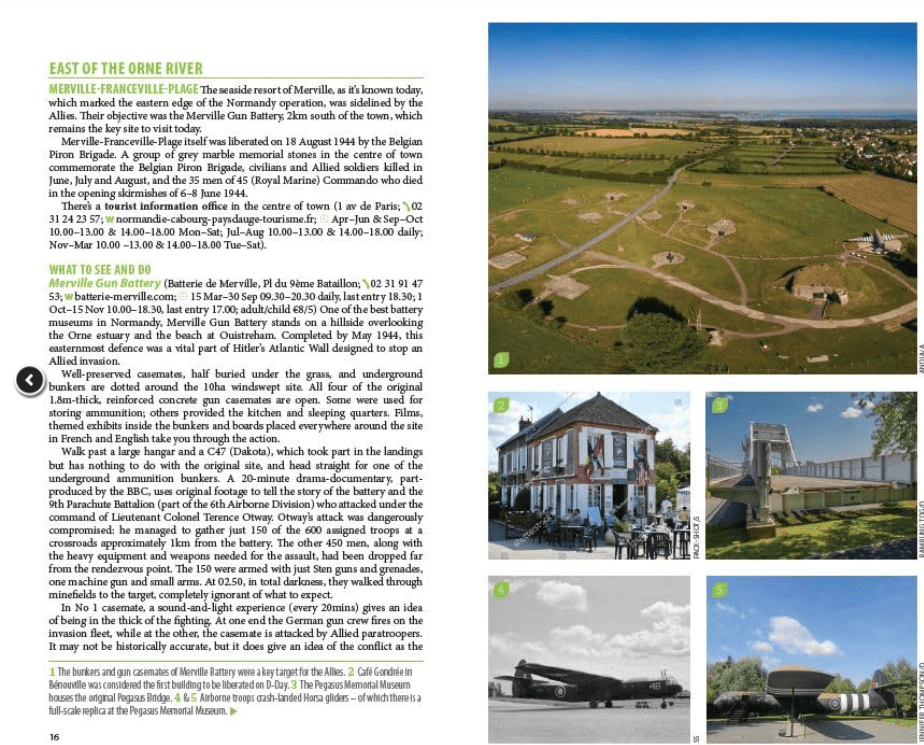
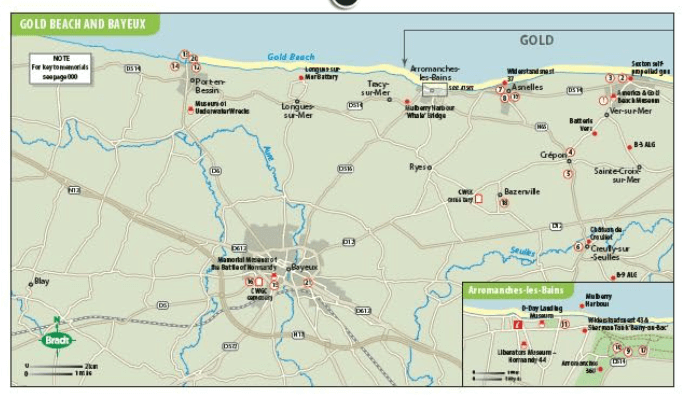
Written by two experienced travel writers who, between them, are experts in France and military history, D-Day Landings is designed for visitors who want to see all or part of Normandy. Covering the ground from the D-Day landing beaches (Sword, Juno, Gold, Omaha and Utah) up to the Falaise Gap and Cherbourg, it encompasses both every major site and a host of smaller, less well-known locations – venturing well beyond the coast to include sites associated with the capture of Cherbourg (D+20) and the closing of the Falaise Gap (D+76), which marked the end of the Overlord campaign.
Although organised geographically – as befits a travel guide rather than history book – a colour-coded system helps readers understand the historical context by identifying where sites fit into the timeline of the Battle of Normandy and escorting readers through the invasion in a simple, practical format. D-Day Landings aims to enhance the visitor experience by alerting readers to unexpected features such as a ‘concrete panzer’ pillbox topped by a tank turret around which Utah Beach Museum was constructed.
Quirky snippets and human stories colour the text. Learn how Lord Lovat’s Commando Piper Bill saw himself as a ballerina or how the Utah Beach landings were accidentally more successful than planned. Meanwhile, children and adults alike will love the ‘history-spotter’ tick-boxes, such as ten Advanced Landing Ground site plaques to tick off. Whether you are a military-history enthusiast, have family who fought in Normandy or are simply visiting northern France on holiday, Bradt’s D-Day Landings is the guidebook to both plan your trip and take with you.
Artikelen uit dezelfde regio

Wandelkaart 1612 OT Caen & Ouistreham - IGN • 9782758539117
TOPO Wandelkaart Caen & Ouistreham - IGN Productomschrijving: Caen is een stad in Frankrijk, de hoofdstad van de voormalige regio Basse-Normandie en van de prefectuur van het Franse Calvados en ligt 15 kilometer landinwaarts vanaf Het Kanaal. Caen is de eerste stad van de regio Basse-Normandie, ze is de tweede stad na Le Havre en het derde stedelijk gebied na Rouen en Le Havre Descript…
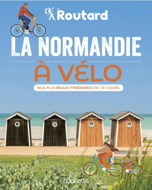
Fietsgids La Normandie à vélo - Le Routard • 9782017272700
La Normandie à vélo - Le Routard Productomschrijving: Le Routard vous invite à enfourcher votre vélo pour découvrir la Normandie autrement ! Suite au succès de son album La France à vélo, Le Routard s'attaque à présent aux routes normandes, toujours dans un format facile à transporter. Nous avons sélectionné pour vous plus de 20 itinéraires pour sillonner la Normandie en famille, entre…
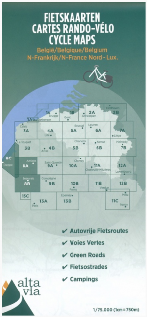
Fietskaart 8 Noord-Frankrijk Dieppe - ALTA VIA • 9789082714487
Fietskaart 8 - Noord-Frankrijk Dieppe Productomschrijving: Dieppe, gelegen aan de Normadische kaust, is een Franse stad, gelegen in het departement Seine-Maritime. Dieppe ligt aan de monding van de Arques in het Kanaal. Dieppe is de belangrijkste Franse stad voor het vissen op sint-jakobsschelpen. Het is ook een plezierhaven voor het anmeren van plezierjachten, en dan uiteraard tijdens de …

Wandelkaart 2008 OT Dieppe- Eu & Forêt d'Arques - IGN • 9782758555407
Wandelkaart Dieppe- Eu & Forêt d'Arques - IGN Productomschrijving: Dieppe Normandië en omliggend gebied zoals Eu & het bos van Forêt d'Arques. De TOP 25-serie is de cartografische referentie in Frankrijk: - Een nauwkeurige beschrijving van het grondgebied op een schaal van 1: 25.000 (1 cm = 250 m) - Gedetailleerde informatie voor de toeristische ontdekking en de praktijk van buiten…
Reisgids Normandie - Gallimard • 9782742466177
Reisgids Normandië - Gallimard Productomschrijving: Falaises d'Etretat, Mont-Saint-Michel, port de Honfleur, villas de la Côte Fleurie, abbayes romanes, maisons à colombages, vergers du pays d'Auge, distilleries de calvados, produits de la ferme, andouille, cidre et fromage, artisans du lin : suivez le guide ! Un concept unique: des cartes grand format dépliables par ville et par région; L…