

Reigids Southwestern USA - Lonely Planet
Las Vegas, Nevada, Arizona, Greater Phoenix, Grand Canyon Region


Korte omschrijving
Reisgidsen Verenigde staten van Amerika van Lonely Planet Publications. Ideaal voor tochten in Verenigde Staten van Amerika (USA).
Reigids Southwest USA - Lonely Planet Productomschrijving: The Southwest is America’s untamed playground, luring adventurous travelers with thrilling red-rock landscapes, the legends of shoo...

Specificaties
- Uitgever: Lonely Planet Publications
- ISBN-13: 9781837583799
- HOOFDCATEGORIEËN: Reisgids
- Activiteiten: Toerisme
- Auteur: Amy C Balfour, Ashley Harrel, Jade Bremner, Lauren Keith, Sarah Kezele
- Regio: Verenigde staten van Amerika
- Land: Verenigde Staten van Amerika (USA)
- Editie: 10
- Taal: Engels
Volledige omschrijving
Reigids Southwest USA - Lonely Planet
Productomschrijving: The Southwest is America’s untamed playground, luring adventurous travelers with thrilling red-rock landscapes, the legends of shoot-’em-up cowboys, and the kicky delights of green-chile stew. Lonely Planet will get you to the heart of Southwest USA, with amazing travel experiences and the best planning advice.
- Colour maps and images throughout.
- Highlights and itineraries help you tailor your trip to your personal needs and interests.
- Insider tips to save time and money and get around like a local, avoiding crowds and trouble spots.
- Essential info at your fingertips - hours of operation, phone numbers, websites, transit tips, prices.
- Honest reviews for all budgets - eating, sleeping, sight-seeing, going out, shopping.
- Cultural insights give you a richer, more rewarding travel experience - history, politics, lifestyle, Native Americans, culture, art.
- Over 61 color maps.
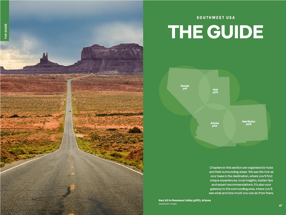
Coverage includes: Las Vegas, Nevada, Arizona, Greater Phoenix, Grand Canyon Region, Navajo Reservation, Taos, Las Vegas, New Mexico, Albuquerque, Santa Fe, Southwestern Colorado, Utah and more.

Artikelen uit dezelfde regio

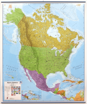
Plano Politiek & Antieke Wandkaart USA 111 x 77 cm - Nat Geo • 9780792233787
Wandkaart USA 111 x 77 cm - Nat Geo Productomschrijving: National Geographic's Executive reference map of the United States features all 50 States with insets for Alaska and Hawaii in antique-executive cartographic style. Each state is colored to clearly define borders and shaded relief accentuates geographical features. All major cities, transportation routes, state boundaries, National P…

Plano Politieke & decoratieve Wandkaart USA GROOT 176 x 122 cm • 9780792283195
Politieke & decoratieve Wandkaart USA GROOT 176 x 122 cm Productomschrijving: National Geographic's Decorator style map of the United States features rich, attractive color fills that bring any room or classroom to life. The map clearly highlights the differences in the urban and physical geography of each state, and national parks are outlined with eye-catching green vignettes. All 50 Sta…

Plano Politiek & Antieke Wandkaart USA 91 x 61 cm - Nat Geo • 9781597752213
Wandkaart USA 91 x 61 cm - Nat Geo Productomschrijving: National Geographic's Executive reference map of the United States features all 50 States with insets for Alaska and Hawaii in antique-executive cartographic style. Each state is colored to clearly define borders and shaded relief accentuates geographical features. All major cities, transportation routes, state boundaries, National Pa…

Landkaart Planing map USA - Lonely Planet • 9781787017887
Planning map USA - Lonely Planet Productomschrijving: Durable and waterproof, with a handy slipcase and an easy-fold format, Lonely Planet USA Planning Map is your conveniently-sized passport to traveling with ease. Get more from your map and your trip with images and information about top country attractions, itinerary suggestions, a transport guide, planning information, themed lists and…
Plano Politieke Wandkaart America 100 x 120 CM - Lovell Johns • 9781904892083
Plano politieke Wandkaart America - Lovell Johns Productomschrijving: Deze politieke kaart van Noord-Amerika toont het hele continent, van Alaska en Canada door de US naar Mexico, Centraal Amerika en de Caraïbische eilanden. Elk land heeft een andere kleur waardoor het eenvoudig is om internationale grenzen te zien. In de legende onderaan de kaart staan de vlaggen van elk land. Deze politi…