
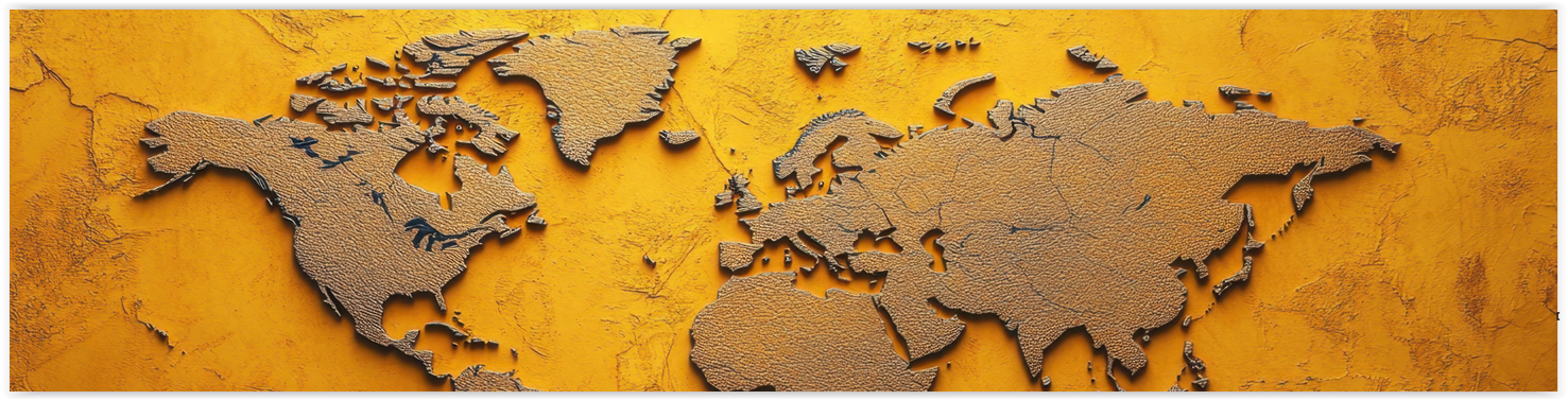
Plano Wandkaart Caribbean 91 x 61 cm - Nat Geo
Geplastificeerd


Korte omschrijving
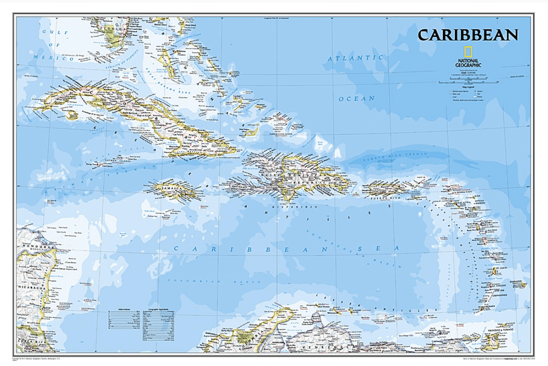
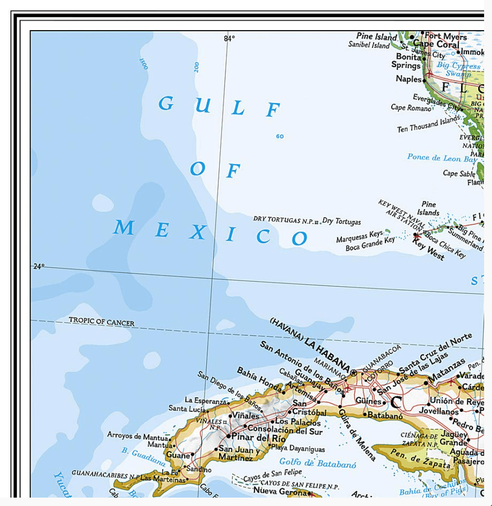
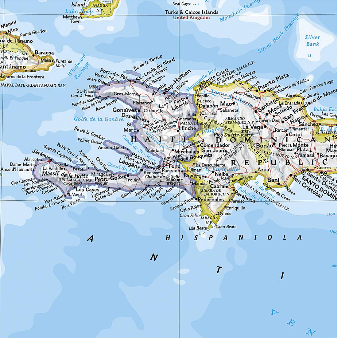
Wandkaart Caribbean 91 x 61 cm - Nat Geo Productomschrijving: One of the most authoritative maps for the islands of the Caribbean Sea. It shows the entire region in great detail, with covera...

Specificaties
- Uitgever: National Geographic
- ISBN-13: 9781597754415
- HOOFDCATEGORIEËN: Wandkaarten Planokaart/opgerold
- Activiteiten: Wandkaarten
- Regio: Caraïbische eilanden, Centraal Amerika
- Land: Caraïbische Eilanden
- Waterafstotende kaart: National Geographic, Geplastificeerd
- Schaal: 1:3293000
- Taal: Engels
- Reeks/Serie: Planokaart/opgerold
- Wandkaarten & Planokaarten: Wandkaarten & Planokaarten
Volledige omschrijving
Wandkaart Caribbean 91 x 61 cm - Nat Geo
Productomschrijving: One of the most authoritative maps for the islands of the Caribbean Sea. It shows the entire region in great detail, with coverage extending from the tip of Florida to the northern extents of Colombia and Venezuela, east to Barbados, and west to the eastern edge of Honduras, Costa Rica, and Nicaragua. Detailed bathymetry reveals the remarkable seafloor variation of the Caribbean including the Puerto Rico Trench, the deepest point in the Atlantic Ocean at 8,605 meters (28,232 feet).
Includes over 1,000 named places including country capitals, primary and secondary towns; political boundaries, important infrastructure, and all key landforms. Useful and informative notes about the region's history and unique geography are spread throughout the map, providing the reader further understanding of the Caribbean's unique attributes.
Afmeting: 91 x 61 cm
Artikelen uit dezelfde regio

Passage kaart B Martinique naar Trinidad - Imray (F&B) • 9781846238338
Passage kaart B Martinique naar Trinidad - Imray (F&B) Productomschrijving: Kleine Antillen - Martinique naar Trinidad + Venezuelaanse kust (Freytag & Berndt) - 1:750.000 Algemene zeekaart van de Kleine Antillen - Zeekaarten voor de overtocht van Martinique naar Trinidad. Vlakke kaart & waterbestendig papier. De Imray B-serie van Iolaire-kaarten bestrijkt de Caribische Bovenwindse Ei…

Landkaart Wegenkaart 138 Martinique - Michelin • 9782067224513
Wegenkaart Martinique - Michelin Productomschrijving: De MICHELIN Martinique zoomkaart is de ideale reisgenoot om deze populaire Franse bestemming volledig te ontdekken, dankzij het gebruiksvriendelijke formaat en de schaal van 1:150.000. De Zoom-collectie wordt gekenmerkt door de hoge nauwkeurigheid van de gedetailleerde schaal, speciaal aangepast voor gebieden met een hoog toeristisch o…

Passage kaart B311 Midden-Grenadines - Imray (F&B) • 9781846239847
Passagekaart Midden-Grenadines - Imray (F&B) Productomschrijving: Voor deze editie zijn magnetische variatiecurves toegevoegd. De kaart is volledig geactualiseerd.. (Freytag & Berndt) - 1:32.500 Kaart omvat: Canouan tot Carriacou De Imray Charts B-serie bestrijkt de Caribische Bovenwindse Eilanden van Martinique tot Tobago, inclusief Barbados biedt dekking van populaire gebieden op …

Guide Routard Guadeloupe 2026-27 - Le Routard • 9782017338185
Reisgids Guadeloupe - Le Routard Productomschrijving: S'offrir des plongées inoubliables autour de la Guadeloupe. Visiter les plantations de café. Randonner autour de la Soufrière. Partir à la découverte de la mangrove. Profiter des plages de Marie-Galante et de Saint-Barth. Passer une nuit aux Saintes, pour retrouver l'ambiance d'un village de pêcheurs. Profiter d'une journée de détente s…
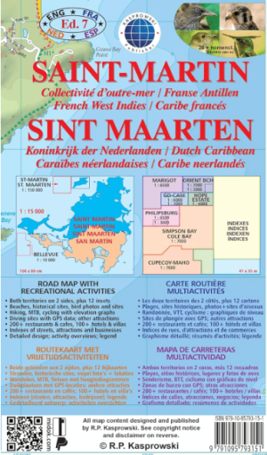
Landkaart Wegenkaart Saint-Martin of Sint Maarten - Kasprowski • 9791095793151
Saint-Martin Caraibische zee - Kasprowski Productomschrijving: De meest recente uitgave van de eerste en enige complete wegenkaart van het Frans-Nederlandse eiland Saint-Martin/Sint Maarten geeft alle bekende wegen en straten met hun namen weer; geeft wandelpaden, fietsroutes en duiklocaties aan; brengt restaurants en hotels in kaart; bevat onderverdelingen van de hoofdsteden Marigot en Ph…