

Plano Politiek & Antieke Wandkaart Europa 77 x 60 cm - Nat Geo
Geplastificeerd


Korte omschrijving
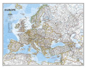
Wandkaart Europa 77 x 60 cm - Nat Geo Productomschrijving: The Executive political map of Europe is a striking example of the cartographic excellence National Geographic is known for. The an...

Specificaties
- Uitgever: National Geographic
- ISBN-13: 9780792289845
- HOOFDCATEGORIEËN: Wandkaarten Planokaart/opgerold
- Activiteiten: Plano Antiek & Politieke Wandkaart
- Regio: Europa
- Land: Europa
- Waterafstotende kaart: National Geographic, Geplastificeerd
- Schaal: 1:8400000
- Taal: Engels
- Reeks/Serie: Planokaart/opgerold
- Wandkaarten & Planokaarten: Wandkaarten & Planokaarten

Volledige omschrijving
Wandkaart Europa 77 x 60 cm - Nat Geo
Productomschrijving: The Executive political map of Europe is a striking example of the cartographic excellence National Geographic is known for. The antique color palette, shaded relief, and easy-to-read fonts make this map both beautiful and functional. International boundaries are clearly defined and thousands of place names, waterbodies, airports, major highways and roads, national parks and more are included.
Includes: Albania, Armenia, Austria, Azerbaijan, Belarus, Belgium, Bosnia & Herzegovina, Bulgaria, Croatia, Cyprus, Czech Republic, Denmark, Estonia, Finland, France, Georgia, Germany, Greece, Hungary, Iceland, Ireland, Italy, Kosovo, Latvia, Liechtenstein, Lithuania, Luxembourg, Macedonia, Moldova, Montenegro, The Netherlands, Norway, Poland, Portugal, Romania, Russia, Serbia, Slovakia, Slovenia, Spain, Sweden, Switzerland, Turkey, Ukraine, and the United Kingdom.
Afmeting: 77 x 60 cm
Artikelen uit dezelfde regio

Fietskaart L'Europe & la France vélo - Suzac Editions • 9782487211278
L'Europe & la France vélo - Suzac Editions Detail: L'intégrale des itinéraires cyclables de moyenne et longue distance à travers l'Europe, avec parcours repérés et légendés qui renseignent sur les principaux bourgs, villes et villages traversés. Un panorama complet de l'Europe à vélo: – Le réseau cyclable EuroVelo, regroupant 19 routes spécialement aménagées pour l'itinérance à vé…

Europa met de trein - 50 treinreizen - Kosmos • 9789043935906
Europa met de trein - Kosmos Productomschrijving: Kies je voor een culturele trip langs (hoofd)steden of voor een episch avontuur door bergketens? In deze inspirerende reisgids staan 50 schilderachtige treinroutes over de mooiste spoorlijnen van Europa. Dit boek is je ideale reiscompagnon voor een snelle, comfortabele en milieuvriendelijke vakantie. Het staat boordevol praktische infor…

Mooiste treinreizen - Kosmos UJitgeverijen • 9789043942256
Mooiste treinreizen - Kosmos Productomschrijving: Volledig herziene editie met 60 van de beste treinreizen ter wereld, van klassieke langeafstandsreizen tot onbekende pareltjes. Met 10 ongelofelijke nieuwe avonturen per trein waaronder Mr Henderson's Railway (Spanje), De Flamsbana (Noorwegen) en De Kusttram (België) Elke reis gaat vergezeld van praktische informatie, ticketopties, dien…

Reisgids Slow travel in Europa - Kosmos Uitgeverijen • 9789043938372
Slow travel in Europa - Kosmos Productomschrijving: Slow Travel in Europa van Marjolein Linstra neemt je mee op een unieke reiservaring waarbij het draait om onthaasten en het loslaten van de dagelijkse stress. Dit boek biedt tal van bestemmingen in Europa die perfect zijn voor wie wil genieten van een langzamer tempo. Of je nu te voet, op de fiets of met de trein reist, het gaat niet om h…

Plano Politieke Wandkaart Europa 77 x 60 cm - Nat Geo • 9780792250166
Wandkaart Europa 77 x 60 cm - Nat Geo Productomschrijving: National Geographic's Classic political map of Europe features clearly defined international boundaries, thousands of place names, waterbodies, airports, major highways and roads, national parks, and much more. The tasteful color palette, shaded relief, and coastal bathymetry make this map as attractive as it is functional. Inc…