

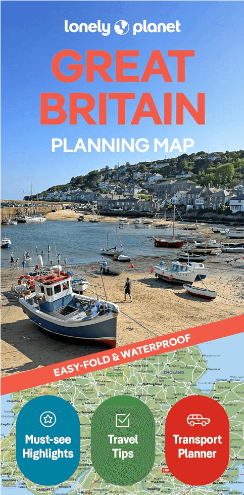
Landkaart Wegenkaart Planning map Great Britain - Lonely Planet
London- Canterbury- Cambridge- Oxford- Cotswolds...


Korte omschrijving
Wegenkaart & Planning map Great Britain - Lonely Planet Productomschrijving: Durable and waterproof, with a handy slipcase and an easy-fold format, Lonely Planet Great Britain Planning Map i...

Specificaties
- Uitgever: Lonely Planet Publications
- ISBN-13: 9781787015722
- HOOFDCATEGORIEËN: Wegenkaart - Landkaart
- Activiteiten: Street/Road maps & city plans
- Regio: United Kindom Great Britain
- Land: United Kingdom, Great Britain
- Editie: 2
- Taal: Engels
- Reeks/Serie: Lonely Planet Planning maps
Volledige omschrijving
Wegenkaart & Planning map Great Britain - Lonely Planet
Productomschrijving: Durable and waterproof, with a handy slipcase and an easy-fold format, Lonely Planet Great Britain Planning Map is your conveniently-sized passport to traveling with ease.
Get more from your map and your trip with images and information about top country attractions, itinerary suggestions, a transport guide, planning information, themed lists and practical travel tips. With this easy-to-use, full colour navigation tool in your back pocket, you can truly get to the heart of Great Britain, so begin your journey now!
Durable and waterproof
Easy-fold format and convenient size
Handy slipcase
Full colour and easy-to-use
Before-you-go info
Beautiful imagery
Tailored itineraries
Can’t-miss regional highlights
Detailed town index
Transport planner
Themed lists
Coverage Includes: London, Canterbury, Cambridge, Oxford, Cotswolds, Stratford-Upon-Avon, Stonehenge, Bath, Bristol, Cornwall, York, Lake District, Liverpool, Pembrokeshire, Cardiff, Brecon Beacons, Snowdonia, Edinburgh, Glasgow, Scottish Borders, Skye, Mull, Glen Coe, Northwest Highlands Coast, Scotland’s whisky distilleries
Full Map Dimensions: 63.5 cm x 49.5 cm (25 in. x 19.5 in.)
Artikelen uit dezelfde regio
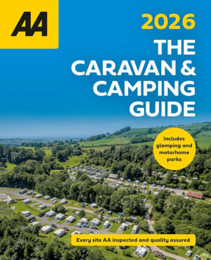
Campinggids Caravan & Camping Guide Britain 2026 - AA Publ. • 9780749584474
Caravan & Camping Guide Britain 2026 - AA Productomschrijving: De AA Caravan & Camping Guide 2026 bundelt meer dan 550 gecontroleerde kampeerterreinen verspreid over het Verenigd Koninkrijk. De gids richt zich op reizigers met een tent, caravan of camper, maar neemt ook glampinglocaties en vakantieparken op. Elk terrein werd bezocht en beoordeeld door professionele inspecteurs van de AA. …
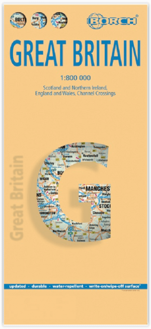
Landkaart Groot-Brittannië - Borch • 9783866093157
Wandelkaart Landkaart Groot-Brittannië - Borch Productomschrijving: Our soft-laminated folded map of Great Britain in the 13th edition shows: Scotland and Northern Ireland 1:800 000, England and Wales 1:800 000, Channel Crossings 1:800 000, Great Britain and Ireland administrative, Europe time zones. Borch Maps are easy to fold, durable and water-repellent with a wipeable surface. Borch Ma…