

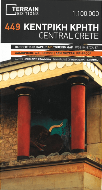
Landkaart Wegenkaart Fietskaart 449 Kreta Centraal - Terrein Maps
Kreta Centraal
Korte omschrijving
Wegenkaart Fietskaart Kreta Centraal - Terrein Maps Productomschrijving: Terrain’s map of Central Crete provides travelers with everything they need: Scale of 100.000, which attributes ...

Specificaties
- Uitgever: Terrain Editions
- ISBN-13: 9789609456678
- HOOFDCATEGORIEËN: Fietskaart, Wegenkaart - Landkaart
- Activiteiten: Street/Road maps & city plans
- Regio: Kreta Griekenland
- Land: Griekenland
- Schaal: 1:100000
- Taal: Engels
- De Griekse Eilanden: Kreta
Volledige omschrijving
Wegenkaart Fietskaart Kreta Centraal - Terrein Maps
Productomschrijving: Terrain’s map of Central Crete provides travelers with everything they need:
Scale of 100.000, which attributes all the information with clarity and in detail.
Map data processed within a GIS environment, resulting in great accuracy.
Double coordinate system, WGS 84 and GS 87, completely compatible with GPS.
It is printed on Polyart material, making it totally waterproof and rip-proof. You can fold it and unfold it a hundred times, fold it in irregular ways, dunk it in the sea or leave it out in the rain. This map is indestructible! Clear symbols, easily readable fonts, rich colors and excellent arrangement of every element make the map extremely friendly to the user.
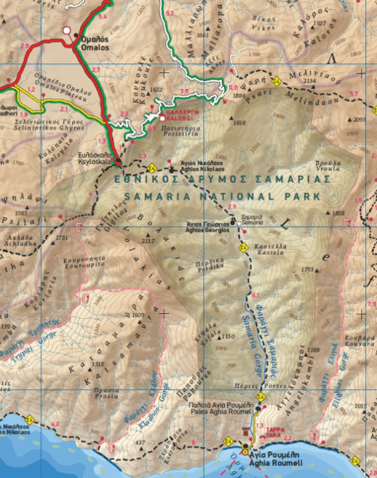
Unique wealth of information. Every village, every road (including their distance in km), every sight, every beach, every gas station, the camping areas and much more, are all included in the map. The most important trails of the area are marked in the map, with clear lines, in two categories (main and secondary trails), including their exact distance in km, as well as the mountain refuges. For the first time in a map of Crete, the bolted canyoning routes and the climbing crags of the area are included. Moreover, suggested scenic routes are marked with a green shadow on the map. Also, a full index of the place names and the archaeological sites is included, as well as a detailed townplan of Heraklion in the scale of 1:4.500
Locatie op kaart
Artikelen uit dezelfde regio

Guide Routard Crète 2026-27 + randonnées - Le Routard • 9782017356820
Reisgids Crète + randonnées - Hachette Toerisme Productomschrijving: Partez en Crète découvrir la civilisation minoenne à Knossos ou à Phaitos, flâner autour des ports vénitiens de Hania et de Réthymon, randonner dans la vallée des morts vers Kato Zakros ou simplement bronzer sur une des innombrables plages de cette île sauvage. Dans Le Routard Crète, mis à jour par nos spécialistes, v…
Reisgids Crete Kreta Greece - Rough Guides • 9781835296370
Reisgids Crete - Rough Guides Productomschrijving: The Rough Guide to Crete is the most in-depth and reliable guide to one of Europe’s most beautiful islands. With thorough coverage of everything from big sights such as the Samariá Gorge and Knossós to tiny mountain hamlets and idyllic, unspoilt coves, The Rough Guide to Crete will ensure you make the most of your time on the island. Whet…

Landkaart Wegenkaart Fietskaart 450 Kreta Oost - Terrein Maps • 9789609456661
Wegenkaart Fietskaart Kreta Oost - Terrein Maps Productomschrijving: Scale of 100.000, which attributes all the information with clarity and impressive detail. Clear symbols, readable fonts and excellent map composition make the map extremely user friendly. Unique wealth of information. The complete road network, all villages, monuments and tourist attractions, all beaches, camping sites,…

Wandelkaart 402 KRETA Griekenland - Road Editions • 9789604489503
Wandelkaart KRETA Griekenland - Road Editions Productomschrijving: Een algemene, gedetailleerde topografische wandelkaart van het eiland Kreta. De kaart omvat alle nodige wandel informatie met verblijfplaatsen. Een algemene zeer geschikte kaart voor alle wat u op een eiland zou kunnen doen! Omvat: Lefka Ori, Samaria, Sfakia, Rethymno & Plakias

Reisgids Crete - Lonely Planet • 9781837583201
Travelguide Crete - Lonely Planet Productomschrijving: Crete is a tapestry of splendid beaches, ancient treasures, and landscapes encompassing vibrant cities and dreamy villages, where locals share their traditions, cuisine and generous spirit. Covers: Hania, Iraklio, Rethymno, Lasithi, Knossos, Vai, Elounda, Agia Nikolaos, Agia Marina, Hersonisos, Platanias, Vamos, Almyrida, Ierapetr…