

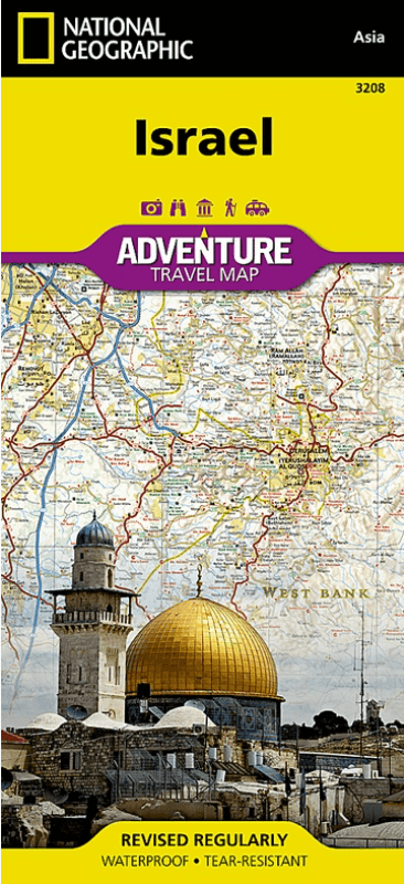
Landkaart Wegenkaart 3208 Israel - Nat Geo
Jerusalem- Tel-Aviv- Haifa- Galilee- Nazareth- Golan Heights


Korte omschrijving
Wegenkaart Israel - Nat Geo Productomschrijving: National Geographic's Israel Adventure Map is the perfect travel companion for Holy Land adventure travelers. This expertly researched map d...

Specificaties
- Uitgever: National Geographic
- ISBN-13: 9781566956178
- HOOFDCATEGORIEËN: Wegenkaart - Landkaart
- Activiteiten: Street/Road maps & city plans
- Auteur: National Geographic
- Regio: Midden-Oosten
- Land: Israël
- Waterafstotende kaart: Nat Geo waterproof series
- TOPO's & Stafkaarten: Topografisch wandelen
- Schaal: 1:275000
- Taal: Engels
- Reeks/Serie: NAT GEO Adventure travel maps
Volledige omschrijving
Wegenkaart Israel - Nat Geo
Productomschrijving: National Geographic's Israel Adventure Map is the perfect travel companion for Holy Land adventure travelers. This expertly researched map details the country with unparalleled information not found in traditional road maps. Hundreds of diverse and unique recreational, ecological, cultural, and historic destinations are pinpointed, including many hidden gems, such as Islamic and Jewish sacred sites, churches, mosques, archeological site, beaches, hotels, hostels, airports and harbors.
A clearly marked network of both primary and secondary roads, shown with distances, along with an index of cities and towns will guide you on your adventure, while mapped hiking trails, including The Israel Trail, will help you get off the beaten path.
This comprehensive map covers Israel in its entirety and complements any guidebook to the region. Also shown are Palestinian areas in the West Bank and Gaza Strip and bordering areas in Jordan, Syria and Lebanon. The country's three most populated cities Jerusalem, Tel-Aviv and Haifa can be found on the map's northern side, along with the Sea of Galilee (Kinneret), Nazareth, the Golan Heights and most of the Dead Sea. The map's southern side covers the cities of Be'ersheva, Hebron, Bethlehem and Eilat along with the Gaza Strip, Dead Sea, the ancient fortification of Masada and the Jordanian city of Aqaba.
Every Adventure Map is printed on durable synthetic paper, making them waterproof, tear-resistant and tough — capable of withstanding the rigors of international travel.
Artikelen uit dezelfde regio
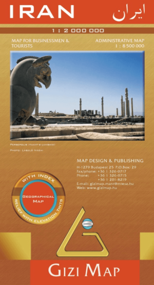
Landkaart Geografische Wegenkaart Iran - GiziMaps • 9789638703026
Geografische Wegenkaart Iran - Gizi Productomschrijving: Iran op een geïndexeerde kaart op 1:2.000.000 van Gizi Map met duidelijke hoogtekleuren om de topografie weer te geven, provinciale grenzen en een extra inzet tonen de administratieve verdeling in provincies, weg- en spoorwegnetwerken, interessante plaatsen, enz. De dekking strekt zich uit naar het westen, inclusief Oost-Irak me…

Landkaart Geografische Wegenkaart Rode Zee - Red Sea - GiziMaps • 9789638746580
Geografische Wegenkaart omgeving Rode Zee - Gizi Productomschrijving: De omgveing van de Rode Zee op schaal 1:2.000.000, met lijsten van duiklocaties en wrakken langs de kust, een uitbreiding van het zuiden van de Sinaï en de kustwateren, plus plattegronden van Sharm el Sheikh en Hurghada met toeristische informatie. De kaart strekt zich uit van Port Said en het Suezkanaal voorbij de…
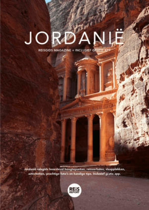
Jordanië Reisgids magazine 2026 - Reisreport • 9789083510125
Jordanië Reisgids magazine - Reisreport Productomschrijving: Jordanië reisgids boordevol hoogtepunten, reisverhalen, slaapplekken, activiteiten, prachtige foto’s en handige tips. Inclusief gratis app.
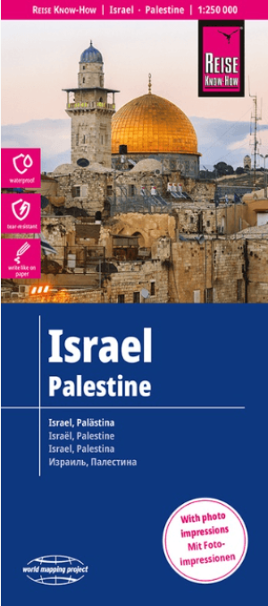
Landkaart Wegenkaart Israël & Palestina - Reise Know-How • 9783831772681
Wegenkaart Israël & Palestina - Reise Know-How Productomschrijving: Reis Know-How-kaarten (wereldkaart-projectreeks) zijn gemakkelijk te lezen, waterdichte en zeer duurzame reiskaarten die speciaal zijn ontworpen voor dagelijks gebruik op de weg. Onze kaarten combineren state-of-the-art, GPS-compatibele cartografie (inclusief hypsometrische tinten en contourlijnen) met een gedetailleerde …

Reisgids Dubai V.A.E - Rough Guides • 9781835290460
Reisgids Dubai - Rough Guides Productomschrijving: The Rough Guide to Dubai is the ultimate travel guide to one of the world’s most exciting cities. Discover Dubai’s highlights with stunning photography, colour-coded maps, handpicked listings and in-depth coverage of all the attractions. You’ll find detailed practical advice on what to see and do – from going up the world’s tallest buildin…