

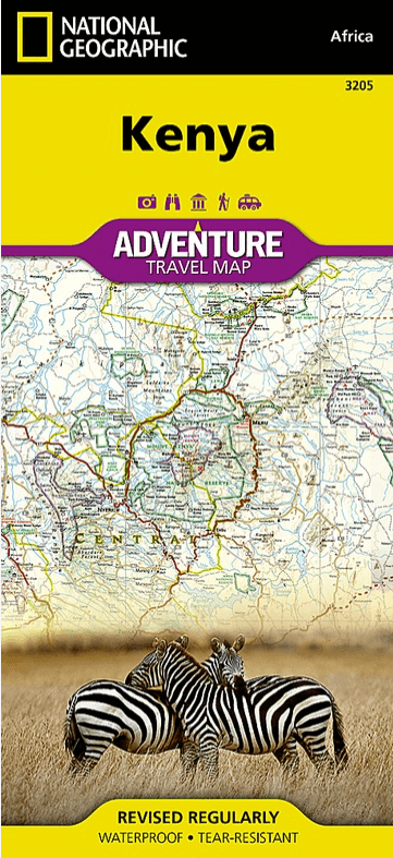
Landkaart Wegenkaart 3205 Kenia - Nat Geo
National parks- World Heritage sites- forts- Archeological sites
Korte omschrijving
Wegenkaart Kenia - Nat Geo Productomschrijving: Explore the diverse and iconic landscapes and many unique recreation activities available in this exciting country with National Geographic's...

Specificaties
- Uitgever: National Geographic
- ISBN-13: 9781566956185
- HOOFDCATEGORIEËN: Wegenkaart - Landkaart
- Activiteiten: Street/Road maps & city plans
- Auteur: National Geographic
- Regio: Kenia, Afrika
- Land: Kenia
- Waterafstotende kaart: Nat Geo waterproof series
- TOPO's & Stafkaarten: Topografisch wandelen
- Schaal: 1:1040000
- Taal: Engels
- Reeks/Serie: NAT GEO Adventure travel maps
Volledige omschrijving
Wegenkaart Kenia - Nat Geo
Productomschrijving: Explore the diverse and iconic landscapes and many unique recreation activities available in this exciting country with National Geographic's Kenya Adventure Map. Designed to meet the needs of adventure travelers with its detailed, accurate information, this map includes the location of cities and towns with a user-friendly index and a clearly marked road network complete with distances and designations for expressways and roads. Scenic routes, four-wheel-drive tracks, and other trails are shown for those seeking to explore more remote regions. National parks, World Heritage sites, forts, archeological sites, campsites, hot springs, beaches, diving areas, and more are clearly indicated so travelers can take advantage of Kenya's many natural and historical attractions.
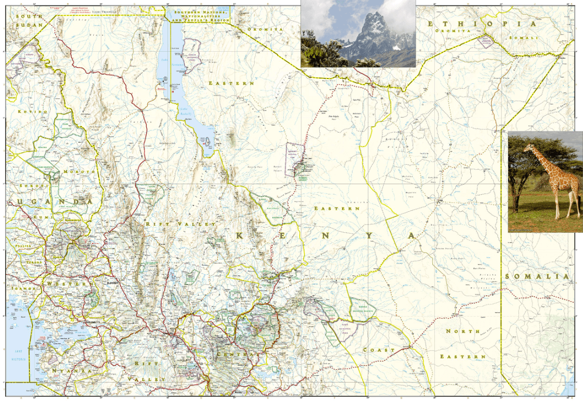
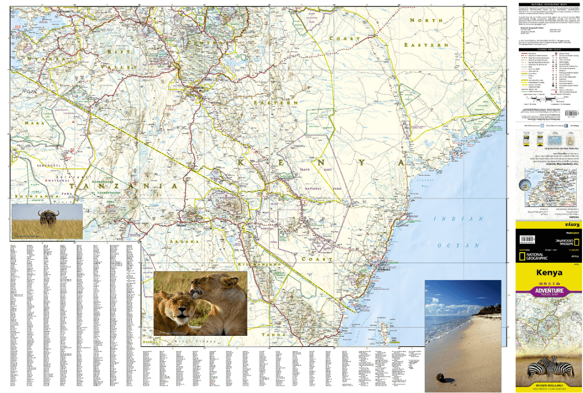
The front side of the Kenya print map details the southern region of the country, from The Indian Ocean to the east, to the bordering country of Tanzania to the southwest. The reverse side of the map details the northern region, showing the bordering country of Ethiopia to the north, Somalia to the east, and Uganda to the west. Travel aids such as the locations of airports, airfields, railways, petrol stations, park entrances, and border crossings take the guesswork out of travel around the country.
Every Adventure Map is printed on durable synthetic paper, making them waterproof, tear-resistant and tough — capable of withstanding the rigors of international travel.
Artikelen uit dezelfde regio
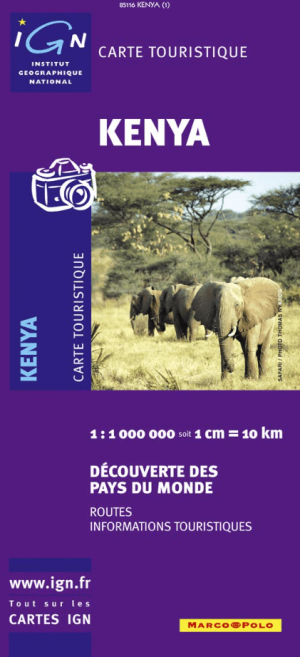
Landkaart Wegenkaart 85116 Kenia Afrika - IGN • 9782758501626
Wegenkaart Kenia Afrika - IGN Productomschrijving: Deze wegenkaart omvat het volledige Kenia op schaal 1:1.000.000 (1 cm = 10 km), hij bevat alle touristische wegen als ook Nationale parken. De kaart behoort tot de reeks van de Pays, Découverte du Monde van IGN

Reisgids Kenya 2025-2026 - Petit Futé • 9782305116938
Reisgids Kenya - Petit Futé Productomschrijving: Les deux grands pôles d'attraction du Kenya sont sa côte et ses réserves naturelles. Les grandes réserves du Sud, le Kilimandjaro, la vallée du Rift, les sites préhistoriques de Kariandusi et de Hyrax Hill. Le grand ouest, le mont Elgon Sawa Samp. La forêt de Kakamega, le lac Victoria, les plantations de thé de Kericho, les Aberdares, le mon…