

Landkaart Wegenkaart 3116 Jamaica - Nat Geo
Kingston- Blue Mountains- John Crow National Park- Morant Point
Korte omschrijving
Wegenkaart Jamaica - Nat Geo Productomschrijving: National Geographic's Jamaica Adventure Map is designed to meet the needs of adventure travelers with its detailed and accurate information...

Specificaties
- Uitgever: National Geographic
- ISBN-13: 9781597756181
- HOOFDCATEGORIEËN: Wegenkaart - Landkaart
- Activiteiten: Street/Road maps & city plans
- Auteur: National Geographic
- Regio: Jamaica
- Land: Jamaica
- Waterafstotende kaart: Nat Geo waterproof series
- TOPO's & Stafkaarten: Topografisch wandelen
- Schaal: 1:150000
- Taal: Engels
- Reeks/Serie: NAT GEO Adventure travel maps
- De Caraïbische eilanden: Jamaica, Caraïben
Volledige omschrijving
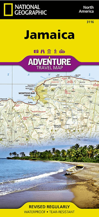
Wegenkaart Jamaica - Nat Geo
Productomschrijving: National Geographic's Jamaica Adventure Map is designed to meet the needs of adventure travelers with its detailed and accurate information. This map includes the locations of cities and towns with a user-friendly index, a clearly marked road network complete with distances and designations for roads/highways, plus secondary routes for those seeking to explore off the beaten path. Adventure Maps differ from a traditional road map because of the specialty content they include.
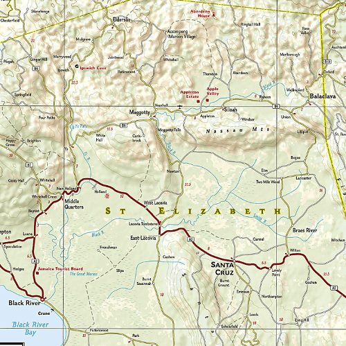
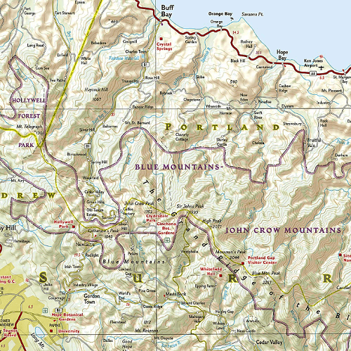
Each map contains hundreds of diverse and unique recreational, ecological, cultural, and historic destinations — outside of the major tourist hubs. National Geographic Adventure Maps are the perfect companion to a guidebook.
The Jamaica Adventure Map covers the entire island nation in one easy to use map. The east side of the map includes the capital city of Kingston, Blue Mountains - John Crow National Park as well as Morant Point on the eastern edge of Jamaica. The west side of the map includes the famous tourist destinations of Montego Bay and Negril with its miles of uninterrupted white-sand beaches. The map also shows the many offshore reefs that ring this Caribbean nation.
Every Adventure Map is printed on durable synthetic paper, making them waterproof, tear-resistant and tough — capable of withstanding the rigors of international travel.
Key Features:
- Waterproof and tear-resistant
- Detailed interpretive information and local travel tips
- Detailed topography complete with activity symbols, ideal for exploring the country
- City overview maps
- Hundreds of points of interest, including the location of World Heritage sites, national parks and nature reserves, aboriginal settlements.
- Thousands of place names
- Important travel aids including airports, lighthouses, ferry routes and rail lines
- Developed in cooperation with local agencies
- Updated regularly to ensure accuracy
Artikelen uit dezelfde regio
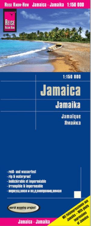
Landkaart Wegenkaart Jamaica - Reise Know-How • 9783831774098
Wegenkaart Jamaica - Reise Know-How Productomschrijving: Reis Know-How-kaarten (wereldkaart-projectreeks) zijn gemakkelijk te lezen, waterdichte en zeer duurzame reiskaarten die speciaal zijn ontworpen voor dagelijks gebruik op de weg. Onze kaarten combineren state-of-the-art, GPS-compatibele cartografie (inclusief hypsometrische tinten en contourlijnen) met een gedetailleerde weergave va…
Reisgids Jamaica - Elmar • 9789038927046
Reisgids Jamaica Productomschrijving: Er zijn mensen die naar Jamaica gaan om lekker te genieten van de eindeloze stranden en de schijnbaar altijd aanwezige zon. Dat is een prettige bijkomstigheid in dit prachtige land. Een rondreis vooraf laat je kennis maken met heel andere aspecten van het land. Van harte aanbevolen! In een week tijd kun je, zonder je te haasten, veel zien van het natuu…