

Landkaart Wegenkaart 3112 Cuba - Nat Geo
Havana- Vianles National Park- Varadero Beach- Cayo Largo
Korte omschrijving
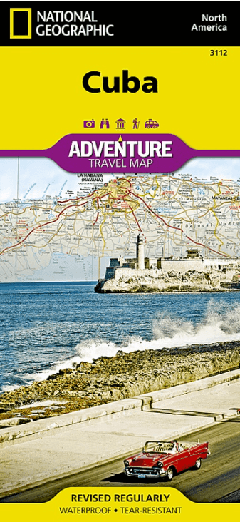
Wegenkaart Cuba - Nat Geo Productomschrijving: National Geographic's Cuba Adventure Map is designed with the detail and accurate information that is needed by adventure travelers to this Ca...

Specificaties
- Uitgever: National Geographic
- ISBN-13: 9781566956529
- HOOFDCATEGORIEËN: Wegenkaart - Landkaart
- Activiteiten: Street/Road maps & city plans
- Auteur: National Geographic
- Regio: Caraïbische eilanden, Centraal Amerika
- Land: Cuba
- Waterafstotende kaart: Nat Geo waterproof series
- TOPO's & Stafkaarten: Topografisch wandelen
- Schaal: 1:750000
- Taal: Engels
- Reeks/Serie: NAT GEO Adventure travel maps
- De Caraïbische eilanden: Cuba, Caraïben
Volledige omschrijving
Wegenkaart Cuba - Nat Geo
Productomschrijving: National Geographic's Cuba Adventure Map is designed with the detail and accurate information that is needed by adventure travelers to this Caribbean island nation. With its abundance of specialized content, not available in traditional road maps, this adventure map is the ideal compliment to any guide book. Included is a user-friendly index of cities and towns, a clearly marked road network and hundreds of diverse and unique points of interest.
The mapped road network shows expressways and major routes, complete with distance markers, as well as secondary roads for those looking to travel off the beaten path. Additional transportation features included pinpointed airports, airfields, harbors, marinas and seaports along with railroads and ferry routes.
Mapped recreational, ecological, cultural, and historic destinations points of interest include UNESCO World Heritage Sites, caves, churches, forts, ruins, monasteries, coral reefs, spas, beaches, swamps, mangroves and areas for diving, fishing and camping. Protected areas, such as national parks, are clearly shown with their boundaries. The map's west half includes the capital of Havana, Vianles National Park, Varadero Beach and the islands of Cayo Largo and Isla de la Juventud. The eastern half displays the cities of Santa Clara and Trinidad, Topes de Collantes and Alejandro de Humboldt National Parks and some of the southeastern islands of the Bahamas.
Every Adventure Map is printed on durable synthetic paper, making them waterproof, tear-resistant and tough — capable of withstanding the rigors of international travel.
Key Features:
- Waterproof and tear-resistant
- Detailed interpretive information and local travel tips
- Detailed topography complete with activity symbols, ideal for exploring the country
- City overview maps
- Hundreds of points of interest, including the location of World Heritage sites, national parks and nature reserves, aboriginal settlements.
- Thousands of place names
- Important travel aids including airports, lighthouses, ferry routes and rail lines
- Developed in cooperation with local agencies
- Updated regularly to ensure accuracy
Artikelen uit dezelfde regio
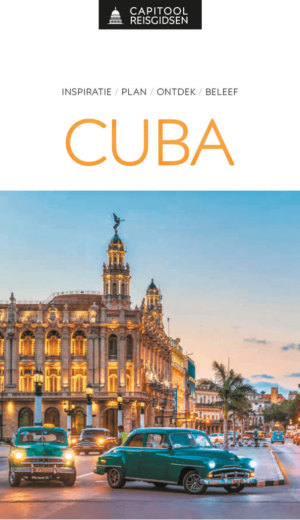
Reisgids Cuba Caraïbische eilanden - Capitool reisgidsen • 9789000396351
Reisgids Cuba - Capitool Productomschrijving: Cuba is een fascinerend land. De prachtige Cubaanse palmstranden, zoals bij Varadero en Cayo Largo, genieten wereldfaam. De levendige, kleurrijke hoofdstad Havana staat vol historische gebouwen en interessante musea. Trinidad staat bekend om zijn koloniale architectuur. Ook de rest van het eiland zit vol met aangename verrassingen; indrukw…

Reisgids Cuba 2025 - Petit Futé • 9782305114712
Reisgids Cuba - Petit Futé Productomschrijving: Dotée de près de 4 000 km de côtes, Cuba offre une quantité impressionnante de belles plages aux eaux cristallines. Amis plongeurs, à vos bouteilles, l'île offre en effet de superbes sites dignes des meilleurs spots comme Maria la Gorda, l'isla de la Juventud et la baie des cochons (playa Larga, playa Girón). Cuba est à l'image du métissa…

Reisgids Cuba - Mini Rough Guide • 9781835290446
Reisgids Cuba - Rough Guide Productomschrijving: This mini pocket Cuba travel guidebook is perfect for travellers seeking basic information about Cuba. It covers key places, main attractions and a short hotel and restaurant recommendations list. This book is printed on paper from responsible sources, verified to meet FSC's strict environmental and social standards. Covers: Havana, Pina…
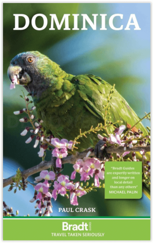
Reisgids Dominica - Bradt guides • 9781804691021
Reisgids Dominica - Bradt guides Engelse omschrijving: Packed with the extensive, detailed local knowledge of author Paul Clack, a long-term resident, Bradt’s Dominica remains the only up-to-date standalone guide to this Caribbean island. In this new, thoroughly updated fourth edition, a range of accommodation and dining options are described in depth, guide and tour-operator listings are …
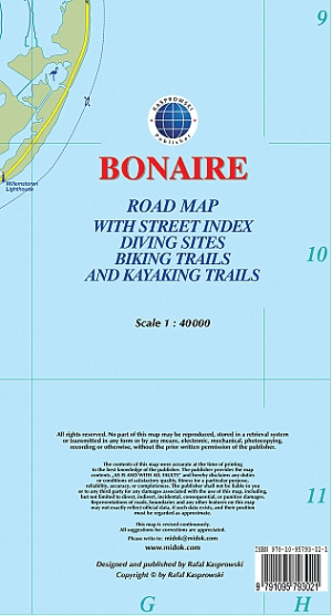
Landkaart Wegenkaart Bonaire Nederlandse Antillen - Kasprowski • 9791095793021
Bonaire Nederlandse Antillen - Kasprowski Productomschrijving: De meest up-to-date en enige complete wegenkaart van Bonaire (Schaal 1 : 40 000), evenals het stedelijk gebied van Kralendijk, vanaf Santa Barbara Crowns, via het vliegveld, tot Punt Vierkant (Schaal 1 : 15 000). Een inzet van Rincon (Schaal 1 : 12 000) is ook inbegrepen. Alle kaarten en inzetstukken zijn voorzien van een grond…