

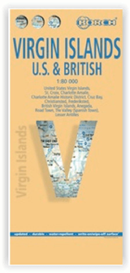
Landkaart Maagden-Eilanden - Borch
Charlotte Amelie - St Thomas - St Croix
Korte omschrijving
Wandelkaarten Verenigde staten van Amerika van Borch GmbH. Ideaal voor tochten in Virgin Islands (USA), Maagdeneilanden en Caraïbische Eilanden.
Landkaart Maagden-Eilanden - Borch Productomschrijving: Our soft-laminated map of the Virgin Islands in the 5th edition includes: US Virgin Islands 1:80 000, St. Croix 1:80 000, Charlotte Am...
Specificaties
- Uitgever: Borch GmbH
- ISBN-13: 9783866095175
- HOOFDCATEGORIEËN: Wandelkaart, Wegenkaart - Landkaart
- Activiteiten: Wandelen, Hiking & Trekking
- Regio: Verenigde staten van Amerika
- Land: Caraïbische Eilanden, Maagdeneilanden, Virgin Islands (USA)
- Schaal: 1:80000
- Editie: 5
- Taal: Duits, Engels, Frans, Itailaans, Spaans
Volledige omschrijving
Landkaart Maagden-Eilanden - Borch
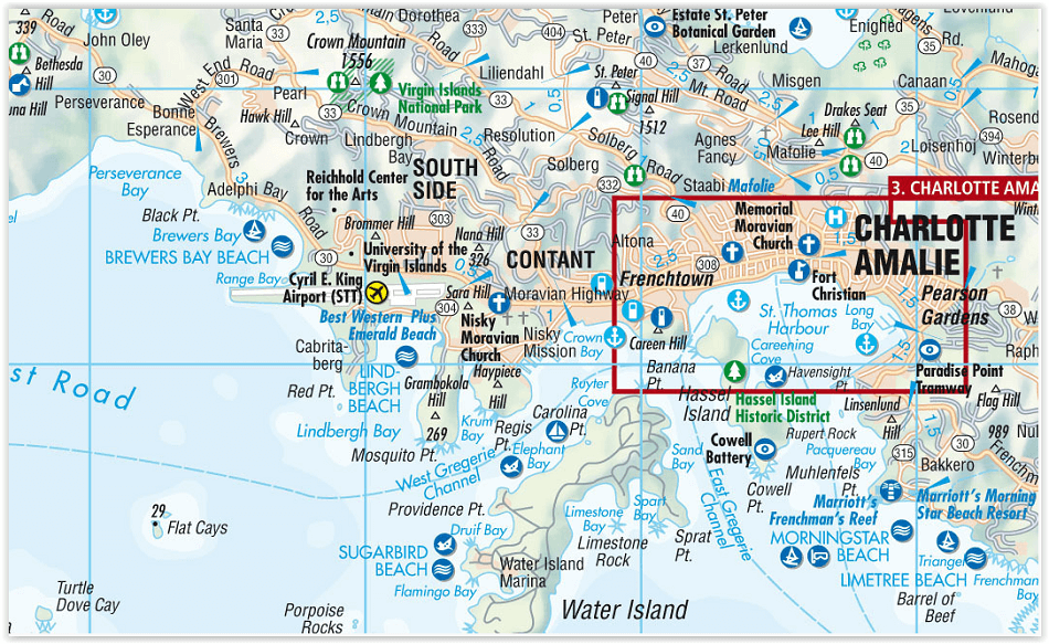
Productomschrijving: Our soft-laminated map of the Virgin Islands in the 5th edition includes: US Virgin Islands 1:80 000, St. Croix 1:80 000, Charlotte Amalie 1:15 000, Charlotte Amalie Historic District 1:7 500, Cruz Bay 1:15 000, Christiansted, Frederiksted 1:15 000, British Virgin Islands 1:80 000, Anegada 1:80 000, Road Town, The Valley (Spanish Town) 1:15 000, Lesser Antilles 1:7 000 000, Virgin Islands administrative / time zones interesting statistics British / US Virgin Islands: conversion chart for temperatures, weights and measures; climate chart with temperatures, sunshine hours, precipitation and humidity; hotels, museums, markets and much more.
Virgin Islands is the name of two groups of small islands east of Puerto Rico which form the Virgin Islands archipelago. They lie between the Caribbean Sea and the Atlantic Ocean. One of the groups which consists of St. Croix, St. John and St. Thomas islands, together with many nearby islets, is called the U.S. Virgin Islands. The other group including Anegada, Jost van Dyke, Tortola, and Virgin Gorda islands, with their own surrounding islets, is known as the British Virgin Islands. The Virgin Islands are rugged and hilly, with little level land.
They enjoy a delightful tropical climate the year round. Trade winds blow over the islands most of the year and there are no extremes of heat or cold. Hurricanes, however, may strike occasionally between July and November. Tropical flowers and trees flourish throughout the islands and the seas abound with fish. The excellent climate, the attractive beaches and the beautiful scenery make these islands a paradise worth visiting!
Artikelen uit dezelfde regio

Plano Politieke & decoratieve Wandkaart USA GROOT 176 x 122 cm • 9780792283195
Politieke & decoratieve Wandkaart USA GROOT 176 x 122 cm Productomschrijving: National Geographic's Decorator style map of the United States features rich, attractive color fills that bring any room or classroom to life. The map clearly highlights the differences in the urban and physical geography of each state, and national parks are outlined with eye-catching green vignettes. All 50 Sta…

Landkaart Planing map USA - Lonely Planet • 9781787017887
Planning map USA - Lonely Planet Productomschrijving: Durable and waterproof, with a handy slipcase and an easy-fold format, Lonely Planet USA Planning Map is your conveniently-sized passport to traveling with ease. Get more from your map and your trip with images and information about top country attractions, itinerary suggestions, a transport guide, planning information, themed lists and…
Plano Politieke Wandkaart America 100 x 120 CM - Lovell Johns • 9781904892083
Plano politieke Wandkaart America - Lovell Johns Productomschrijving: Deze politieke kaart van Noord-Amerika toont het hele continent, van Alaska en Canada door de US naar Mexico, Centraal Amerika en de Caraïbische eilanden. Elk land heeft een andere kleur waardoor het eenvoudig is om internationale grenzen te zien. In de legende onderaan de kaart staan de vlaggen van elk land. Deze politi…

Reisgids Midwestern USA - Lonely Planet • 9781837588176
Travelguide Midwestern USA - Lonely Planet Productomschrijving: Lonely Planet's local travel experts reveal all you need to know to plan the trip of a lifetime in this latest edition of our guide to Midwest USA. Discover Midwest USA's most popular experiences and best kept secrets from heading to Sugarcreek, the 'Little Switzerland of Ohio', to see the World's Largest Cuckoo Clock, to taki…

Plano Wandkaart Nationale Parken USA 107 x 76 cm - Nat Geo • 9781597754248
Wandkaart Nationale Parken USA 107 x 76 cm - Nat Geo Productomschrijving: National Geographic's wall map of National Parks of the United States highlights the nearly 400 magnificent parks across America. The country is represented in subtle earth-tones with shaded mountain relief and intricately drawn river systems. Photos capture some of the diverse landscapes preserved and protected by t…