

Wegenatlas Road Atlas Britain 2025 - AA Publishing
TOP selling roadatlas for 2025


Korte omschrijving
Road Atlas Britain 2025 - AA Publishing Productomschrijving: This top-selling road atlas showcases Britain’s clearest mapping from the experts at the AA. Each page has been titled with its ...

Specificaties
- Uitgever: AA Publishing
- ISBN-13: 9780749584009
- HOOFDCATEGORIEËN: Wegenatlas, Wegenkaart - Landkaart
- Activiteiten: WegenAtlas
- Regio: Engeland, Schotland, Wales
- Land: England, Schotland, United Kingdom, Great Britain, Wales
- Schaal: 1:633000
- Taal: Engels
- Reeks/Serie: Wegenatlassen
Volledige omschrijving
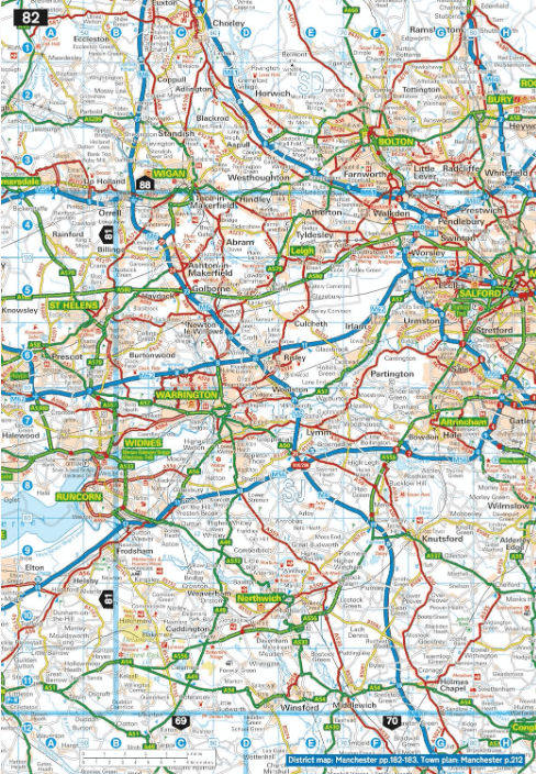
Road Atlas Britain 2025 - AA Publishing
Productomschrijving: This top-selling road atlas showcases Britain’s clearest mapping from the experts at the AA. Each page has been titled with its geographical location so you can turn to the page you need more easily. Wide and narrow minor roads, National Trust, English and World Heritage sites and hard-to-find places are shown. There are 112 city, town, port and airport plans, full colour country, unitary and administrative area map and a comprehensive 31,500 entry index with airports, top tourist sites and motorway services listed.
Plus, scenic routes, golf courses and caravan and camping sites symbolised on the mapping. Motorway maps, ferry planning information and 5 district maps provide the essential motoring content for travelling the country.
Artikelen uit dezelfde regio
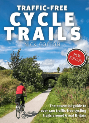
Traffic-Free Cycle Trails around Great Britain - Vertebrate Publ. • 9781912560769
Traffic-Free Cycle Trails around Great Britain - Vertebrate Productomschrijving: The essential guide to over 400 traffic-free cycling trails around Great Britain Traffic-Free Cycle Trails by Nick Cotton contains over 400 cycle routes in Great Britain. This book includes a great variety of routes on former railway paths, canal towpaths and forest trails in England, Scotland and Wales, w…
Wegenatlas Britain & Ireland road atlas A5-formaat - Collins • 9780008719227
Wegenatlas Britain & Ireland road atlas - Collins Productomschrijving: This easy-to-use, handy A5 sized road atlas with popular lie-flat spiral binding features extremely clear route planning maps of Britain and Ireland and fits neatly into your glove box or bag. The atlas has been fully updated. The maps of Britain are at 9.9 miles to 1 inch (1:625,000) and the whole of Ireland is co…

Reisgids Angleterre Pays de Galles sans Londres - Le Routard • 9782017338024
Reisgids Angleterre Pays de Galles sans Londres - Le Routard Oriductomschrijving: Une présentation de ces deux régions du Royaume-Uni avec des informations générales, des renseignements pratiques, des circuits touristiques, des descriptions de sites et un choix d'adresses pour se restaurer, se loger ou se divertir. Sans Londres - Engeland - Wales
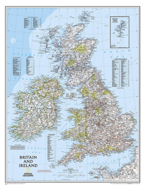
Plano Wandkaart Groot-Brittannië & Ierland 60 x 76 cm - Nat Geo • 9780792250234
Wandkaart Groot-Brittannië & Ierland 60 x 76 cm - Nat Geo Productomschrijving: National Geographic's Classic political map of Britain and Ireland is both an attractive addition to any study or classroom and an informative tool for exploring these fascinating countries. The map features thousands of place names, major highways and roads, airports, ferry routes, bodies of water, and more. Ha…

Fietsgids Great British Gravel Rides - Vertebrate Publ. • 9781839811265
Great British Gravel Rides - Vertebrate Productomschrijving: Cycling the wild trails of England, Scotland & Wales Great British Gravel Rides by Markus Stitz is a collection of 25 routes – each is a favourite of a passionate gravel cyclist – exploring the very best gravel cycling across England, Wales and Scotland. Illustrated with stunning action photography and overview mapping; downl…