

Reisgids Western Australia - Bradt guides
137 gebieden - Nationale parken en lange uitgestrekte routes


Korte omschrijving
Western Australia - Bradt Productomschrijving: Bradt's Western Australia is de eerste gids gericht op de lange landwegen, inspirerende nationale parken en wijngaarden van wereldklasse van Au...

Specificaties
- Uitgever: Bradt guides
- ISBN-13: 9781784777531
- HOOFDCATEGORIEËN: Reisgids
- Activiteiten: Toerisme
- Auteur:: Scott Dareff
- Regio: Western Australia
- Land: Australië
- Editie: 1
- Taal: Engels
Volledige omschrijving
Western Australia - Bradt
Productomschrijving: Bradt's Western Australia is de eerste gids gericht op de lange landwegen, inspirerende nationale parken en wijngaarden van wereldklasse van Australië's grootste staat. Inwoner Scott Dareff heeft de afgelopen vijf jaar bijna alle 137 administratieve gebieden van de staat bezocht, waardoor hij een buitengewoon inzicht in en kennis van een van 's werelds grootste wildernissen heeft gekregen. Reizigers associëren West-Australië vaak met Perth", zegt hij. Maar Perth is slechts de uitvalsbasis voor reizen naar deze spectaculaire staat.
Veel van de magie van West-Australië ontstaat wanneer je je buiten de hoofdstad begeeft. Ningaloo Reef is net zo verbazingwekkend als het Great Barrier Reef, maar toegankelijker. Je kunt gewoon vanaf het strand het water inlopen en je bevindt je tussen de riffen. Het Burrup Peninsula heeft rotskunst van 50.000 jaar oud, terwijl Margaret River een van de beste wijngebieden ter wereld is en de nabijgelegen Karri Forests een van de hoogste boomsoorten ter wereld bevatten.
Engelse omschrijving: Bradt’s Western Australia is the first guidebook focused on the long country roads, inspirational national parks and world-class vineyards of Australia’s largest state. Local resident Scott Dareff has visited almost all of the state’s 137 administrative areas in the past five years, giving him an extraordinary insight into, and knowledge of, one of the world’s great wildernesses. ‘Travellers often associate Western Australia with Perth’ he says. ‘But Perth is just the staging ground for travel to this spectacular state. Much of the magic of Western Australia comes when you venture beyond its capital city. Ningaloo Reef is every bit as astounding as the Great Barrier Reef, but more accessible. . . you can just walk off the beach into the water, and you’re in among its reefs. The Burrup Peninsula has rock art that is 50,000 years old, while Margaret River is one of the world’s finest wine regions and the nearby Karri Forests contain one of the tallest species of tree in the world.’
Bradt’s Western Australia capitalises on the area’s geography to help travellers create the ultimate Road Trips in spectacular remote locations, without having to rough it or give up air conditioning, ensuite accommodation or restaurant meals. What’s more, this is the first major guidebook to stray from the coast to provide in-depth coverage of the West Australian interior. For travellers looking for a unique experience, and ‘something different’, this book makes the Outback accessible and affordable, busting the myth once and for all that a trip to Western Australia requires a four wheel drive, a month off work, and deep pockets.
Locatie op kaart
Artikelen uit dezelfde regio
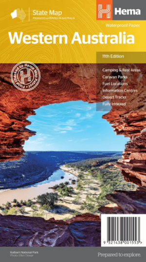
Landkaart Wegenkaart West-Australië state map - Hema Maps • 9321438001553
Wegenkaart West-Australië state map - Hema Productomschrijving: A map of Western Australia (WA) for touring throughout the state that has camping and rest areas, 24-hour fuel and points of interest marked on the mapping. On the reverse are CBD and through road maps of Perth in addition to inset maps of Leeuwin-Naturaliste National Park, Cape Range National Park, Nambung National Park, …
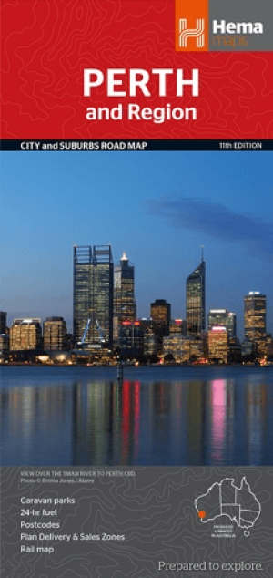
Stadskaart plattegrond Perth & omgeving - Hema Maps • 9781925195163
Stadskaart Perth & omgeving - Hema Productomschrijving: Perth CBD, City & Suburbs Map A map that has the Perth suburbs (1:80,000) and Perth city (1:15,000) maps on one side and the Perth region (1:750,000) and Fremantle (1:20,000) maps on the other. Included is a rail network map of Perth as well as points of interest and accommodation for both Fremantle and Perth. Perth is one of …

Kampinggids Perth & The South West 4WD + Camping escapes - Hema • 9781865006215
Wegenatlas Kampinggids Perth & The South West Productomschrijving: 4WD + Camping Escapes – Perth & the South West is a guide to the best four-wheel driving and camping locations in South West Western Australia. Each regional section outlines the area’s 4WD Tracks and Featured Camping Areas, with a Camping Directory at the end to provide comprehensive coverage of other camping areas. T…
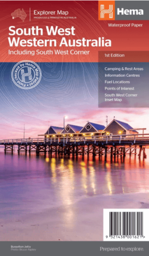
Landkaart Wegenkaart West & Zuidwest-Australië NP's - Hema • 9321438001621
Landkaart West & Zuidwest-Australië - Hema Productomschrijving: A regional map for discovering South West & Western Australia (WA). On the reverse side of the map are detailed inset maps of Nambung National Park, Avon Valley National Park, Lane Poole Reservation, the South West Corner, Stirling Range National Park, D'Entrecastreaux National Park and Albany Coast. Also included is tourist …

Landkaart Wegenkaart Western Australia state handy map - Hema • 9321438001560
Wegenkaart Western Australia state handy map - Hema Productomschrijving: A compact map of Western Australia (WA) for touring throughout the state with a distance grid and index for planning and reference. Marked on the mapping are highways, major and minor roads, camping and rest areas, 24-hour fuel, information centres, picnic areas, caravan parks and lookouts.