

Landkaart Wegenkaart 3 Schotland Zuid & Northumberland - OSI
Southern Scotland- Northumberland in the North of England


Korte omschrijving
Wegenkaart Schotland Zuid & Northumberland - OSI Productomschrijving: Plan your journey with this series of road maps from OS. Showing all major road, rail and ferry links as well as settle...

Specificaties
- Uitgever: Ordnance Survey
- ISBN-13: 9780319263754
- HOOFDCATEGORIEËN: Wegenkaart - Landkaart
- Activiteiten: Street/Road maps & city plans
- Regio: Northumberland, Engeland, Zuid Schotland
- Land: England, Schotland
- Schaal: 1:250000
- Taal: Engels
- Reeks/Serie: OSI Regional UK Roadmaps 1:250.000
- De Nationale Parken: Northumberland National Park, England
- De Engelse Graafschappen: Northumberland
Volledige omschrijving
Wegenkaart Schotland Zuid & Northumberland - OSI
Productomschrijving: Plan your journey with this series of road maps from OS. Showing all major road, rail and ferry links as well as settlements and selected features in 1: 250 000 scale, this is the ideal map for planning trips and holidays by car or cycle.
OS Road 3 covers: Southern Scotland plus Northumberland in the North of England.

Overzichtskaarten
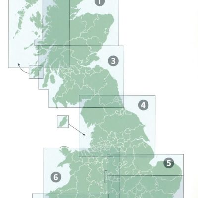
OSI Roadmaps UK 1 > 8 - 1:250.000
OSI Roadmaps UK 1 > 8 - 1:250.000

Producten op de overzichtskaart
Klik op een product om naar de detailpagina te gaan.
- Landkaart Wegenkaart 1 Schotland Noord - OSI
- Landkaart Wegenkaart 2 Schotland West & Western Isles - OSI
- Landkaart Wegenkaart 3 Schotland Zuid & Northumberland - OSI
- Landkaart Wegenkaart 4 Engeland Noord - OSI
- Landkaart Wegenkaart 5 Midlands Oost & East Anglia - OSI
- Landkaart Wegenkaart 6 Wales & Midlands West - OSI
- Landkaart Wegenkaart 7 Zuidwest Engeland & Zuid Wales - OSI
- Landkaart Wegenkaart 8 Zuidoost Engeland - OSI
Artikelen uit dezelfde regio
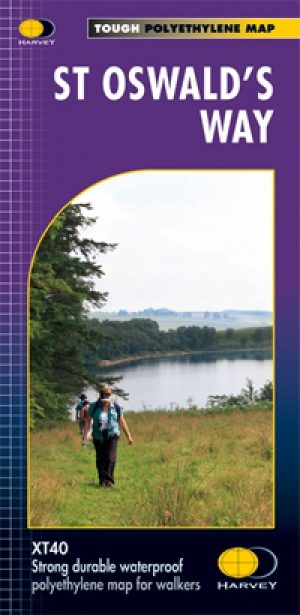
Wandelkaart St-Oswald's Way - Harvey maps • 9781851375233
Wandelkaart St-Oswald's Way - Harvey maps Productomschrijving: Van Holy Island naar Heavenfield, verbindt de 97 mijl lange St. Oswald's way enkele van de plaatsen die zijn gekoppeld aan St Oswald, die de koning van Northumbria in de vroege 7e eeuw was. De route loopt via het natuurpark van Northumbria langs de prachtige kust van Northumberland en loopt in het binnenland door via het platte…

Wandelgids Hadrian's wall Path - Knife Edge • 9781912933075
Wandelgids - Hadrian's wall Path - Knife Edge Productomschrijving: De definitieve tweerichtingsgids voor het Hadrian's Wall Path: zowel oostwaartse als westelijke routes worden volledig beschreven. 14 verschillende routes: schema's van 3, 4, 5, 6, 7, 8 en 9 dagen voor wandelaars en hardlopers. Omvat reisroutes naar het noorden en het zuiden. De moeilijkere berekeningen van tijd, afstand en…

Wandelkaart OL31 Northern Pennines AONB, Teesdale & Weardale - OS • 9780319242704
Wandelkaart Northern Pennines, Teesdale & Weardale - OS Productomschrijving: Northern Pennines AONB, Teesdale & Weardale, part of the Pennine Way, Omvat: A pennine Journey, E2 European Long Distance Path, Isaac's Tea Trail, Pennine Way, South Tyne Trail, Tees Railway Path, Teesdale Way & Weardale Way. Ontdek de OL-serie van Ordnance Survey: De OL-serie (Outdoor Leisure) van Ordn…

Wandelgids 087 Pathfinder guides Northumberland - OS • 9780319092576
Wandelgids Northumberland - OS Productomschrijving: Opening with a gentle short walk at Kielder Water and concluding with an energetic and challenging ramble to the summit of The Cheviot, walks are arranged in the book by completion time, with shorter and easier routes at the start and longer outings at the end. Walks are professionally authored and depicted with GPS waypoints, Ordnance S…
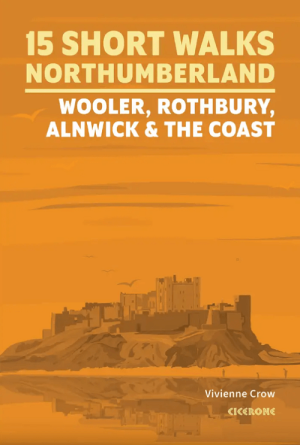
Wandelgids Northumberland short walks - Cicerone • 9781786312013
Northumberland short walks - Cicerone Productomschrijving: Wil je het beste van Wooler, Rothbury, Alnwick en de kust van Northumberland ontdekken? Deze gids bevat 15 van de beste korte wandelingen in Northumberland (3 uur of minder, tussen 3 en 14 km), waaronder Holy Island (Lindisfarne), de Simonside Hills, Alnwick Castle, Craster, Dunstanburgh Castle, Bamburgh en Berwick-upon-Tweed. …